Directions to Lone Beacon Media (Boston) with public transportation
The following transit lines have routes that pass near Lone Beacon Media
 Bus: 354, 43, 450, 501, 504.
- Train: FRAMINGHAM/WORCESTER, HAVERHILL, NEEDHAM.
- Subway: GREEN LINE B, GREEN LINE D, ORANGE LINE, RED LINE, GREEN LINE C.
How to get to Lone Beacon Media by bus?
Click on the bus route to see step by step directions with maps, line arrival times and updated time schedules.
From Melrose Wakefield Hospital, Malden
75 minFrom Heartbreak Hill, Newton
44 minFrom Washington St, Boston
45 minFrom Suffolk Downs, Boston
55 minFrom Arlington, MA, Arlington
81 minFrom Qea, Quincy
98 minFrom Boston College (BC), Boston
61 minFrom Newton, MA, Newton
44 minFrom FOUR POINTS BY SHERATON Boston Newton, Newton
27 minFrom Newton, MA, Newton
55 min
How to get to Lone Beacon Media by train?
Click on the train route to see step by step directions with maps, line arrival times and updated time schedules.
How to get to Lone Beacon Media by subway?
Click on the subway route to see step by step directions with maps, line arrival times and updated time schedules.
Bus stops near Lone Beacon Media in Boston
Subway stations near Lone Beacon Media in Boston
Bus lines to Lone Beacon Media in Boston
- 9, City Point,VIEW
- 10, Arlington via South Bay Center - City Point via South Bay Center,VIEW
- 39, Back Bay - Forest Hills,VIEW
- 55, Arlington - West Fenway,VIEW
- 57, Kenmore - Watertown Yard,VIEW
- 501, Downtown via Copley (Express) - Brighton via Copley (Express),VIEW
- 504, Downtown via Copley (Express) - Watertown via Copley and Newton Corner (Express),VIEW
- GREEN LINE E SHUTTLE, Heath Street - Park Street,VIEW
- GREEN LINE SHUTTLE, Boston University East - Park Street,VIEW
- SL5, Downtown,VIEW
- 11, Chauncy & Summer,VIEW
- 15, Mattapan Via Nubian & Fields Corner,VIEW
- SL4, South Station,VIEW
- 43, Park St & Tremont St,VIEW
What are the closest stations to Lone Beacon Media?
The closest stations to Lone Beacon Media are:
- Arlington St @ Saint James Ave is 98 yards away, 2 min walk.
- Saint James Ave @ Arlington St is 103 yards away, 2 min walk.
- Washington St @ Essex St is 189 yards away, 3 min walk.
- Park Street is 343 yards away, 5 min walk.
- Tremont St @ Marginal St is 400 yards away, 5 min walk.
- Chinatown is 729 yards away, 9 min walk.
Which bus lines stop near Lone Beacon Media?
These bus lines stop near Lone Beacon Media: 354, 43, 450, 501, 504, SL4.
Which train lines stop near Lone Beacon Media?
These train lines stop near Lone Beacon Media: FRAMINGHAM/WORCESTER, HAVERHILL, NEEDHAM.
Which subway lines stop near Lone Beacon Media?
These subway lines stop near Lone Beacon Media: GREEN LINE B, GREEN LINE D, ORANGE LINE, RED LINE.
What’s the nearest subway station to Lone Beacon Media in Boston?
The nearest subway station to Lone Beacon Media in Boston is Park Street. It’s a 5 min walk away.
What’s the nearest bus station to Lone Beacon Media in Boston?
The nearest bus stations to Lone Beacon Media in Boston are Arlington St @ Saint James Ave and Saint James Ave @ Arlington St. The closest one is a 2 min walk away.
What time is the first subway to Lone Beacon Media in Boston?
The GREEN LINE E is the first subway that goes to Lone Beacon Media in Boston. It stops nearby at 5:07 AM.
What time is the last subway to Lone Beacon Media in Boston?
The GREEN LINE E is the last subway that goes to Lone Beacon Media in Boston. It stops nearby at 2:18 AM.
What time is the first bus to Lone Beacon Media in Boston?
The 43 is the first bus that goes to Lone Beacon Media in Boston. It stops nearby at 5:06 AM.
What time is the last bus to Lone Beacon Media in Boston?
The 10 is the last bus that goes to Lone Beacon Media in Boston. It stops nearby at 1:19 AM.
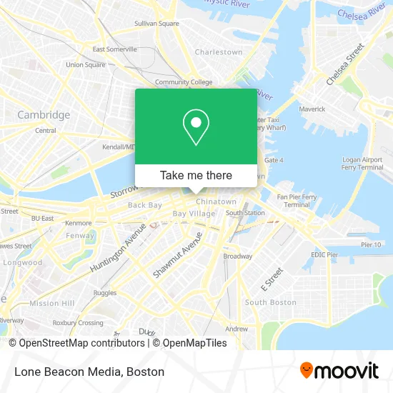
See Lone Beacon Media, Boston, on the map
Public Transit to Lone Beacon Media in Boston
Wondering how to get to Lone Beacon Media in Boston? Moovit helps you find the best way to get to Lone Beacon Media with step-by-step directions from the nearest public transit station.
Moovit provides free maps and live directions to help you navigate through your city. View schedules, routes, timetables, and find out how long does it take to get to Lone Beacon Media in real time.
Looking for the nearest stop or station to Lone Beacon Media? Check out this list of stops closest to your destination: Arlington St @ Saint James Ave; Saint James Ave @ Arlington St; Washington St @ Essex St; Park Street; Tremont St @ Marginal St; Chinatown.
Bus: 354, 43, 450, 501, 504, SL4, 9, 10, 39, 55, 57, SL5, 11, 15.Train: FRAMINGHAM/WORCESTER, HAVERHILL, NEEDHAM.Subway: GREEN LINE B, GREEN LINE D, ORANGE LINE, RED LINE, GREEN LINE C, GREEN LINE E.
Want to see if there’s another route that gets you there at an earlier time? Moovit helps you find alternative routes or times. Get directions from and directions to Lone Beacon Media easily from the Moovit App or Website.
We make riding to Lone Beacon Media easy, which is why over 1.7 million users, including users in Boston, trust Moovit as the best app for public transit. You don’t need to download an individual bus app or train app, Moovit is your all-in-one transit app that helps you find the best bus time or train time available.
For information on prices of bus, subway and train, costs and ride fares to Lone Beacon Media, please check the Moovit app.
Use the app to navigate to popular places including to the airport, hospital, stadium, grocery store, mall, coffee shop, school, college, and university.
Lone Beacon Media Address: 2 Park Plz Ste 312 street in Boston
- P.F. Chang's,
- Elucid Bio,
- Transportation Building in Park Square,
- Massachusetts Bay Transportation Authority,
- Charlie Card,
- Edgar Allan Poe Statue,
- WESTERN UNION,
- Department of Motor Vehicles,
- Massachusetts Department Transport,
- The Trolley Stop Store,
- Emerson College - Off Campus Student Services (OCSS),
- City Place Garage,
- Lincoln Square,
- MVBH,
- Junta Central Electoral,
- CVS/Pharmacy ,
- Four Seasons Hotel Boston,
- Consulate of the Dominican Republic in Boston,
- Chocolate Tour,
- MBTA Commuter Rail Train #715
Places Near Lone Beacon Media (Boston)
- Seaport District, Boston,
- House Of Blues, Boston,
- North End, Boston,
- Boston Medical Center, Boston,
- Boston Children's Hospital, Boston,
- Prudential Center, Boston,
- Cheers, Boston,
- Td Garden, Boston,
- Quincy Market, Boston,
- Boston Convention & Exhibition Center, Boston,
- Wilbur Theatre, Boston,
- Boston Common, Boston,
- Leader Bank Pavilion (Leader Bank Pavillion), Boston,
- Museum Of Science, Boston,
- Faneuil Hall, Boston,
- Wang Theater, Boston,
- Isabella Stewart Gardner Museum, Boston,
- Mgm Music Hall, Boston,
- Castle Island, Boston,
- Massachusetts General Hospital, Boston
How to get to popular places in Boston with public transit
Get around Boston by public transit!
Traveling around Boston has never been so easy. See step by step directions as you travel to any attraction, street or major public transit station. View bus and train schedules, arrival times, service alerts and detailed routes on a map, so you know exactly how to get to anywhere in Boston.
When traveling to any destination around Boston use Moovit's Live Directions with Get Off Notifications to know exactly where and how far to walk, how long to wait for your line, and how many stops are left. Moovit will alert you when it's time to get off — no need to constantly re-check whether yours is the next stop.
Wondering how to use public transit in Boston or how to pay for public transit in Boston? Moovit public transit app can help you navigate your way with public transit easily, and at minimum cost. It includes public transit fees, ticket prices, and costs. Looking for a map of Boston public transit lines? Moovit public transit app shows all public transit maps in Boston with all Bus, Train, Subway and Ferry routes and stops on an interactive map.
Boston has 4 transit type(s), including: Bus, Train, Subway and Ferry, operated by several transit agencies, including MBTA, Southeastern Regional Transit Authority, MetroWest Regional Transit Authority, Rhode Island Public Transit Authority, WRTA, Lowell Regional Transit Authority, Merrimack Valley Transit, Montachusett Regional Transit Authority, Cape Cod Regional Transit Authority, Brockton Area Transit Authority, Martha's Vineyard Transit Authority, the WAVE - Nantucket Regional Transit Authority, GATRA, Cape Ann Transportation Authority and Massport