Directions to Longfellow Design Build (Boston) with public transportation
The following transit lines have routes that pass near Longfellow Design Build
 Bus: 1, 19, 39, 43, 1 BU (CHARLES RIVER-MEDICAL CAMPUS).
- Train: FAIRMOUNT, NEEDHAM, FRANKLIN/FOXBORO, PROVIDENCE/STOUGHTON.
- Subway: GREEN LINE B, ORANGE LINE, GREEN LINE E.
How to get to Longfellow Design Build by bus?
Click on the bus route to see step by step directions with maps, line arrival times and updated time schedules.
From VA Hospital, Boston
55 minFrom Washington St, Boston
62 minFrom Brighton, Boston
65 minFrom Hampton Inn Boston Logan Airport, Revere
50 minFrom Showa Boston Institute, Boston
53 minFrom 7F Everett Street, Revere
58 minFrom Malden Catholic High School, Malden
78 minFrom Uscis Biometrics Office, Revere
57 minFrom Staybridge Suites Boston-Quincy, Quincy
94 minFrom Comfort Inn & Suites Logan International Airport, Revere
59 min
How to get to Longfellow Design Build by train?
Click on the train route to see step by step directions with maps, line arrival times and updated time schedules.
How to get to Longfellow Design Build by subway?
Click on the subway route to see step by step directions with maps, line arrival times and updated time schedules.
From Washington St, Boston
44 minFrom Brighton, Boston
48 minFrom Hampton Inn Boston Logan Airport, Revere
50 minFrom 7F Everett Street, Revere
43 minFrom Uscis Biometrics Office, Revere
45 minFrom Staybridge Suites Boston-Quincy, Quincy
33 minFrom Comfort Inn & Suites Logan International Airport, Revere
46 min
Subway stations near Longfellow Design Build in Boston
Bus stops near Longfellow Design Build in Boston
Train station near Longfellow Design Build in Boston
- Ruggles, 16 min walk,VIEW
Bus lines to Longfellow Design Build in Boston
- 1, Nubian,VIEW
- 43, Ruggles,VIEW
- 1 BU (CHARLES RIVER-MEDICAL CAMPUS), Comm Ave @ Buick St,VIEW
- ORANGE LINE SHUTTLE, Ruggles - Copley,VIEW
- ORANGE LINE SHUTTLE, Forest Hills - Back Bay via Copley (Shuttle),VIEW
- ORANGE LINE SHUTTLE, Jackson Square - Copley,VIEW
- ORANGE LINE SHUTTLE, Forest Hills - Copley,VIEW
- ORANGE LINE SHUTTLE, Forest Hills - Back Bay (Shuttle),VIEW
- ORANGE LINE SHUTTLE, Ruggles - Back Bay,VIEW
- ORANGE LINE SHUTTLE, Jackson Square - Back Bay,VIEW
- ORANGE LINE SHUTTLE, Forest Hills - Back Bay via Ruggles Busway (Shuttle),VIEW
What are the closest stations to Longfellow Design Build?
The closest stations to Longfellow Design Build are:
- Prudential is 195 yards away, 5 min walk.
- Massachusetts Ave @ Tremont St is 230 yards away, 3 min walk.
- Tremont St @ Northampton St is 375 yards away, 5 min walk.
- Mass Ave T Station (To Crc) is 377 yards away, 5 min walk.
- Massachusetts Ave Station - Shuttle is 598 yards away, 8 min walk.
- Massachusetts Ave. is 960 yards away, 12 min walk.
- Ruggles is 1356 yards away, 16 min walk.
Which bus lines stop near Longfellow Design Build?
These bus lines stop near Longfellow Design Build: 1, 19, 39, 43.
Which train lines stop near Longfellow Design Build?
These train lines stop near Longfellow Design Build: FAIRMOUNT, NEEDHAM.
Which subway lines stop near Longfellow Design Build?
These subway lines stop near Longfellow Design Build: GREEN LINE B, ORANGE LINE.
What’s the nearest subway station to Longfellow Design Build in Boston?
The nearest subway station to Longfellow Design Build in Boston is Prudential. It’s a 5 min walk away.
What’s the nearest train station to Longfellow Design Build in Boston?
The nearest train station to Longfellow Design Build in Boston is Ruggles. It’s a 16 min walk away.
What’s the nearest bus station to Longfellow Design Build in Boston?
The nearest bus station to Longfellow Design Build in Boston is Massachusetts Ave @ Tremont St. It’s a 3 min walk away.
What time is the first subway to Longfellow Design Build in Boston?
The GREEN LINE E is the first subway that goes to Longfellow Design Build in Boston. It stops nearby at 5:16 AM.
What time is the last subway to Longfellow Design Build in Boston?
The GREEN LINE E is the last subway that goes to Longfellow Design Build in Boston. It stops nearby at 2:10 AM.
What time is the first train to Longfellow Design Build in Boston?
The PROVIDENCE/STOUGHTON is the first train that goes to Longfellow Design Build in Boston. It stops nearby at 4:28 AM.
What time is the last train to Longfellow Design Build in Boston?
The PROVIDENCE/STOUGHTON is the last train that goes to Longfellow Design Build in Boston. It stops nearby at 12:34 AM.
What time is the first bus to Longfellow Design Build in Boston?
The 1 is the first bus that goes to Longfellow Design Build in Boston. It stops nearby at 4:45 AM.
What time is the last bus to Longfellow Design Build in Boston?
The 1 is the last bus that goes to Longfellow Design Build in Boston. It stops nearby at 2:36 AM.
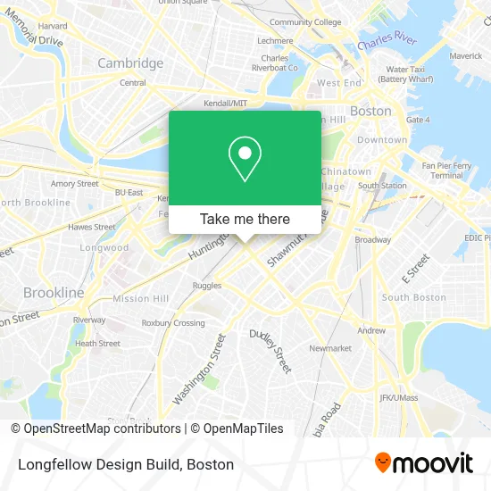
See Longfellow Design Build, Boston, on the map
Public Transit to Longfellow Design Build in Boston
Wondering how to get to Longfellow Design Build in Boston? Moovit helps you find the best way to get to Longfellow Design Build with step-by-step directions from the nearest public transit station.
Moovit provides free maps and live directions to help you navigate through your city. View schedules, routes, timetables, and find out how long does it take to get to Longfellow Design Build in real time.
Looking for the nearest stop or station to Longfellow Design Build? Check out this list of stops closest to your destination: Prudential; Massachusetts Ave @ Tremont St; Tremont St @ Northampton St; Mass Ave T Station (To Crc); Massachusetts Ave Station - Shuttle; Massachusetts Ave.; Ruggles.
Bus: 1, 19, 39, 43, 1 BU (CHARLES RIVER-MEDICAL CAMPUS).Train: FAIRMOUNT, NEEDHAM, FRANKLIN/FOXBORO, PROVIDENCE/STOUGHTON.Subway: GREEN LINE B, ORANGE LINE, GREEN LINE E.
Want to see if there’s another route that gets you there at an earlier time? Moovit helps you find alternative routes or times. Get directions from and directions to Longfellow Design Build easily from the Moovit App or Website.
We make riding to Longfellow Design Build easy, which is why over 1.7 million users, including users in Boston, trust Moovit as the best app for public transit. You don’t need to download an individual bus app or train app, Moovit is your all-in-one transit app that helps you find the best bus time or train time available.
For information on prices of bus, subway and train, costs and ride fares to Longfellow Design Build, please check the Moovit app.
Use the app to navigate to popular places including to the airport, hospital, stadium, grocery store, mall, coffee shop, school, college, and university.
Longfellow Design Build Address: 434 Massachusetts Ave Ste 503 street in Boston
- Wally's Cafe,
- Wally's Cafe Jazz Club,
- SRV,
- Celebrity Cruises,
- Five Horses Tavern,
- Massachusetts Avenue - Silver Line,
- PLS Check Cashing Store,
- Fanuel Hall, 2nd Fl,
- Ilona,
- Carter School Grounds,
- Matthews Arena,
- Gallery at the Factory (Piano Factory),
- Little Donkey,
- Mida,
- MetroPCS (Metro by T-Mobile),
- Zaid al-Bender DDS,
- Tremont St @ Worcester St (Tremont St @ W Springfield St),
- Caffe Bene,
- Symphony Station,
- New England Conservatory
Places Near Longfellow Design Build (Boston)
- Castle Island, Boston,
- Boston Convention & Exhibition Center, Boston,
- Seaport District, Boston,
- Prudential Center, Boston,
- Wilbur Theatre, Boston,
- Museum Of Science, Boston,
- Mgm Music Hall, Boston,
- Wang Theater, Boston,
- Faneuil Hall, Boston,
- Td Garden, Boston,
- Quincy Market, Boston,
- Massachusetts General Hospital, Boston,
- Boston Medical Center, Boston,
- North End, Boston,
- Leader Bank Pavilion (Leader Bank Pavillion), Boston,
- Cheers, Boston,
- Boston Children's Hospital, Boston,
- House Of Blues, Boston,
- Boston Common, Boston,
- Isabella Stewart Gardner Museum, Boston
How to get to popular places in Boston with public transit
Get around Boston by public transit!
Traveling around Boston has never been so easy. See step by step directions as you travel to any attraction, street or major public transit station. View bus and train schedules, arrival times, service alerts and detailed routes on a map, so you know exactly how to get to anywhere in Boston.
When traveling to any destination around Boston use Moovit's Live Directions with Get Off Notifications to know exactly where and how far to walk, how long to wait for your line, and how many stops are left. Moovit will alert you when it's time to get off — no need to constantly re-check whether yours is the next stop.
Wondering how to use public transit in Boston or how to pay for public transit in Boston? Moovit public transit app can help you navigate your way with public transit easily, and at minimum cost. It includes public transit fees, ticket prices, and costs. Looking for a map of Boston public transit lines? Moovit public transit app shows all public transit maps in Boston with all Bus, Train, Subway and Ferry routes and stops on an interactive map.
Boston has 4 transit type(s), including: Bus, Train, Subway and Ferry, operated by several transit agencies, including MBTA, Southeastern Regional Transit Authority, MetroWest Regional Transit Authority, Rhode Island Public Transit Authority, WRTA, Lowell Regional Transit Authority, Merrimack Valley Transit, Montachusett Regional Transit Authority, Cape Cod Regional Transit Authority, Brockton Area Transit Authority, Martha's Vineyard Transit Authority, the WAVE - Nantucket Regional Transit Authority, GATRA, Cape Ann Transportation Authority and Massport