See Longy School Of Music Of Bard College, Cambridge, on the map
Directions to Longy School Of Music Of Bard College (Cambridge) with public transportation
The following transit lines have routes that pass near Longy School Of Music Of Bard College
 Bus:
Bus: - Train:
- Subway:
How to get to Longy School Of Music Of Bard College by bus?
Click on the bus route to see step by step directions with maps, line arrival times and updated time schedules.
How to get to Longy School Of Music Of Bard College by train?
Click on the train route to see step by step directions with maps, line arrival times and updated time schedules.
How to get to Longy School Of Music Of Bard College by subway?
Click on the subway route to see step by step directions with maps, line arrival times and updated time schedules.
Bus stations near Longy School Of Music Of Bard College in Cambridge
- Garden St @ Concord Ave,1 min walk,
- Massachusetts Ave @ Waterhouse St,5 min walk,
- Mt Auburn St @ Brewer St,5 min walk,
- Harvard Sq @ Garden St - Dawes Island,7 min walk,
Train stations near Longy School Of Music Of Bard College in Cambridge
- Porter,8 min walk,
Bus lines to Longy School Of Music Of Bard College in Cambridge
- 74,Harvard,
- 75,Belmont Center,
- 78,Harvard,
- 77,Harvard,
- 96,Medford Square,
- 71,Watertown Square,
- 73,Waverley,
- 66,Harvard Via Allston,
- 86,Reservoir,
What are the closest stations to Longy School Of Music Of Bard College?
The closest stations to Longy School Of Music Of Bard College are:
- Garden St @ Concord Ave is 45 yards away, 1 min walk.
- Massachusetts Ave @ Waterhouse St is 315 yards away, 5 min walk.
- Mt Auburn St @ Brewer St is 413 yards away, 5 min walk.
- Harvard Sq @ Garden St - Dawes Island is 534 yards away, 7 min walk.
- Porter is 668 yards away, 8 min walk.
Which bus lines stop near Longy School Of Music Of Bard College?
These bus lines stop near Longy School Of Music Of Bard College: 66, 71, 75, 78, 86.
Which train line stops near Longy School Of Music Of Bard College?
FRAMINGHAM/WORCESTER
Which subway line stops near Longy School Of Music Of Bard College?
RED LINE
What’s the nearest train station to Longy School Of Music Of Bard College in Cambridge?
The nearest train station to Longy School Of Music Of Bard College in Cambridge is Porter. It’s a 8 min walk away.
What’s the nearest bus stop to Longy School Of Music Of Bard College in Cambridge?
The nearest bus stop to Longy School Of Music Of Bard College in Cambridge is Garden St @ Concord Ave. It’s a 1 min walk away.
What time is the first subway to Longy School Of Music Of Bard College in Cambridge?
The RED LINE is the first subway that goes to Longy School Of Music Of Bard College in Cambridge. It stops nearby at 5:17 AM.
What time is the last subway to Longy School Of Music Of Bard College in Cambridge?
The RED LINE is the last subway that goes to Longy School Of Music Of Bard College in Cambridge. It stops nearby at 1:33 AM.
What time is the first train to Longy School Of Music Of Bard College in Cambridge?
The FITCHBURG is the first train that goes to Longy School Of Music Of Bard College in Cambridge. It stops nearby at 5:47 AM.
What time is the last train to Longy School Of Music Of Bard College in Cambridge?
The FITCHBURG is the last train that goes to Longy School Of Music Of Bard College in Cambridge. It stops nearby at 12:17 AM.
What time is the first bus to Longy School Of Music Of Bard College in Cambridge?
The 73 is the first bus that goes to Longy School Of Music Of Bard College in Cambridge. It stops nearby at 4:46 AM.
What time is the last bus to Longy School Of Music Of Bard College in Cambridge?
The 66 is the last bus that goes to Longy School Of Music Of Bard College in Cambridge. It stops nearby at 1:34 AM.
How much is the subway fare to Longy School Of Music Of Bard College?
The subway fare to Longy School Of Music Of Bard College costs about $2.40.
See Longy School Of Music Of Bard College, Cambridge, on the map
Public Transit to Longy School Of Music Of Bard College in Cambridge
Wondering how to get to Longy School Of Music Of Bard College in Cambridge, United States? Moovit helps you find the best way to get to Longy School Of Music Of Bard College with step-by-step directions from the nearest public transit station.
Moovit provides free maps and live directions to help you navigate through your city. View schedules, routes, timetables, and find out how long does it take to get to Longy School Of Music Of Bard College in real time.
Looking for the nearest stop or station to Longy School Of Music Of Bard College? Check out this list of stops closest to your destination: Garden St @ Concord Ave; Massachusetts Ave @ Waterhouse St; Mt Auburn St @ Brewer St; Harvard Sq @ Garden St - Dawes Island; Porter.
Bus:Train:Subway:
Want to see if there’s another route that gets you there at an earlier time? Moovit helps you find alternative routes or times. Get directions from and directions to Longy School Of Music Of Bard College easily from the Moovit App or Website.
We make riding to Longy School Of Music Of Bard College easy, which is why over 1.5 million users, including users in Cambridge, trust Moovit as the best app for public transit. You don’t need to download an individual bus app or train app, Moovit is your all-in-one transit app that helps you find the best bus time or train time available.
For information on prices of bus, subway and train, costs and ride fares to Longy School Of Music Of Bard College, please check the Moovit app.
Use the app to navigate to popular places including to the airport, hospital, stadium, grocery store, mall, coffee shop, school, college, and university.
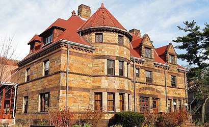
Longy School Of Music Of Bard College Address: Follen Street street in Cambridge
Attractions near Longy School Of Music Of Bard College
Longy School of Music of Bard College,Garden St @ Concord Ave,Mather Court,Hotel Commander (Sheraton Commander Club Lounge),First Church in Cambridge Cong'l,Harvard Square Brandeis Shuttle Stop,Allium Montessori School,Hastings Hall Harvard Law School,The Center for Mindfulness & Compassion Community Fellows,The Institute for Meditation and Psychotherapy,MBTA Bus Route 77 Harvard Square to Arlington Heights,Harvard Law School,Marc's Handyman,Loeb Drama Center,American Repertory Theater,Cambridge Somerville Apartment Rentals, Sales, and Property Management,Currier House,Libertyx Bitcoin ATM,Harvard University,Lesley UniversityHow to get to popular attractions in Cambridge with public transit
MET Back Bay, Boston,Cliff Walk,Downtown Providence,Modern Pastry Shop, Boston,Dillon's, Boston,Redbones Barbecue, Somerville,Tasty Burger, Cambridge,Warwick, RI,Boston Sail Loft, Boston,Southbridge, MA, Southbridge Town,Kings Dining & Entertainment - Boston Back Bay, Boston,The Landing at Long Wharf, Boston,Target,BJ's Wholesale Club, Haverhill,Inman Square, Cambridge,Fajitas & 'Ritas, Boston,Mike's Food and Spirits, Somerville,Raising Cane's Chicken Fingers, Boston,The Lenox Hotel, Boston,Grafton Street Pub, CambridgeGet around Cambridge by public transit!
Traveling around Cambridge has never been so easy. See step by step directions as you travel to any attraction, street or major public transit station. View bus and train schedules, arrival times, service alerts and detailed routes on a map, so you know exactly how to get to anywhere in Cambridge.
When traveling to any destination around Cambridge use Moovit's Live Directions with Get Off Notifications to know exactly where and how far to walk, how long to wait for your line, and how many stops are left. Moovit will alert you when it's time to get off — no need to constantly re-check whether yours is the next stop.
Wondering how to use public transit in Cambridge or how to pay for public transit in Cambridge? Moovit public transit app can help you navigate your way with public transit easily, and at minimum cost. It includes public transit fees, ticket prices, and costs. Looking for a map of Cambridge public transit lines? Moovit public transit app shows all public transit maps in Cambridge with all bus, subway or train routes and stops on an interactive map.
Cambridge has 3 transit type(s), including: bus, subway or train, operated by several transit agencies, including MBTA, MBTA, MBTA, Southeastern Regional Transit Authority, MetroWest Regional Transit Authority, Rhode Island Public Transit Authority, WRTA, Lowell Regional Transit Authority, Merrimack Valley Transit, Montachusett Regional Transit Authority, Cape Cod Regional Transit Authority, Brockton Area Transit Authority, Cape Cod Regional Transit Authority, Martha's Vineyard Transit Authority and the WAVE - Nantucket Regional Transit Authority