Directions to Lookalikes-Usa Entertainment Agency (Boston) with public transportation
The following transit lines have routes that pass near Lookalikes-Usa Entertainment Agency
How to get to Lookalikes-Usa Entertainment Agency by bus?
Click on the bus route to see step by step directions with maps, line arrival times and updated time schedules.
Bus stops near Lookalikes-Usa Entertainment Agency in Boston
Bus lines to Lookalikes-Usa Entertainment Agency in Boston
What are the closest stations to Lookalikes-Usa Entertainment Agency?
The closest stations to Lookalikes-Usa Entertainment Agency are:
- Rockland Park & Ride is 923 yards away, 11 min walk.
- Park & Ride Lot, Rte 3 & 228 is 1001 yards away, 12 min walk.
Which bus line stops near Lookalikes-Usa Entertainment Agency?
HYANNIS - SOUTH SHORE TO LOGAN AIRPORT (Hyannis Transportation Center)
What’s the nearest bus station to Lookalikes-Usa Entertainment Agency in Boston?
The nearest bus station to Lookalikes-Usa Entertainment Agency in Boston is Rockland Park & Ride. It’s a 11 min walk away.
What time is the first bus to Lookalikes-Usa Entertainment Agency in Boston?
The HYANNIS - SOUTH SHORE TO LOGAN AIRPORT is the first bus that goes to Lookalikes-Usa Entertainment Agency in Boston. It stops nearby at 4:25 AM.
What time is the last bus to Lookalikes-Usa Entertainment Agency in Boston?
The HYANNIS - SOUTH SHORE TO LOGAN AIRPORT is the last bus that goes to Lookalikes-Usa Entertainment Agency in Boston. It stops nearby at 12:15 AM.
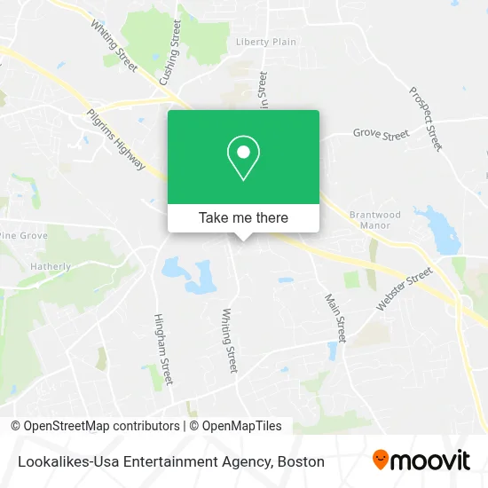
See Lookalikes-Usa Entertainment Agency, Boston, on the map
Public Transit to Lookalikes-Usa Entertainment Agency in Boston
Wondering how to get to Lookalikes-Usa Entertainment Agency in Boston? Moovit helps you find the best way to get to Lookalikes-Usa Entertainment Agency with step-by-step directions from the nearest public transit station.
Moovit provides free maps and live directions to help you navigate through your city. View schedules, routes, timetables, and find out how long does it take to get to Lookalikes-Usa Entertainment Agency in real time.
Looking for the nearest stop or station to Lookalikes-Usa Entertainment Agency? Check out this list of stops closest to your destination: Rockland Park & Ride; Park & Ride Lot.
Bus: HYANNIS - SOUTH SHORE TO LOGAN AIRPORT, PETER PAN.
Want to see if there’s another route that gets you there at an earlier time? Moovit helps you find alternative routes or times. Get directions from and directions to Lookalikes-Usa Entertainment Agency easily from the Moovit App or Website.
We make riding to Lookalikes-Usa Entertainment Agency easy, which is why over 1.7 million users, including users in Boston, trust Moovit as the best app for public transit. You don’t need to download an individual bus app or train app, Moovit is your all-in-one transit app that helps you find the best bus time or train time available.
For information on prices of bus, subway and train, costs and ride fares to Lookalikes-Usa Entertainment Agency, please check the Moovit app.
Use the app to navigate to popular places including to the airport, hospital, stadium, grocery store, mall, coffee shop, school, college, and university.
Lookalikes-Usa Entertainment Agency Address: 10 Blueberry Ct street in Boston
- American Restoration Professionals,
- Beacon Building Products,
- McKee's Moving & Storage,
- Able Restoration,
- Hicham Nouaime, Psychiatrist,
- Marisa Brava, Psychiatric Nurse Practitioner,
- Lifestance Therapists & Psychiatrists Norwell,
- Coler & Colantonio,
- Thomas Moore, Psychologist,
- Kevin Hayden, MSW,
- The U.S. Department of Veterans Affairs,
- De Foods,
- Tricia Karvounis, Counselor,
- Cha Consulting,
- Rockland mass,
- Plumbers for Winter Freeze,
- Harvest Trading Group,
- Kent's Carpet Outlet,
- Nissan,
- Collision Center
Places Near Lookalikes-Usa Entertainment Agency (Boston)
- Wilbur Theatre, Boston,
- Boston Convention & Exhibition Center, Boston,
- Castle Island, Boston,
- Cheers, Boston,
- Boston Common, Boston,
- Isabella Stewart Gardner Museum, Boston,
- Museum Of Science, Boston,
- Td Garden, Boston,
- House Of Blues, Boston,
- Boston Medical Center, Boston,
- North End, Boston,
- Quincy Market, Boston,
- Faneuil Hall, Boston,
- Prudential Center, Boston,
- Mgm Music Hall, Boston,
- Seaport District, Boston,
- Boston Children's Hospital, Boston,
- Wang Theater, Boston,
- Massachusetts General Hospital, Boston,
- Leader Bank Pavilion (Leader Bank Pavillion), Boston
How to get to popular places in Boston with public transit
Get around Boston by public transit!
Traveling around Boston has never been so easy. See step by step directions as you travel to any attraction, street or major public transit station. View bus and train schedules, arrival times, service alerts and detailed routes on a map, so you know exactly how to get to anywhere in Boston.
When traveling to any destination around Boston use Moovit's Live Directions with Get Off Notifications to know exactly where and how far to walk, how long to wait for your line, and how many stops are left. Moovit will alert you when it's time to get off — no need to constantly re-check whether yours is the next stop.
Wondering how to use public transit in Boston or how to pay for public transit in Boston? Moovit public transit app can help you navigate your way with public transit easily, and at minimum cost. It includes public transit fees, ticket prices, and costs. Looking for a map of Boston public transit lines? Moovit public transit app shows all public transit maps in Boston with all Bus, Train, Subway and Ferry routes and stops on an interactive map.
Boston has 4 transit type(s), including: Bus, Train, Subway and Ferry, operated by several transit agencies, including MBTA, Southeastern Regional Transit Authority, MetroWest Regional Transit Authority, Rhode Island Public Transit Authority, WRTA, Lowell Regional Transit Authority, Merrimack Valley Transit, Montachusett Regional Transit Authority, Cape Cod Regional Transit Authority, Brockton Area Transit Authority, Martha's Vineyard Transit Authority, the WAVE - Nantucket Regional Transit Authority, GATRA, Cape Ann Transportation Authority and Massport