Directions to Loomis Armored Us (Wakefield) with public transportation
The following transit lines have routes that pass near Loomis Armored Us
How to get to Loomis Armored Us by bus?
Click on the bus route to see step by step directions with maps, line arrival times and updated time schedules.
From Wellington Station, Medford
60 minFrom Terrace Room, Paige Hall, Medford
69 minFrom Somerville, MA, Somerville
71 minFrom Chelsea District Court, Chelsea
66 minFrom Encore Boston Harbor, Everett
62 minFrom La Quinta Inn & Suites Boston Somerville, Somerville
76 minFrom Massachusetts Water Resource Authority (MWRA), Chelsea
75 minFrom Arlington, MA, Arlington
104 minFrom Uscis Biometrics Office, Revere
81 minFrom Regent Theatre, Arlington
102 min
How to get to Loomis Armored Us by train?
Click on the train route to see step by step directions with maps, line arrival times and updated time schedules.
Bus stops near Loomis Armored Us in Wakefield
Train station near Loomis Armored Us in Wakefield
- Oak Grove, 24 min walk,VIEW
Bus lines to Loomis Armored Us in Wakefield
- 137, Malden,VIEW
- HAVERHILL LINE SHUTTLE, Ballardvale - Malden Center,VIEW
- HAVERHILL LINE SHUTTLE, Reading - Oak Grove,VIEW
- HAVERHILL LINE SHUTTLE, Haverhill - Malden Center,VIEW
- HAVERHILL LINE SHUTTLE, Ballardvale - North Station,VIEW
- HAVERHILL LINE SHUTTLE, Haverhill - North Station,VIEW
- HAVERHILL, Haverhill,VIEW
What are the closest stations to Loomis Armored Us?
The closest stations to Loomis Armored Us are:
- Main St Opp Bay State Rd is 437 yards away, 6 min walk.
- Greenwood is 1077 yards away, 13 min walk.
- Oak Grove is 1988 yards away, 24 min walk.
Which bus line stops near Loomis Armored Us?
137 (Reading Depot)
Which train line stops near Loomis Armored Us?
HAVERHILL (#229 | Haverhill)
What’s the nearest train station to Loomis Armored Us in Wakefield?
The nearest train station to Loomis Armored Us in Wakefield is Oak Grove. It’s a 24 min walk away.
What’s the nearest bus station to Loomis Armored Us in Wakefield?
The nearest bus station to Loomis Armored Us in Wakefield is Main St Opp Bay State Rd. It’s a 6 min walk away.
What time is the first subway to Loomis Armored Us in Wakefield?
The ORANGE LINE is the first subway that goes to Loomis Armored Us in Wakefield. It stops nearby at 5:15 AM.
What time is the last subway to Loomis Armored Us in Wakefield?
The ORANGE LINE is the last subway that goes to Loomis Armored Us in Wakefield. It stops nearby at 1:59 AM.
What time is the first train to Loomis Armored Us in Wakefield?
The HAVERHILL is the first train that goes to Loomis Armored Us in Wakefield. It stops nearby at 5:27 AM.
What time is the last train to Loomis Armored Us in Wakefield?
The HAVERHILL is the last train that goes to Loomis Armored Us in Wakefield. It stops nearby at 12:03 AM.
What time is the first bus to Loomis Armored Us in Wakefield?
The 137 is the first bus that goes to Loomis Armored Us in Wakefield. It stops nearby at 5:05 AM.
What time is the last bus to Loomis Armored Us in Wakefield?
The 137 is the last bus that goes to Loomis Armored Us in Wakefield. It stops nearby at 10:51 PM.
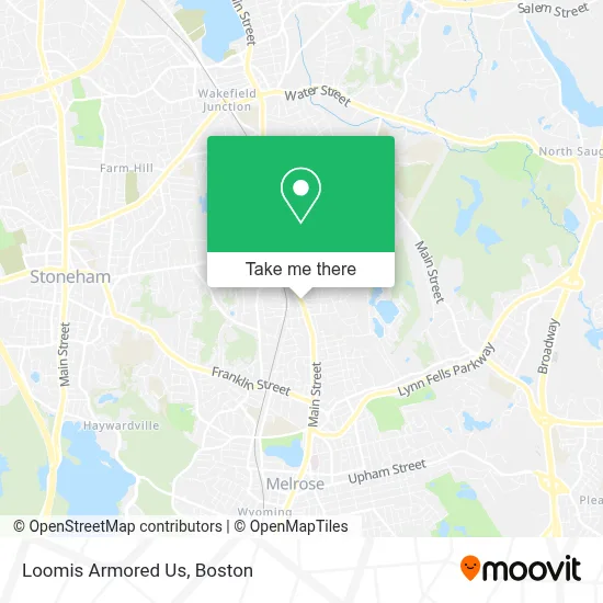
See Loomis Armored Us, Wakefield, on the map
Public Transit to Loomis Armored Us in Wakefield
Wondering how to get to Loomis Armored Us in Wakefield? Moovit helps you find the best way to get to Loomis Armored Us with step-by-step directions from the nearest public transit station.
Moovit provides free maps and live directions to help you navigate through your city. View schedules, routes, timetables, and find out how long does it take to get to Loomis Armored Us in real time.
Looking for the nearest stop or station to Loomis Armored Us? Check out this list of stops closest to your destination: Main St Opp Bay State Rd; Greenwood; Oak Grove.
Bus: 137, HAVERHILL LINE SHUTTLE, HAVERHILL LINE SHUTTLE, HAVERHILL LINE SHUTTLE, HAVERHILL LINE SHUTTLE, HAVERHILL LINE SHUTTLE.Train: HAVERHILL, ORANGE LINE.
Want to see if there’s another route that gets you there at an earlier time? Moovit helps you find alternative routes or times. Get directions from and directions to Loomis Armored Us easily from the Moovit App or Website.
We make riding to Loomis Armored Us easy, which is why over 1.7 million users, including users in Wakefield, trust Moovit as the best app for public transit. You don’t need to download an individual bus app or train app, Moovit is your all-in-one transit app that helps you find the best bus time or train time available.
For information on prices of bus, subway and train, costs and ride fares to Loomis Armored Us, please check the Moovit app.
Use the app to navigate to popular places including to the airport, hospital, stadium, grocery store, mall, coffee shop, school, college, and university.
Loomis Armored Us Address: 1105 Main St street in Wakefield
- Morgan Jewelers,
- Branch,
- Melrose, MA,
- Main St Grille & Taphouse,
- Floramos Restaurants,
- Wakefield MA Locksmith Store,
- Little Blue Nursery School,
- Donna's Daycare,
- Bill Veno Landscaping & Lawn Maintenance,
- DJM Realty Trust,
- Greenwood,
- Mobil (Fast Freddie's),
- Mini Bimmers,
- Veterans of Foreign Wars,
- McGills,
- Damaceno's Cleaning,
- Erika Lally,
- Cetctest Passlow,
- Ocean Glass & Mirror,
- Perfect Cuts Landscaping
Places Near Loomis Armored Us (Wakefield)
- Boston Medical Center, Boston,
- North End, Boston,
- Seaport District, Boston,
- House Of Blues, Boston,
- Cheers, Boston,
- Castle Island, Boston,
- Wang Theater, Boston,
- Isabella Stewart Gardner Museum, Boston,
- Quincy Market, Boston,
- Wilbur Theatre, Boston,
- Massachusetts General Hospital, Boston,
- Td Garden, Boston,
- Boston Children's Hospital, Boston,
- Leader Bank Pavilion (Leader Bank Pavillion), Boston,
- Faneuil Hall, Boston,
- Museum Of Science, Boston,
- Boston Convention & Exhibition Center, Boston,
- Boston Common, Boston,
- Prudential Center, Boston,
- Mgm Music Hall, Boston
How to get to popular places in Boston with public transit
Get around Wakefield by public transit!
Traveling around Wakefield has never been so easy. See step by step directions as you travel to any attraction, street or major public transit station. View bus and train schedules, arrival times, service alerts and detailed routes on a map, so you know exactly how to get to anywhere in Wakefield.
When traveling to any destination around Wakefield use Moovit's Live Directions with Get Off Notifications to know exactly where and how far to walk, how long to wait for your line, and how many stops are left. Moovit will alert you when it's time to get off — no need to constantly re-check whether yours is the next stop.
Wondering how to use public transit in Wakefield or how to pay for public transit in Wakefield? Moovit public transit app can help you navigate your way with public transit easily, and at minimum cost. It includes public transit fees, ticket prices, and costs. Looking for a map of Wakefield public transit lines? Moovit public transit app shows all public transit maps in Wakefield with all Bus, Train, Subway and Ferry routes and stops on an interactive map.
Boston has 4 transit type(s), including: Bus, Train, Subway and Ferry, operated by several transit agencies, including MBTA, Southeastern Regional Transit Authority, MetroWest Regional Transit Authority, Rhode Island Public Transit Authority, WRTA, Lowell Regional Transit Authority, Merrimack Valley Transit, Montachusett Regional Transit Authority, Cape Cod Regional Transit Authority, Brockton Area Transit Authority, Martha's Vineyard Transit Authority, the WAVE - Nantucket Regional Transit Authority, GATRA, Cape Ann Transportation Authority and Massport