Directions to Loomis Village (Boston) with public transportation
The following transit lines have routes that pass near Loomis Village
 Bus: P21E.
- Train: VALLEY FLYER, VERMONTER.
How to get to Loomis Village by bus?
Click on the bus route to see step by step directions with maps, line arrival times and updated time schedules.
From Worcester, MA, Worcester
143 minFrom Saint Vincent Hospital at Worcester Medical Center, Worcester
145 minFrom South High Community School, Worcester
240 minFrom Polar Park, Worcester
144 minFrom Foxwoods, Worcester
172 minFrom Gardner, MA, Gardner
285 minFrom Palladium, Worcester
148 minFrom Registry Of Motor Vehicles (Rmv) Branch Office, Worcester
147 minFrom Dcu Center, Worcester
145 min
Train station near Loomis Village in Boston
- Holyoke Amtrak, 30 min walk,VIEW
What are the closest stations to Loomis Village?
The closest stations to Loomis Village are:
- Holyoke Amtrak is 2515 yards away, 30 min walk.
Which bus line stops near Loomis Village?
P21E (Holyoke Trans Center Via I-391 Express)
What’s the nearest train station to Loomis Village in Boston?
The nearest train station to Loomis Village in Boston is Holyoke Amtrak. It’s a 30 min walk away.
What time is the first train to Loomis Village in Boston?
The VALLEY FLYER is the first train that goes to Loomis Village in Boston. It stops nearby at 6:45 AM.
What time is the last train to Loomis Village in Boston?
The VALLEY FLYER is the last train that goes to Loomis Village in Boston. It stops nearby at 9:51 PM.
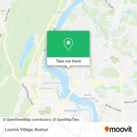
See Loomis Village, Boston, on the map
Public Transit to Loomis Village in Boston
Wondering how to get to Loomis Village in Boston? Moovit helps you find the best way to get to Loomis Village with step-by-step directions from the nearest public transit station.
Moovit provides free maps and live directions to help you navigate through your city. View schedules, routes, timetables, and find out how long does it take to get to Loomis Village in real time.
Looking for the nearest stop or station to Loomis Village? Check out this list of stops closest to your destination: Holyoke Amtrak.
Bus: P21E.Train: VALLEY FLYER, VERMONTER.
Want to see if there’s another route that gets you there at an earlier time? Moovit helps you find alternative routes or times. Get directions from and directions to Loomis Village easily from the Moovit App or Website.
We make riding to Loomis Village easy, which is why over 1.7 million users, including users in Boston, trust Moovit as the best app for public transit. You don’t need to download an individual bus app or train app, Moovit is your all-in-one transit app that helps you find the best bus time or train time available.
For information on prices of bus, costs and ride fares to Loomis Village, please check the Moovit app.
Use the app to navigate to popular places including to the airport, hospital, stadium, grocery store, mall, coffee shop, school, college, and university.
Loomis Village Address: 20 Bayon Dr street in Boston
- South Hadley Canal Park,
- USPS Collection Box - Blue Box,
- South Hadley Girls Treatment,
- Jones Point Park,
- Yankee Candle & General Cable,
- Red Cliffe Canoe Club,
- Rotary,
- Am/PM Plumbing & Heating,
- Log Pond,
- Park Z1,
- Highland Park,
- Castleknock,
- Sincere Autocare Auto Repair,
- Classic Refinishers,
- Highland Dingle,
- Environmental Integrity,
- Integrity Plumbing & Heating,
- E.N. White Elementary School,
- Northampton and River Street(Holyoke Tripper),
- Underdown Fine Carpentry
Places Near Loomis Village (Boston)
- Seaport District, Boston,
- Museum Of Science, Boston,
- Boston Children's Hospital, Boston,
- Faneuil Hall, Boston,
- Leader Bank Pavilion (Leader Bank Pavillion), Boston,
- Wilbur Theatre, Boston,
- House Of Blues, Boston,
- North End, Boston,
- Boston Medical Center, Boston,
- Castle Island, Boston,
- Boston Convention & Exhibition Center, Boston,
- Quincy Market, Boston,
- Boston Common, Boston,
- Td Garden, Boston,
- Wang Theater, Boston,
- Massachusetts General Hospital, Boston,
- Cheers, Boston,
- Mgm Music Hall, Boston,
- Prudential Center, Boston,
- Isabella Stewart Gardner Museum, Boston
How to get to popular places in Boston with public transit
Get around Boston by public transit!
Traveling around Boston has never been so easy. See step by step directions as you travel to any attraction, street or major public transit station. View bus and train schedules, arrival times, service alerts and detailed routes on a map, so you know exactly how to get to anywhere in Boston.
When traveling to any destination around Boston use Moovit's Live Directions with Get Off Notifications to know exactly where and how far to walk, how long to wait for your line, and how many stops are left. Moovit will alert you when it's time to get off — no need to constantly re-check whether yours is the next stop.
Wondering how to use public transit in Boston or how to pay for public transit in Boston? Moovit public transit app can help you navigate your way with public transit easily, and at minimum cost. It includes public transit fees, ticket prices, and costs. Looking for a map of Boston public transit lines? Moovit public transit app shows all public transit maps in Boston with all Bus, Train, Subway and Ferry routes and stops on an interactive map.
Boston has 4 transit type(s), including: Bus, Train, Subway and Ferry, operated by several transit agencies, including MBTA, Southeastern Regional Transit Authority, MetroWest Regional Transit Authority, Rhode Island Public Transit Authority, WRTA, Lowell Regional Transit Authority, Merrimack Valley Transit, Montachusett Regional Transit Authority, Cape Cod Regional Transit Authority, Brockton Area Transit Authority, Martha's Vineyard Transit Authority, the WAVE - Nantucket Regional Transit Authority, GATRA, Cape Ann Transportation Authority and Massport