Directions to Lopes Softball Field (Barnstable Town) with public transportation
The following transit lines have routes that pass near Lopes Softball Field
How to get to Lopes Softball Field by bus?
Click on the bus route to see step by step directions with maps, line arrival times and updated time schedules.
Bus stops near Lopes Softball Field in Barnstable Town
Train station near Lopes Softball Field in Barnstable Town
- Hyannis, 9 min walk,VIEW
Bus lines to Lopes Softball Field in Barnstable Town
- HYANNIS CROSSTOWN, Hyannis Transportation Center (Htc),VIEW
- H2O HYANNIS-ORLEANS, Stop & Shop, Orleans,VIEW
- SANDWICH LINE, Hyannis Transportation Center (Htc),VIEW
- SEALINE HYANNIS-FALMOUTH/WOODS HOLE, Mashpee Commons (Stop & Shop),VIEW
- PETER PAN, CAPE COD - PROVIDENCE - NEW YORK,VIEW
- PETER PAN, BOSTON LOGAN AIRPORT - BOSTON - HYANNIS,VIEW
- PETER PAN, PROVINCETOWN - HYANNIS,VIEW
- PETER PAN, NEW YORK - PROVIDENCE - CAPE COD,VIEW
- PETER PAN, HYANNIS - PROVINCETOWN,VIEW
- PETER PAN, HYANNIS - BOSTON - BOSTON LOGAN AIRPORT,VIEW
- HYANNIS - SOUTH SHORE TO LOGAN AIRPORT, Hyannis Transportation Center,VIEW
- BARNSTABLE VILLAGER, Cape Cod Community College, West Barnstable,VIEW
- HYANNIS AREA TROLLEY, Hyannis Transportation Center (Htc),VIEW
- PATRIOT LTD, Patriot Square, South Dennis,VIEW
What are the closest stations to Lopes Softball Field?
The closest stations to Lopes Softball Field are:
- Dta @ North St is 174 yards away, 3 min walk.
- Cape Cod Hospital (Bayview Street), Hyannis is 494 yards away, 6 min walk.
- St. Francis/Pope John Paul, Hyannis is 640 yards away, 8 min walk.
- Hyannis is 662 yards away, 9 min walk.
- Transportation Center Hyannis is 745 yards away, 10 min walk.
- Hyannis Transportation Center is 821 yards away, 10 min walk.
- Hyannis Transportation Center (Htc) is 865 yards away, 11 min walk.
Which bus lines stop near Lopes Softball Field?
These bus lines stop near Lopes Softball Field: PETER PAN, SEALINE HYANNIS-FALMOUTH/WOODS HOLE.
What’s the nearest train station to Lopes Softball Field in Barnstable Town?
The nearest train station to Lopes Softball Field in Barnstable Town is Hyannis. It’s a 9 min walk away.
What’s the nearest bus station to Lopes Softball Field in Barnstable Town?
The nearest bus station to Lopes Softball Field in Barnstable Town is Dta @ North St. It’s a 3 min walk away.
What time is the first bus to Lopes Softball Field in Barnstable Town?
The HYANNIS - SOUTH SHORE TO LOGAN AIRPORT is the first bus that goes to Lopes Softball Field in Barnstable Town. It stops nearby at 3:00 AM.
What time is the last bus to Lopes Softball Field in Barnstable Town?
The HYANNIS - SOUTH SHORE TO LOGAN AIRPORT is the last bus that goes to Lopes Softball Field in Barnstable Town. It stops nearby at 1:35 AM.
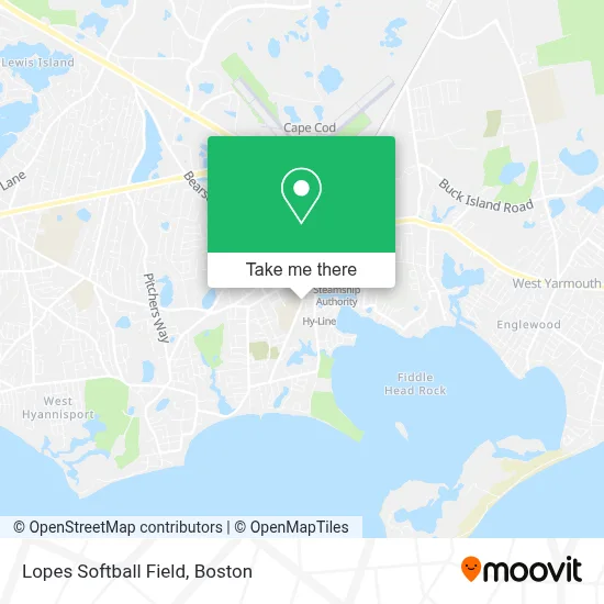
See Lopes Softball Field, Barnstable Town, on the map
Public Transit to Lopes Softball Field in Barnstable Town
Wondering how to get to Lopes Softball Field in Barnstable Town? Moovit helps you find the best way to get to Lopes Softball Field with step-by-step directions from the nearest public transit station.
Moovit provides free maps and live directions to help you navigate through your city. View schedules, routes, timetables, and find out how long does it take to get to Lopes Softball Field in real time.
Looking for the nearest stop or station to Lopes Softball Field? Check out this list of stops closest to your destination: Dta @ North St; Cape Cod Hospital (Bayview Street); St. Francis/Pope John Paul; Hyannis; Transportation Center Hyannis; Hyannis Transportation Center; Hyannis Transportation Center (Htc).
Bus: PETER PAN, SEALINE HYANNIS-FALMOUTH/WOODS HOLE, HYANNIS CROSSTOWN, H2O HYANNIS-ORLEANS, SANDWICH LINE, HYANNIS - SOUTH SHORE TO LOGAN AIRPORT.Train: CAPEFLYER.
Want to see if there’s another route that gets you there at an earlier time? Moovit helps you find alternative routes or times. Get directions from and directions to Lopes Softball Field easily from the Moovit App or Website.
We make riding to Lopes Softball Field easy, which is why over 1.7 million users, including users in Barnstable Town, trust Moovit as the best app for public transit. You don’t need to download an individual bus app or train app, Moovit is your all-in-one transit app that helps you find the best bus time or train time available.
For information on prices of bus and ferry, costs and ride fares to Lopes Softball Field, please check the Moovit app.
Use the app to navigate to popular places including to the airport, hospital, stadium, grocery store, mall, coffee shop, school, college, and university.
Location: Barnstable Town, Boston
- AmpUp,
- Hyannis Harbor Hotel Cape Cod,
- Arts Barnstable,
- Break,
- Ocean Street Inn,
- Hy-Line Cruises Cruises,
- St. John Paul II School,
- Hyannis Athletic Assoc,
- Ben & Jerry's,
- Hy-Line Cruises (Hy-Line Ferry),
- The Cape Cod Central Railroad,
- Koffeefm Cape Cod,
- Coxswain Media,
- St Vincent de Paul Society,
- Michael K Aselton Memorial Park,
- Red Cross,
- Arts Barnstable,
- Sail Cape Cod,
- Baxter's Boathouse and Fish & Chips,
- Ronald F Knight DDS
Places Near Lopes Softball Field (Barnstable Town)
- Boston Medical Center, Boston,
- Prudential Center, Boston,
- House Of Blues, Boston,
- Quincy Market, Boston,
- Boston Common, Boston,
- Museum Of Science, Boston,
- Isabella Stewart Gardner Museum, Boston,
- Seaport District, Boston,
- Leader Bank Pavilion (Leader Bank Pavillion), Boston,
- Castle Island, Boston,
- North End, Boston,
- Boston Children's Hospital, Boston,
- Boston Convention & Exhibition Center, Boston,
- Massachusetts General Hospital, Boston,
- Wilbur Theatre, Boston,
- Faneuil Hall, Boston,
- Cheers, Boston,
- Mgm Music Hall, Boston,
- Wang Theater, Boston,
- Td Garden, Boston
How to get to popular places in Boston with public transit
Get around Barnstable Town by public transit!
Traveling around Barnstable Town has never been so easy. See step by step directions as you travel to any attraction, street or major public transit station. View bus and train schedules, arrival times, service alerts and detailed routes on a map, so you know exactly how to get to anywhere in Barnstable Town.
When traveling to any destination around Barnstable Town use Moovit's Live Directions with Get Off Notifications to know exactly where and how far to walk, how long to wait for your line, and how many stops are left. Moovit will alert you when it's time to get off — no need to constantly re-check whether yours is the next stop.
Wondering how to use public transit in Barnstable Town or how to pay for public transit in Barnstable Town? Moovit public transit app can help you navigate your way with public transit easily, and at minimum cost. It includes public transit fees, ticket prices, and costs. Looking for a map of Barnstable Town public transit lines? Moovit public transit app shows all public transit maps in Barnstable Town with all Bus, Train, Subway and Ferry routes and stops on an interactive map.
Boston has 4 transit type(s), including: Bus, Train, Subway and Ferry, operated by several transit agencies, including MBTA, Southeastern Regional Transit Authority, MetroWest Regional Transit Authority, Rhode Island Public Transit Authority, WRTA, Lowell Regional Transit Authority, Merrimack Valley Transit, Montachusett Regional Transit Authority, Cape Cod Regional Transit Authority, Brockton Area Transit Authority, Martha's Vineyard Transit Authority, the WAVE - Nantucket Regional Transit Authority, GATRA, Cape Ann Transportation Authority and Massport