Directions to Lord And Ladys (Marlborough) with public transportation
The following transit lines have routes that pass near Lord And Ladys
 Bus: 07C.
How to get to Lord And Ladys by bus?
Click on the bus route to see step by step directions with maps, line arrival times and updated time schedules.
Bus stop near Lord And Ladys in Marlborough
- Solomon Pond Mall, 11 min walk,VIEW
Bus lines to Lord And Ladys in Marlborough
- 07C, Solomon Pond Mall,VIEW
What are the closest stations to Lord And Ladys?
The closest stations to Lord And Ladys are:
- Solomon Pond Mall is 839 yards away, 11 min walk.
Which bus line stops near Lord And Ladys?
07C (Bolton St Bus Shelter→Solomon Pond Mall)
What’s the nearest bus station to Lord And Ladys in Marlborough?
The nearest bus station to Lord And Ladys in Marlborough is Solomon Pond Mall. It’s a 11 min walk away.
What time is the first bus to Lord And Ladys in Marlborough?
The 07C is the first bus that goes to Lord And Ladys in Marlborough. It stops nearby at 7:28 AM.
What time is the last bus to Lord And Ladys in Marlborough?
The 07C is the last bus that goes to Lord And Ladys in Marlborough. It stops nearby at 9:12 PM.
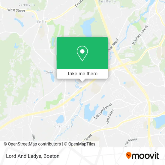
See Lord And Ladys, Marlborough, on the map
Public Transit to Lord And Ladys in Marlborough
Wondering how to get to Lord And Ladys in Marlborough? Moovit helps you find the best way to get to Lord And Ladys with step-by-step directions from the nearest public transit station.
Moovit provides free maps and live directions to help you navigate through your city. View schedules, routes, timetables, and find out how long does it take to get to Lord And Ladys in real time.
Looking for the nearest stop or station to Lord And Ladys? Check out this list of stops closest to your destination: Solomon Pond Mall.
Bus: 07C.
Want to see if there’s another route that gets you there at an earlier time? Moovit helps you find alternative routes or times. Get directions from and directions to Lord And Ladys easily from the Moovit App or Website.
We make riding to Lord And Ladys easy, which is why over 1.7 million users, including users in Marlborough, trust Moovit as the best app for public transit. You don’t need to download an individual bus app or train app, Moovit is your all-in-one transit app that helps you find the best bus time or train time available.
For information on prices of bus, costs and ride fares to Lord And Ladys, please check the Moovit app.
Use the app to navigate to popular places including to the airport, hospital, stadium, grocery store, mall, coffee shop, school, college, and university.
Lord And Ladys Address: 601 Donald Lynch Blvd street in Marlborough
- The Sleep Number Store by Select Comfort,
- Apple Store, Solomon Pond Mall,
- The Threading Spa (Gatsby's Salon an Spa by Instyle),
- Olympia Sports (Thunder-the Sports Source),
- Plumb Gold,
- Fabia Tatiana Boutique,
- VICTORIA'S SECRET,
- In Style Fragrances,
- Mark Blanchette Wormto,
- Solomon Pond Mall Food Court,
- Suitmen,
- Regal Cinemas,
- F.Y.E.,
- Luxottica Retail,
- A Direct Dish Satellite TV,
- Marlborough Medicare Insurance,
- Geek Boutique,
- Hi Beauty Siluet,
- Eyebrow Place,
- Shoe Supply
Places Near Lord And Ladys (Marlborough)
- Wang Theater, Boston,
- Boston Children's Hospital, Boston,
- Seaport District, Boston,
- Faneuil Hall, Boston,
- Cheers, Boston,
- Massachusetts General Hospital, Boston,
- Td Garden, Boston,
- Boston Common, Boston,
- Museum Of Science, Boston,
- Isabella Stewart Gardner Museum, Boston,
- North End, Boston,
- Mgm Music Hall, Boston,
- Wilbur Theatre, Boston,
- House Of Blues, Boston,
- Boston Convention & Exhibition Center, Boston,
- Boston Medical Center, Boston,
- Castle Island, Boston,
- Quincy Market, Boston,
- Prudential Center, Boston,
- Leader Bank Pavilion (Leader Bank Pavillion), Boston
How to get to popular places in Boston with public transit
Get around Marlborough by public transit!
Traveling around Marlborough has never been so easy. See step by step directions as you travel to any attraction, street or major public transit station. View bus and train schedules, arrival times, service alerts and detailed routes on a map, so you know exactly how to get to anywhere in Marlborough.
When traveling to any destination around Marlborough use Moovit's Live Directions with Get Off Notifications to know exactly where and how far to walk, how long to wait for your line, and how many stops are left. Moovit will alert you when it's time to get off — no need to constantly re-check whether yours is the next stop.
Wondering how to use public transit in Marlborough or how to pay for public transit in Marlborough? Moovit public transit app can help you navigate your way with public transit easily, and at minimum cost. It includes public transit fees, ticket prices, and costs. Looking for a map of Marlborough public transit lines? Moovit public transit app shows all public transit maps in Marlborough with all Bus, Train, Subway and Ferry routes and stops on an interactive map.
Boston has 4 transit type(s), including: Bus, Train, Subway and Ferry, operated by several transit agencies, including MBTA, Southeastern Regional Transit Authority, MetroWest Regional Transit Authority, Rhode Island Public Transit Authority, WRTA, Lowell Regional Transit Authority, Merrimack Valley Transit, Montachusett Regional Transit Authority, Cape Cod Regional Transit Authority, Brockton Area Transit Authority, Martha's Vineyard Transit Authority, the WAVE - Nantucket Regional Transit Authority, GATRA, Cape Ann Transportation Authority and Massport