How to get to Lot-Less by bus?
Click on the bus route to see step by step directions with maps, line arrival times and updated time schedules.
From E 70th St (70th and york), Manhattan
76 minFrom E 34th St, Manhattan
62 minFrom Grand Central Station, Manhattan
50 minFrom General Consulate Guyana, Manhattan
38 minFrom Weill Cornell Greenberg Center 1305 York Avenue, Manhattan
76 minFrom Lenox Hill Hospital, Manhattan
76 minFrom E 77th St / Lexington Ave, Manhattan
76 minFrom 70th St and York Ave, Manhattan
76 minFrom 42, Manhattan
61 minFrom 14th St & 8th Ave, Manhattan
62 min
How to get to Lot-Less by train?
Click on the train route to see step by step directions with maps, line arrival times and updated time schedules.
Bus stops near Lot-Less in Jersey City
Train station near Lot-Less in Jersey City
- Grove Street, 25 min walk,VIEW
Light Rail stations near Lot-Less in Jersey City
- 2nd Street Light Rail Station, 31 min walk,VIEW
Bus lines to Lot-Less in Jersey City
- 8, Bergen Ave Bayonne 55th St,VIEW
- 80, Gates Ave Via Journal Sq,VIEW
- 87, Journal Sq,VIEW
- 10, Bayonne,VIEW
- 119, New York,VIEW
- 14, Hudson Mall Stadium Plaza Via Duncan & Mallory Aves,VIEW
- 1, Newark 6th St,VIEW
- 2, Secaucus Via NJ Intl & Bulk Mail Ctr Via Secaucus Plaza,VIEW
- 83, Hackensack,VIEW
- 84, 91st Street Via Bergenline,VIEW
- 88, C North Bergen 91st Street Via Central,VIEW
- 6, Bayonne 55th Street Via Ocean Ave,VIEW
- 16, Newport Centre Mall,VIEW
- 125, New York,VIEW
- 319, Atlantic City Via Toms Rvr,VIEW
What are the closest stations to Lot-Less?
The closest stations to Lot-Less are:
- Bergen Ave at Newkirk St is 132 yards away, 2 min walk.
- JFK Blvd at Sip Ave is 243 yards away, 3 min walk.
- JFK Blvd East Of Tonnelle Ave is 250 yards away, 4 min walk.
- Journal Square Transportation Center is 313 yards away, 4 min walk.
- Grove Street is 2103 yards away, 25 min walk.
- 2nd Street Light Rail Station is 2583 yards away, 31 min walk.
Which bus line stops near Lot-Less?
119 (B Jersey City Bayonne)
Which train line stops near Lot-Less?
YEL (Journal Square - 33rd Street)
What’s the nearest train station to Lot-Less in Jersey City?
The nearest train station to Lot-Less in Jersey City is Grove Street. It’s a 25 min walk away.
What’s the nearest bus station to Lot-Less in Jersey City?
The nearest bus station to Lot-Less in Jersey City is Bergen Ave at Newkirk St. It’s a 2 min walk away.
What time is the first light rail to Lot-Less in Jersey City?
The HBLR is the first light rail that goes to Lot-Less in Jersey City. It stops nearby at 4:37 AM.
What time is the last light rail to Lot-Less in Jersey City?
The HBLR is the last light rail that goes to Lot-Less in Jersey City. It stops nearby at 2:22 AM.
What time is the first train to Lot-Less in Jersey City?
The ATW is the first train that goes to Lot-Less in Jersey City. It stops nearby at 3:14 AM.
What time is the last train to Lot-Less in Jersey City?
The ATW is the last train that goes to Lot-Less in Jersey City. It stops nearby at 3:19 AM.
What time is the first bus to Lot-Less in Jersey City?
The 1 is the first bus that goes to Lot-Less in Jersey City. It stops nearby at 3:00 AM.
What time is the last bus to Lot-Less in Jersey City?
The 1 is the last bus that goes to Lot-Less in Jersey City. It stops nearby at 2:52 AM.
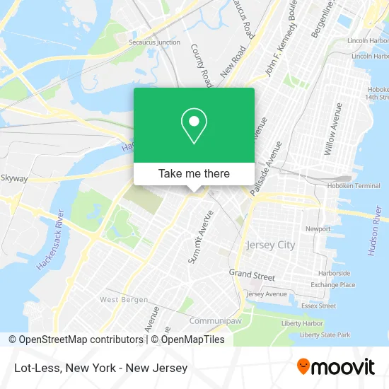
See Lot-Less, Jersey City, on the map
Public Transit to Lot-Less in Jersey City
Wondering how to get to Lot-Less in Jersey City? Moovit helps you find the best way to get to Lot-Less with step-by-step directions from the nearest public transit station.
Moovit provides free maps and live directions to help you navigate through your city. View schedules, routes, timetables, and find out how long does it take to get to Lot-Less in real time.
Looking for the nearest stop or station to Lot-Less? Check out this list of stops closest to your destination: Bergen Ave at Newkirk St; JFK Blvd at Sip Ave; JFK Blvd East Of Tonnelle Ave; Journal Square Transportation Center; Grove Street; 2nd Street Light Rail Station.
Bus: 119, 8, 80, 87, 10, 14, 6, 16, 125, 319, 1, 2, 83, 84, 88.Train: YEL, ATW, RED.
Want to see if there’s another route that gets you there at an earlier time? Moovit helps you find alternative routes or times. Get directions from and directions to Lot-Less easily from the Moovit App or Website.
We make riding to Lot-Less easy, which is why over 1.5 million users, including users in Jersey City, trust Moovit as the best app for public transit. You don’t need to download an individual bus app or train app, Moovit is your all-in-one transit app that helps you find the best bus time or train time available.
For information on prices of bus, train and subway, costs and ride fares to Lot-Less, please check the Moovit app.
Use the app to navigate to popular places including to the airport, hospital, stadium, grocery store, mall, coffee shop, school, college, and university.
Lot-Less Address: 2839 John F Kennedy Blvd street in Jersey City
- Sleep Cheap,
- Usa Vein Clinics,
- Twilight Thrift Shop & Estate Sales,
- Total Wireless,
- Every Door Direct Mail (Eddm),
- Ojo Printing,
- Jbm Tech Corp,
- Rr-Soft,
- H&R Block,
- Usa Fibroid Centers,
- Arts2print.Com,
- Mira Fruit and Farm,
- 10spot,
- Fans Of Music Station,
- Capital One Bank,
- Buffalo Wild Wings,
- Rockitcoin Bitcoin Atm,
- Smoke Shop Jersey City,
- New York Chicken & Burgers,
- Delgado Travel Agency
Places Near Lot-Less (Jersey City)
- qqqq, Manhattan,
- 1 Police Plaza, Manhattan,
- 111 Centre New York City Supreme Court, Manhattan,
- Queens Center Mall, Queens,
- 911 Memorial, Manhattan,
- Chinatown, Manhattan,
- Rockefeller Center, Manhattan,
- 3 Stone St, Manhattan,
- Pier 83, Manhattan,
- Katz's Deli, Manhattan,
- San Gennaro Feast, Manhattan,
- Mountainside Hospital, Glen Ridge,
- 376 Hudson Street, Manhattan,
- Wall Street, Manhattan,
- Times Square, Manhattan,
- Bellevue Hospital, Manhattan,
- Hudson Yards, Manhattan,
- 66 John Street, Manhattan,
- 26 Federal Plaza, Manhattan,
- SoHo, Manhattan
How to get to popular places in New York - New Jersey with public transit
Get around Jersey City by public transit!
Traveling around Jersey City has never been so easy. See step by step directions as you travel to any attraction, street or major public transit station. View bus and train schedules, arrival times, service alerts and detailed routes on a map, so you know exactly how to get to anywhere in Jersey City.
When traveling to any destination around Jersey City use Moovit's Live Directions with Get Off Notifications to know exactly where and how far to walk, how long to wait for your line, and how many stops are left. Moovit will alert you when it's time to get off — no need to constantly re-check whether yours is the next stop.
Wondering how to use public transit in Jersey City or how to pay for public transit in Jersey City? Moovit public transit app can help you navigate your way with public transit easily, and at minimum cost. It includes public transit fees, ticket prices, and costs. Looking for a map of Jersey City public transit lines? Moovit public transit app shows all public transit maps in Jersey City with all Bus, Train, Subway, Light Rail, Ferry and Cable Car routes and stops on an interactive map.
New York - New Jersey has 6 transit type(s), including: Bus, Train, Subway, Light Rail, Ferry and Cable Car, operated by several transit agencies, including MTA Subway, Metro-North Railroad, LIRR, PATH, MTA New York City Transit - Express routes, MTA Bus, NJ Transit, NYC Ferry, NICE bus, Bee-Line Bus, NJ Transit Rail, Norwalk Transit District, Hartford Line, River Valley Transit and HART