How to get to Louis Pizzeria by bus?
Click on the bus route to see step by step directions with maps, line arrival times and updated time schedules.
From Malden, MA, Malden
41 minFrom Four Points by Sheraton Boston Logan Airport, Revere
92 minFrom Hyatt Place Medford, Medford
57 minFrom Saugus, MA, Saugus
63 minFrom 200 Trade Center, Woburn
70 minFrom Market Basket, Revere
52 minFrom Everett, MA, Everett
58 minFrom Wellington Station, Medford
43 minFrom Costco, Everett
67 minFrom Burlington Mall, Burlington
80 min
How to get to Louis Pizzeria by train?
Click on the train route to see step by step directions with maps, line arrival times and updated time schedules.
Bus stop near Louis Pizzeria in Stoneham
- Redstone Shopping Center, 8 min walk,VIEW
Train station near Louis Pizzeria in Stoneham
- Reading, 39 min walk,VIEW
Bus lines to Louis Pizzeria in Stoneham
- 132, Malden,VIEW
What are the closest stations to Louis Pizzeria?
The closest stations to Louis Pizzeria are:
- Redstone Shopping Center is 609 yards away, 8 min walk.
- Reading is 3281 yards away, 39 min walk.
Which bus lines stop near Louis Pizzeria?
These bus lines stop near Louis Pizzeria: 132, 354.
Which train line stops near Louis Pizzeria?
HAVERHILL (#223 | Haverhill)
What’s the nearest bus station to Louis Pizzeria in Stoneham?
The nearest bus station to Louis Pizzeria in Stoneham is Redstone Shopping Center. It’s a 8 min walk away.
What time is the first train to Louis Pizzeria in Stoneham?
The HAVERHILL is the first train that goes to Louis Pizzeria in Stoneham. It stops nearby at 5:18 AM.
What time is the last train to Louis Pizzeria in Stoneham?
The HAVERHILL is the last train that goes to Louis Pizzeria in Stoneham. It stops nearby at 12:13 AM.
What time is the first bus to Louis Pizzeria in Stoneham?
The 132 is the first bus that goes to Louis Pizzeria in Stoneham. It stops nearby at 5:44 AM.
What time is the last bus to Louis Pizzeria in Stoneham?
The 132 is the last bus that goes to Louis Pizzeria in Stoneham. It stops nearby at 11:28 PM.
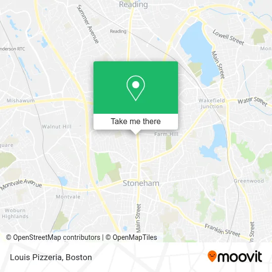
See Louis Pizzeria, Stoneham, on the map
Public Transit to Louis Pizzeria in Stoneham
Wondering how to get to Louis Pizzeria in Stoneham? Moovit helps you find the best way to get to Louis Pizzeria with step-by-step directions from the nearest public transit station.
Moovit provides free maps and live directions to help you navigate through your city. View schedules, routes, timetables, and find out how long does it take to get to Louis Pizzeria in real time.
Looking for the nearest stop or station to Louis Pizzeria? Check out this list of stops closest to your destination: Redstone Shopping Center; Reading.
Bus: 132, 354.Train: HAVERHILL.
Want to see if there’s another route that gets you there at an earlier time? Moovit helps you find alternative routes or times. Get directions from and directions to Louis Pizzeria easily from the Moovit App or Website.
We make riding to Louis Pizzeria easy, which is why over 1.7 million users, including users in Stoneham, trust Moovit as the best app for public transit. You don’t need to download an individual bus app or train app, Moovit is your all-in-one transit app that helps you find the best bus time or train time available.
For information on prices of bus and train, costs and ride fares to Louis Pizzeria, please check the Moovit app.
Use the app to navigate to popular places including to the airport, hospital, stadium, grocery store, mall, coffee shop, school, college, and university.
Louis Pizzeria Address: 125 Main St street in Stoneham
- BRM Transportation,
- LA Fitness Pool,
- Orest Painting,
- Twin Fence,
- Cerretani Liquors,
- Mcsweeney Properties,
- Quick Lane at Stoneham Motor,
- Direct SAT TV,
- DUNKIN',
- Charlestown Lacrosse and Learning Center,
- 1176 Hearinglife Stone,
- Stretchlab,
- Shred Nations,
- The Piro Compound,
- Lentine Landscaping,
- EV Connect,
- Sarah!'s Spanking Spa,
- Kathy's Swingers Hideout,
- Sarah!'s Spanking Hoint,
- Ima Construction Corp
Places Near Louis Pizzeria (Stoneham)
- Td Garden, Boston,
- Castle Island, Boston,
- Wilbur Theatre, Boston,
- Prudential Center, Boston,
- North End, Boston,
- Faneuil Hall, Boston,
- Massachusetts General Hospital, Boston,
- Seaport District, Boston,
- Boston Medical Center, Boston,
- House Of Blues, Boston,
- Boston Common, Boston,
- Boston Convention & Exhibition Center, Boston,
- Museum Of Science, Boston,
- Cheers, Boston,
- Boston Children's Hospital, Boston,
- Mgm Music Hall, Boston,
- Quincy Market, Boston,
- Isabella Stewart Gardner Museum, Boston,
- Wang Theater, Boston,
- Leader Bank Pavilion (Leader Bank Pavillion), Boston
How to get to popular places in Boston with public transit
Get around Stoneham by public transit!
Traveling around Stoneham has never been so easy. See step by step directions as you travel to any attraction, street or major public transit station. View bus and train schedules, arrival times, service alerts and detailed routes on a map, so you know exactly how to get to anywhere in Stoneham.
When traveling to any destination around Stoneham use Moovit's Live Directions with Get Off Notifications to know exactly where and how far to walk, how long to wait for your line, and how many stops are left. Moovit will alert you when it's time to get off — no need to constantly re-check whether yours is the next stop.
Wondering how to use public transit in Stoneham or how to pay for public transit in Stoneham? Moovit public transit app can help you navigate your way with public transit easily, and at minimum cost. It includes public transit fees, ticket prices, and costs. Looking for a map of Stoneham public transit lines? Moovit public transit app shows all public transit maps in Stoneham with all Bus, Train, Subway and Ferry routes and stops on an interactive map.
Boston has 4 transit type(s), including: Bus, Train, Subway and Ferry, operated by several transit agencies, including MBTA, Southeastern Regional Transit Authority, MetroWest Regional Transit Authority, Rhode Island Public Transit Authority, WRTA, Lowell Regional Transit Authority, Merrimack Valley Transit, Montachusett Regional Transit Authority, Cape Cod Regional Transit Authority, Brockton Area Transit Authority, Martha's Vineyard Transit Authority, the WAVE - Nantucket Regional Transit Authority, GATRA, Cape Ann Transportation Authority and Massport