Directions to Lowkey Dispensary (Boston) with public transportation
The following transit lines have routes that pass near Lowkey Dispensary
 Bus: 34, 34E, 35.
- Train: NEEDHAM, FRANKLIN/FOXBORO, PROVIDENCE/STOUGHTON.
How to get to Lowkey Dispensary by bus?
Click on the bus route to see step by step directions with maps, line arrival times and updated time schedules.
From Brigham and Women's, Boston
43 minFrom Reggie Lewis Athletic Center, Boston
50 minFrom Wentworth Institute Of Technology, Boston
46 minFrom Isabella Stewart Gardner Museum, Boston
48 minFrom Brighton, Boston
68 minFrom Hilton Garden Inn, Brookline
41 minFrom 1 Brookline Place, Brookline
42 minFrom Ramada by Wyndham Boston, Boston
76 minFrom Ramada Boston, Boston
76 minFrom Jamaica Plain, Boston
37 min
How to get to Lowkey Dispensary by train?
Click on the train route to see step by step directions with maps, line arrival times and updated time schedules.
Bus stops near Lowkey Dispensary in Boston
Train stations near Lowkey Dispensary in Boston
Bus lines to Lowkey Dispensary in Boston
What are the closest stations to Lowkey Dispensary?
The closest stations to Lowkey Dispensary are:
- Washington St @ Desoto Rd is 83 yards away, 2 min walk.
- Washington St @ Grove St is 197 yards away, 3 min walk.
- Endicott is 796 yards away, 10 min walk.
- West Roxbury is 1850 yards away, 22 min walk.
- Readville is 2348 yards away, 29 min walk.
Which bus lines stop near Lowkey Dispensary?
These bus lines stop near Lowkey Dispensary: 34, 34E, 35.
Which train line stops near Lowkey Dispensary?
NEEDHAM (#625 | Needham Heights)
What’s the nearest train station to Lowkey Dispensary in Boston?
The nearest train station to Lowkey Dispensary in Boston is Endicott. It’s a 10 min walk away.
What’s the nearest bus station to Lowkey Dispensary in Boston?
The nearest bus station to Lowkey Dispensary in Boston is Washington St @ Desoto Rd. It’s a 2 min walk away.
What time is the first train to Lowkey Dispensary in Boston?
The PROVIDENCE/STOUGHTON is the first train that goes to Lowkey Dispensary in Boston. It stops nearby at 5:08 AM.
What time is the last train to Lowkey Dispensary in Boston?
The PROVIDENCE/STOUGHTON is the last train that goes to Lowkey Dispensary in Boston. It stops nearby at 12:22 AM.
What time is the first bus to Lowkey Dispensary in Boston?
The 34 is the first bus that goes to Lowkey Dispensary in Boston. It stops nearby at 4:42 AM.
What time is the last bus to Lowkey Dispensary in Boston?
The 34 is the last bus that goes to Lowkey Dispensary in Boston. It stops nearby at 1:30 AM.
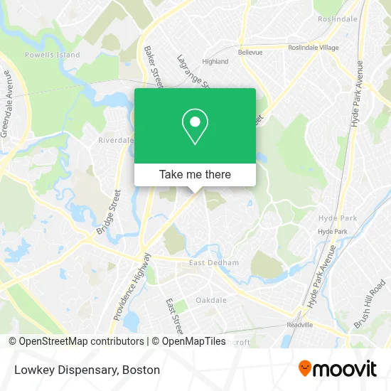
See Lowkey Dispensary, Boston, on the map
Public Transit to Lowkey Dispensary in Boston
Wondering how to get to Lowkey Dispensary in Boston? Moovit helps you find the best way to get to Lowkey Dispensary with step-by-step directions from the nearest public transit station.
Moovit provides free maps and live directions to help you navigate through your city. View schedules, routes, timetables, and find out how long does it take to get to Lowkey Dispensary in real time.
Looking for the nearest stop or station to Lowkey Dispensary? Check out this list of stops closest to your destination: Washington St @ Desoto Rd; Washington St @ Grove St; Endicott; West Roxbury; Readville.
Bus: 34, 34E, 35.Train: NEEDHAM, FRANKLIN/FOXBORO, PROVIDENCE/STOUGHTON.
Want to see if there’s another route that gets you there at an earlier time? Moovit helps you find alternative routes or times. Get directions from and directions to Lowkey Dispensary easily from the Moovit App or Website.
We make riding to Lowkey Dispensary easy, which is why over 1.7 million users, including users in Boston, trust Moovit as the best app for public transit. You don’t need to download an individual bus app or train app, Moovit is your all-in-one transit app that helps you find the best bus time or train time available.
For information on prices of bus, train and subway, costs and ride fares to Lowkey Dispensary, please check the Moovit app.
Use the app to navigate to popular places including to the airport, hospital, stadium, grocery store, mall, coffee shop, school, college, and university.
Lowkey Dispensary Address: 5252 Washington St street in Boston
- Fairouz Restaurant,
- Cristelle's Restaurant,
- North of the Border Mexican Grill,
- Tipico Salvadoreno I,
- Family Dentistry, Dr. Mahesh Sadhnani,
- Black Anchor Real Estate,
- Allstate Insurance,
- Draper Pool,
- Shechtman Halperin Savage,
- Saint Mark of Ephesus Mission Dedham,
- Christ the Rock Church,
- Pomodoros Italian Kitchen,
- Ally's Boxing Bootcamp,
- West Roxbury Apartments,
- Jackmer Air Duct Cleaning Service,
- Jewish Civil Service Cemetery,
- Alternate Angles Photography,
- Classic Car Wash & Propane,
- RHD Ma,
- Birch Street Bistro
Places Near Lowkey Dispensary (Boston)
- House Of Blues, Boston,
- Prudential Center, Boston,
- Boston Convention & Exhibition Center, Boston,
- Wang Theater, Boston,
- Seaport District, Boston,
- Td Garden, Boston,
- Leader Bank Pavilion (Leader Bank Pavillion), Boston,
- Museum Of Science, Boston,
- North End, Boston,
- Castle Island, Boston,
- Boston Medical Center, Boston,
- Boston Children's Hospital, Boston,
- Boston Common, Boston,
- Quincy Market, Boston,
- Massachusetts General Hospital, Boston,
- Faneuil Hall, Boston,
- Wilbur Theatre, Boston,
- Cheers, Boston,
- Isabella Stewart Gardner Museum, Boston,
- Mgm Music Hall, Boston
How to get to popular places in Boston with public transit
Get around Boston by public transit!
Traveling around Boston has never been so easy. See step by step directions as you travel to any attraction, street or major public transit station. View bus and train schedules, arrival times, service alerts and detailed routes on a map, so you know exactly how to get to anywhere in Boston.
When traveling to any destination around Boston use Moovit's Live Directions with Get Off Notifications to know exactly where and how far to walk, how long to wait for your line, and how many stops are left. Moovit will alert you when it's time to get off — no need to constantly re-check whether yours is the next stop.
Wondering how to use public transit in Boston or how to pay for public transit in Boston? Moovit public transit app can help you navigate your way with public transit easily, and at minimum cost. It includes public transit fees, ticket prices, and costs. Looking for a map of Boston public transit lines? Moovit public transit app shows all public transit maps in Boston with all Bus, Train, Subway and Ferry routes and stops on an interactive map.
Boston has 4 transit type(s), including: Bus, Train, Subway and Ferry, operated by several transit agencies, including MBTA, Southeastern Regional Transit Authority, MetroWest Regional Transit Authority, Rhode Island Public Transit Authority, WRTA, Lowell Regional Transit Authority, Merrimack Valley Transit, Montachusett Regional Transit Authority, Cape Cod Regional Transit Authority, Brockton Area Transit Authority, Martha's Vineyard Transit Authority, the WAVE - Nantucket Regional Transit Authority, GATRA, Cape Ann Transportation Authority and Massport