How to get to Lshd Advertising by bus?
Click on the bus route to see step by step directions with maps, line arrival times and updated time schedules.
Bus stop near Lshd Advertising in Boston
- Pleasant / Ridgewood (E), 2 min walk,VIEW
Bus lines to Lshd Advertising in Boston
What are the closest stations to Lshd Advertising?
The closest stations to Lshd Advertising are:
- Pleasant / Ridgewood (E) is 130 yards away, 2 min walk.
Which bus lines stop near Lshd Advertising?
These bus lines stop near Lshd Advertising: G47, R41.
What’s the nearest bus station to Lshd Advertising in Boston?
The nearest bus station to Lshd Advertising in Boston is Pleasant / Ridgewood (E). It’s a 2 min walk away.
What time is the first bus to Lshd Advertising in Boston?
The R41 is the first bus that goes to Lshd Advertising in Boston. It stops nearby at 6:27 AM.
What time is the last bus to Lshd Advertising in Boston?
The G47 is the last bus that goes to Lshd Advertising in Boston. It stops nearby at 8:16 PM.
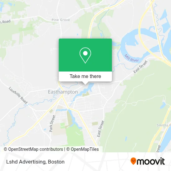
See Lshd Advertising, Boston, on the map
Public Transit to Lshd Advertising in Boston
Wondering how to get to Lshd Advertising in Boston? Moovit helps you find the best way to get to Lshd Advertising with step-by-step directions from the nearest public transit station.
Moovit provides free maps and live directions to help you navigate through your city. View schedules, routes, timetables, and find out how long does it take to get to Lshd Advertising in real time.
Looking for the nearest stop or station to Lshd Advertising? Check out this list of stops closest to your destination: Pleasant / Ridgewood (E).
Bus: G47, R41, NE.
Want to see if there’s another route that gets you there at an earlier time? Moovit helps you find alternative routes or times. Get directions from and directions to Lshd Advertising easily from the Moovit App or Website.
We make riding to Lshd Advertising easy, which is why over 1.7 million users, including users in Boston, trust Moovit as the best app for public transit. You don’t need to download an individual bus app or train app, Moovit is your all-in-one transit app that helps you find the best bus time or train time available.
For information on prices of bus, costs and ride fares to Lshd Advertising, please check the Moovit app.
Use the app to navigate to popular places including to the airport, hospital, stadium, grocery store, mall, coffee shop, school, college, and university.
Lshd Advertising Address: 180 Pleasant St street in Boston
- Paragon Arts & Industry Building,
- Techcavalry,
- Northampton SUZUKI Studio,
- Little Trúc,
- Envision Easthampton,
- Dzi,
- Lebeau Boudoir,
- Designers of Packaging,
- Beloved Earth Company,
- Aarons Paradise Transportation,
- Alwaysplay Web Design and Development,
- Droid Store,
- Shalan Stained Glass,
- Pleasant Green,
- Pleasant & Terrace,
- The Brickyard,
- Ginger Love Cafe,
- Shays Armory Distributor,
- Mallard Audio,
- Lovefield & Terrace
Places Near Lshd Advertising (Boston)
- Prudential Center, Boston,
- Td Garden, Boston,
- Boston Medical Center, Boston,
- House Of Blues, Boston,
- North End, Boston,
- Mgm Music Hall, Boston,
- Wang Theater, Boston,
- Boston Common, Boston,
- Boston Convention & Exhibition Center, Boston,
- Quincy Market, Boston,
- Cheers, Boston,
- Castle Island, Boston,
- Wilbur Theatre, Boston,
- Isabella Stewart Gardner Museum, Boston,
- Leader Bank Pavilion (Leader Bank Pavillion), Boston,
- Museum Of Science, Boston,
- Faneuil Hall, Boston,
- Seaport District, Boston,
- Boston Children's Hospital, Boston,
- Massachusetts General Hospital, Boston
How to get to popular places in Boston with public transit
Get around Boston by public transit!
Traveling around Boston has never been so easy. See step by step directions as you travel to any attraction, street or major public transit station. View bus and train schedules, arrival times, service alerts and detailed routes on a map, so you know exactly how to get to anywhere in Boston.
When traveling to any destination around Boston use Moovit's Live Directions with Get Off Notifications to know exactly where and how far to walk, how long to wait for your line, and how many stops are left. Moovit will alert you when it's time to get off — no need to constantly re-check whether yours is the next stop.
Wondering how to use public transit in Boston or how to pay for public transit in Boston? Moovit public transit app can help you navigate your way with public transit easily, and at minimum cost. It includes public transit fees, ticket prices, and costs. Looking for a map of Boston public transit lines? Moovit public transit app shows all public transit maps in Boston with all Bus, Train, Subway and Ferry routes and stops on an interactive map.
Boston has 4 transit type(s), including: Bus, Train, Subway and Ferry, operated by several transit agencies, including MBTA, Southeastern Regional Transit Authority, MetroWest Regional Transit Authority, Rhode Island Public Transit Authority, WRTA, Lowell Regional Transit Authority, Merrimack Valley Transit, Montachusett Regional Transit Authority, Cape Cod Regional Transit Authority, Brockton Area Transit Authority, Martha's Vineyard Transit Authority, the WAVE - Nantucket Regional Transit Authority, GATRA, Cape Ann Transportation Authority and Massport