Directions to Lucy’S Lunch Box (Malden) with public transportation
The following transit lines have routes that pass near Lucy’S Lunch Box
 Bus: 104, 105, 108, 411, 99.
- Train: HAVERHILL, NEWBURYPORT/ROCKPORT, ORANGE LINE.
- Subway: ORANGE LINE.
How to get to Lucy’S Lunch Box by bus?
Click on the bus route to see step by step directions with maps, line arrival times and updated time schedules.
From Isabella Stewart Gardner Museum, Boston
73 minFrom Beth Israel Deaconess Medical Center, Boston
68 minFrom Hilton Boston Back Bay, Boston
73 minFrom Capo Restaurant & Supper Club, Boston
73 minFrom Lechmere Station, Cambridge
52 minFrom The Institute Of Contemporary Art, Boston
66 minFrom Yankee Lobster, Boston
56 minFrom Biogen, Cambridge
58 minFrom Boston Latin School, Boston
73 minFrom Ruggles Station, Boston
92 min
How to get to Lucy’S Lunch Box by train?
Click on the train route to see step by step directions with maps, line arrival times and updated time schedules.
How to get to Lucy’S Lunch Box by subway?
Click on the subway route to see step by step directions with maps, line arrival times and updated time schedules.
From Isabella Stewart Gardner Museum, Boston
51 minFrom Beth Israel Deaconess Medical Center, Boston
60 minFrom Hilton Boston Back Bay, Boston
43 minFrom Capo Restaurant & Supper Club, Boston
49 minFrom Lechmere Station, Cambridge
32 minFrom The Institute Of Contemporary Art, Boston
45 minFrom Yankee Lobster, Boston
57 minFrom Biogen, Cambridge
47 minFrom Boston Latin School, Boston
57 minFrom Ruggles Station, Boston
35 min
Bus stops near Lucy’S Lunch Box in Malden
Bus lines to Lucy’S Lunch Box in Malden
What are the closest stations to Lucy’S Lunch Box?
The closest stations to Lucy’S Lunch Box are:
- Main St @ Salem St is 27 yards away, 1 min walk.
- Salem St @ Park St is 82 yards away, 2 min walk.
- Eastern Ave @ Main St is 98 yards away, 2 min walk.
- Main St @ Madison St is 138 yards away, 2 min walk.
- Centre St @ Jackson St is 335 yards away, 5 min walk.
- Chelsea is 1582 yards away, 22 min walk.
- Oak Grove is 2592 yards away, 31 min walk.
Which bus lines stop near Lucy’S Lunch Box?
These bus lines stop near Lucy’S Lunch Box: 104, 105, 108, 411, 99.
Which train line stops near Lucy’S Lunch Box?
HAVERHILL (#229 | Haverhill)
Which subway line stops near Lucy’S Lunch Box?
ORANGE LINE (Oak Grove)
What’s the nearest train station to Lucy’S Lunch Box in Malden?
The nearest train station to Lucy’S Lunch Box in Malden is Chelsea. It’s a 22 min walk away.
What’s the nearest bus station to Lucy’S Lunch Box in Malden?
The nearest bus station to Lucy’S Lunch Box in Malden is Main St @ Salem St. It’s a 1 min walk away.
What time is the first subway to Lucy’S Lunch Box in Malden?
The ORANGE LINE is the first subway that goes to Lucy’S Lunch Box in Malden. It stops nearby at 5:15 AM.
What time is the last subway to Lucy’S Lunch Box in Malden?
The ORANGE LINE is the last subway that goes to Lucy’S Lunch Box in Malden. It stops nearby at 1:59 AM.
What time is the first train to Lucy’S Lunch Box in Malden?
The HAVERHILL is the first train that goes to Lucy’S Lunch Box in Malden. It stops nearby at 5:35 AM.
What time is the last train to Lucy’S Lunch Box in Malden?
The NEWBURYPORT/ROCKPORT is the last train that goes to Lucy’S Lunch Box in Malden. It stops nearby at 12:06 AM.
What time is the first bus to Lucy’S Lunch Box in Malden?
The 104 is the first bus that goes to Lucy’S Lunch Box in Malden. It stops nearby at 4:27 AM.
What time is the last bus to Lucy’S Lunch Box in Malden?
The 104 is the last bus that goes to Lucy’S Lunch Box in Malden. It stops nearby at 1:38 AM.
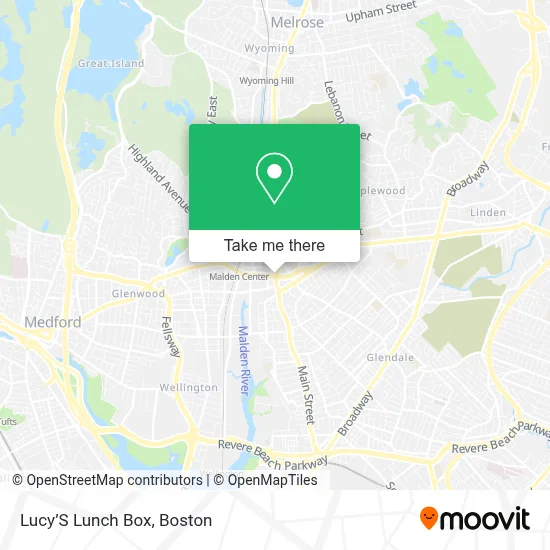
See Lucy’S Lunch Box, Malden, on the map
Public Transit to Lucy’S Lunch Box in Malden
Wondering how to get to Lucy’S Lunch Box in Malden? Moovit helps you find the best way to get to Lucy’S Lunch Box with step-by-step directions from the nearest public transit station.
Moovit provides free maps and live directions to help you navigate through your city. View schedules, routes, timetables, and find out how long does it take to get to Lucy’S Lunch Box in real time.
Looking for the nearest stop or station to Lucy’S Lunch Box? Check out this list of stops closest to your destination: Main St @ Salem St; Salem St @ Park St; Eastern Ave @ Main St; Main St @ Madison St; Centre St @ Jackson St; Chelsea; Oak Grove.
Bus: 104, 105, 108, 411, 99, 131, 137, 106, 430.Train: HAVERHILL, NEWBURYPORT/ROCKPORT, ORANGE LINE.Subway: ORANGE LINE.
Want to see if there’s another route that gets you there at an earlier time? Moovit helps you find alternative routes or times. Get directions from and directions to Lucy’S Lunch Box easily from the Moovit App or Website.
We make riding to Lucy’S Lunch Box easy, which is why over 1.7 million users, including users in Malden, trust Moovit as the best app for public transit. You don’t need to download an individual bus app or train app, Moovit is your all-in-one transit app that helps you find the best bus time or train time available.
For information on prices of bus, subway, ferry and train, costs and ride fares to Lucy’S Lunch Box, please check the Moovit app.
Use the app to navigate to popular places including to the airport, hospital, stadium, grocery store, mall, coffee shop, school, college, and university.
Lucy’S Lunch Box Address: 350 Main St street in Malden
- Spaulding Outpatient Center Malden,
- Trellis,
- Dietrich Group,
- Pine Banks Park Foundation,
- Cha Center for Mindfulness and Compassion,
- Hair 101,
- Army Recuiter,
- Smileland Pediatric de,
- Volpicelli House of Quality,
- Peking Gourmet,
- Xfinity Store by Comcast,
- Cushion Clinic,
- Luva Hair and Day Spa (Lana Beauty Spa),
- US Navy Recruiting Office,
- Ax Mortgage,
- Carlson Management Consulting,
- Glenn Associates,
- Darlene Josephs,
- Northeastern Remodeling,
- Beck
Places Near Lucy’S Lunch Box (Malden)
- Wang Theater, Boston,
- North End, Boston,
- Wilbur Theatre, Boston,
- Isabella Stewart Gardner Museum, Boston,
- Seaport District, Boston,
- Td Garden, Boston,
- Boston Children's Hospital, Boston,
- Castle Island, Boston,
- Mgm Music Hall, Boston,
- Cheers, Boston,
- Museum Of Science, Boston,
- Faneuil Hall, Boston,
- Massachusetts General Hospital, Boston,
- House Of Blues, Boston,
- Quincy Market, Boston,
- Boston Medical Center, Boston,
- Boston Common, Boston,
- Prudential Center, Boston,
- Boston Convention & Exhibition Center, Boston,
- Leader Bank Pavilion (Leader Bank Pavillion), Boston
How to get to popular places in Boston with public transit
Get around Malden by public transit!
Traveling around Malden has never been so easy. See step by step directions as you travel to any attraction, street or major public transit station. View bus and train schedules, arrival times, service alerts and detailed routes on a map, so you know exactly how to get to anywhere in Malden.
When traveling to any destination around Malden use Moovit's Live Directions with Get Off Notifications to know exactly where and how far to walk, how long to wait for your line, and how many stops are left. Moovit will alert you when it's time to get off — no need to constantly re-check whether yours is the next stop.
Wondering how to use public transit in Malden or how to pay for public transit in Malden? Moovit public transit app can help you navigate your way with public transit easily, and at minimum cost. It includes public transit fees, ticket prices, and costs. Looking for a map of Malden public transit lines? Moovit public transit app shows all public transit maps in Malden with all Bus, Train, Subway and Ferry routes and stops on an interactive map.
Boston has 4 transit type(s), including: Bus, Train, Subway and Ferry, operated by several transit agencies, including MBTA, Southeastern Regional Transit Authority, MetroWest Regional Transit Authority, Rhode Island Public Transit Authority, WRTA, Lowell Regional Transit Authority, Merrimack Valley Transit, Montachusett Regional Transit Authority, Cape Cod Regional Transit Authority, Brockton Area Transit Authority, Martha's Vineyard Transit Authority, the WAVE - Nantucket Regional Transit Authority, GATRA, Cape Ann Transportation Authority and Massport