Directions to Lutherville Timonium with public transportation
The following transit lines have routes that pass near Lutherville Timonium
How to get to Lutherville Timonium by bus?
Click on the bus route to see step by step directions with maps, line arrival times and updated time schedules.
Bus stations near Lutherville Timonium
- Lutherville Light Rail Station Bay 2,17 min walk,
- Towsontown Blvd & University Ave Wb,52 min walk,
- Sheppard Pratt Hospital Eb,60 min walk,
Light Rail stations near Lutherville Timonium
- Timonium,50 min walk,
Bus lines to Lutherville Timonium
- 93,Towson,
- 51,Downtown,
- 53,Sheppard Pratt,
What are the closest stations to Lutherville Timonium?
The closest stations to Lutherville Timonium are:
- Lutherville Light Rail Station Bay 2 is 1374 yards away, 17 min walk.
- Timonium is 4132 yards away, 50 min walk.
- Towsontown Blvd & University Ave Wb is 4346 yards away, 52 min walk.
- Sheppard Pratt Hospital Eb is 5052 yards away, 60 min walk.
Which bus line stops near Lutherville Timonium?
CITYLINK RED
Which light rail line stops near Lutherville Timonium?
LIGHT RAIL
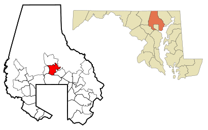
See Lutherville Timonium on the map
Public Transportation to Lutherville Timonium
Wondering how to get to Lutherville Timonium, United States? Moovit helps you find the best way to get to Lutherville Timonium with step-by-step directions from the nearest public transit station.
Moovit provides free maps and live directions to help you navigate through your city. View schedules, routes, timetables, and find out how long does it take to get to Lutherville Timonium in real time.
Looking for the nearest stop or station to Lutherville Timonium? Check out this list of stops closest to your destination: Lutherville Light Rail Station Bay 2; Timonium; Towsontown Blvd & University Ave Wb; Sheppard Pratt Hospital Eb.
Bus:CITYLINK RED935153Light Rail:LIGHT RAIL
Want to see if there’s another route that gets you there at an earlier time? Moovit helps you find alternative routes or times. Get directions from and directions to Lutherville Timonium easily from the Moovit App or Website.
We make riding to Lutherville Timonium easy, which is why over 1.5 million users, including users in Lutherville, trust Moovit as the best app for public transit. You don’t need to download an individual bus app or train app, Moovit is your all-in-one transit app that helps you find the best bus time or train time available.
For information on prices of bus, light rail and metro, costs and ride fares to Lutherville Timonium, please check the Moovit app.
Use the app to navigate to popular places including to the airport, hospital, stadium, grocery store, mall, coffee shop, school, college, and university.
Location: Lutherville, Washington, D.C. - Baltimore, MD
Attractions near Lutherville Timonium
Lutherville,لوتھرویل، میری لینڈ,Лутервил,Timonium Station,1,G S Abbott & Associates,Four Seasons Lawn & Landscapng,Earl Mason,Gallery 3 Ltd,Creative Remodeling Svc,1526 Francke Ave,Twilight Fire,PWRCLN,St. John's United Methodist Church,Jazzercise-Lutherville,Lots Of Love Day Care,Mason Earl Rev,Responsive Home Care,1404 Francke Ave,281 Morris AveHow to get to popular attractions in Lutherville with public transit
Biergarten Haus, Washington,Federal Center SW Metro Station, Washington,White Flint Metro Station, Montgomery County,Bluejacket Brewery, Washington,Odenton MARC Station, Anne Arundel County,Uncle Julio's Rio Grande Cafe, Montgomery County,Hyatt Regency Baltimore Inner Harbor, Baltimore,Renaissance Baltimore Harborplace Hotel, Baltimore,Intercounty Connector (ICC) / MD 200, Montgomery County,I-95 Exit 158: Prince William Pkwy, Prince William County,Bloomingdale, Washington DC, Washington,Mount Vernon Place, Baltimore,Cuba Libre Restaurant & Rum Bar, Washington,Mt. Pleasant, Washington,Dacha Beer Garden, Washington,Costco Wholesale, Howard County,Fogo de Chao, Washington,Big Bear Cafe, Washington,P.J. Clarke's, Washington,Bistrot Du Coin, WashingtonGet around Lutherville by public transit!
Traveling around Lutherville has never been so easy. See step by step directions as you travel to any attraction, street or major public transit station. View bus and train schedules, arrival times, service alerts and detailed routes on a map, so you know exactly how to get to anywhere in Lutherville.
When traveling to any destination around Lutherville use Moovit's Live Directions with Get Off Notifications to know exactly where and how far to walk, how long to wait for your line, and how many stops are left. Moovit will alert you when it's time to get off — no need to constantly re-check whether yours is the next stop.
Wondering how to use public transit in Lutherville or how to pay for public transit in Lutherville? Moovit public transit app can help you navigate your way with public transit easily, and at minimum cost. It includes public transit fees, ticket prices, and costs. Looking for a map of Lutherville public transit lines? Moovit public transit app shows all public transit maps in Lutherville with all bus, light rail or metro routes and stops on an interactive map.
Lutherville has 3 transit type(s), including: bus, light rail or metro, operated by several transit agencies, including WMATA, WMATA, Montgomery County Ride On, Fairfax Connector, TheBus, DC Circulator, MDOT MTA, Marc, MDOT MTA, MDOT MTA, Virginia Railway Express (VRE), PRTC, DASH - Alexandria, Arlington Transit (ART) and DC Streetcar