Directions to Luxury Fast Ride (Wellesley) with public transportation
The following transit lines have routes that pass near Luxury Fast Ride
 Bus: 01, 505, 553, 558, MANSFIELD TO LOGAN AIRPORT.
- Train: FRAMINGHAM/WORCESTER.
- Subway: GREEN LINE D.
How to get to Luxury Fast Ride by bus?
Click on the bus route to see step by step directions with maps, line arrival times and updated time schedules.
From Mount Auburn, Cambridge
96 minFrom Arsenal Mall, Watertown Town
82 minFrom Showa Boston Institute, Boston
144 minFrom Brighton Music Hall, Boston
80 minFrom Alumni Stadium, Newton
102 minFrom Thermo Fisher Scientific, Waltham
65 minFrom VFW Parkway, Boston
106 minFrom Allston, Boston
81 minFrom Brighton, Boston
72 minFrom Brookline High School (Brookline Town High School), Brookline
89 min
How to get to Luxury Fast Ride by train?
Click on the train route to see step by step directions with maps, line arrival times and updated time schedules.
How to get to Luxury Fast Ride by subway?
Click on the subway route to see step by step directions with maps, line arrival times and updated time schedules.
Bus stops near Luxury Fast Ride in Wellesley
Subway station near Luxury Fast Ride in Wellesley
- Waban, 28 min walk,VIEW
Train station near Luxury Fast Ride in Wellesley
- Wellesley Farms, 41 min walk,VIEW
Bus lines to Luxury Fast Ride in Wellesley
What are the closest stations to Luxury Fast Ride?
The closest stations to Luxury Fast Ride are:
- Lower Falls (Washington St/Concord St) is 149 yards away, 2 min walk.
- Waban is 2384 yards away, 28 min walk.
- Riverside Mbta Station is 2823 yards away, 34 min walk.
- Wellesley Farms is 3425 yards away, 41 min walk.
Which bus lines stop near Luxury Fast Ride?
These bus lines stop near Luxury Fast Ride: 01, 505, 553, 558.
Which train line stops near Luxury Fast Ride?
FRAMINGHAM/WORCESTER (#521 | Worcester)
Which subway line stops near Luxury Fast Ride?
GREEN LINE D (Riverside)
What’s the nearest subway station to Luxury Fast Ride in Wellesley?
The nearest subway station to Luxury Fast Ride in Wellesley is Waban. It’s a 28 min walk away.
What’s the nearest bus station to Luxury Fast Ride in Wellesley?
The nearest bus station to Luxury Fast Ride in Wellesley is Lower Falls (Washington St/Concord St). It’s a 2 min walk away.
What time is the first subway to Luxury Fast Ride in Wellesley?
The GREEN LINE D is the first subway that goes to Luxury Fast Ride in Wellesley. It stops nearby at 4:45 AM.
What time is the last subway to Luxury Fast Ride in Wellesley?
The GREEN LINE D is the last subway that goes to Luxury Fast Ride in Wellesley. It stops nearby at 2:48 AM.
What time is the first train to Luxury Fast Ride in Wellesley?
The FRAMINGHAM/WORCESTER is the first train that goes to Luxury Fast Ride in Wellesley. It stops nearby at 5:09 AM.
What time is the last train to Luxury Fast Ride in Wellesley?
The FRAMINGHAM/WORCESTER is the last train that goes to Luxury Fast Ride in Wellesley. It stops nearby at 12:26 AM.
What time is the first bus to Luxury Fast Ride in Wellesley?
The MANSFIELD TO LOGAN AIRPORT is the first bus that goes to Luxury Fast Ride in Wellesley. It stops nearby at 3:35 AM.
What time is the last bus to Luxury Fast Ride in Wellesley?
The MANSFIELD TO LOGAN AIRPORT is the last bus that goes to Luxury Fast Ride in Wellesley. It stops nearby at 1:50 AM.
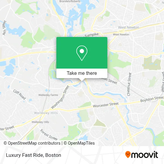
See Luxury Fast Ride, Wellesley, on the map
Public Transit to Luxury Fast Ride in Wellesley
Wondering how to get to Luxury Fast Ride in Wellesley? Moovit helps you find the best way to get to Luxury Fast Ride with step-by-step directions from the nearest public transit station.
Moovit provides free maps and live directions to help you navigate through your city. View schedules, routes, timetables, and find out how long does it take to get to Luxury Fast Ride in real time.
Looking for the nearest stop or station to Luxury Fast Ride? Check out this list of stops closest to your destination: Lower Falls (Washington St/Concord St); Waban; Riverside Mbta Station; Wellesley Farms.
Bus: 01, 505, 553, 558, MANSFIELD TO LOGAN AIRPORT.Train: FRAMINGHAM/WORCESTER.Subway: GREEN LINE D.
Want to see if there’s another route that gets you there at an earlier time? Moovit helps you find alternative routes or times. Get directions from and directions to Luxury Fast Ride easily from the Moovit App or Website.
We make riding to Luxury Fast Ride easy, which is why over 1.7 million users, including users in Wellesley, trust Moovit as the best app for public transit. You don’t need to download an individual bus app or train app, Moovit is your all-in-one transit app that helps you find the best bus time or train time available.
For information on prices of bus, subway and train, costs and ride fares to Luxury Fast Ride, please check the Moovit app.
Use the app to navigate to popular places including to the airport, hospital, stadium, grocery store, mall, coffee shop, school, college, and university.
Luxury Fast Ride Address: 12 Walnut St street in Wellesley
- Boston Hernia (Nora Fullington, MD Facs),
- Kelly Family Law LLC,
- Cree Alessandri & Strauss,
- David Molzan - Financial Advisor Ameriprise Financial Services,
- Kahani Psychiatry,
- Fage USA,
- Kathryn Deanzeris, MD,
- Eaton-Moulton Mill,
- Raynham Helen, MD, PHD,
- Charles River Cfo,
- Newton Lower Falls, Massachusetts,
- Commercial Locksmith,
- Cohen & Sales,
- Morton Financial,
- Mark Lichtenstein Attorney,
- Kellie D Jacques - Financial Advisor, Ameriprise Financial Services,
- Newton Lower Falls 25 Residential Locksmith,
- Allena,
- Grovestreet,
- Alcresta
Places Near Luxury Fast Ride (Wellesley)
- Museum Of Science, Boston,
- Massachusetts General Hospital, Boston,
- Td Garden, Boston,
- Cheers, Boston,
- House Of Blues, Boston,
- Leader Bank Pavilion (Leader Bank Pavillion), Boston,
- Isabella Stewart Gardner Museum, Boston,
- Boston Children's Hospital, Boston,
- North End, Boston,
- Wilbur Theatre, Boston,
- Seaport District, Boston,
- Boston Medical Center, Boston,
- Boston Common, Boston,
- Wang Theater, Boston,
- Castle Island, Boston,
- Mgm Music Hall, Boston,
- Boston Convention & Exhibition Center, Boston,
- Prudential Center, Boston,
- Faneuil Hall, Boston,
- Quincy Market, Boston
How to get to popular places in Boston with public transit
Get around Wellesley by public transit!
Traveling around Wellesley has never been so easy. See step by step directions as you travel to any attraction, street or major public transit station. View bus and train schedules, arrival times, service alerts and detailed routes on a map, so you know exactly how to get to anywhere in Wellesley.
When traveling to any destination around Wellesley use Moovit's Live Directions with Get Off Notifications to know exactly where and how far to walk, how long to wait for your line, and how many stops are left. Moovit will alert you when it's time to get off — no need to constantly re-check whether yours is the next stop.
Wondering how to use public transit in Wellesley or how to pay for public transit in Wellesley? Moovit public transit app can help you navigate your way with public transit easily, and at minimum cost. It includes public transit fees, ticket prices, and costs. Looking for a map of Wellesley public transit lines? Moovit public transit app shows all public transit maps in Wellesley with all Bus, Train, Subway and Ferry routes and stops on an interactive map.
Boston has 4 transit type(s), including: Bus, Train, Subway and Ferry, operated by several transit agencies, including MBTA, Southeastern Regional Transit Authority, MetroWest Regional Transit Authority, Rhode Island Public Transit Authority, WRTA, Lowell Regional Transit Authority, Merrimack Valley Transit, Montachusett Regional Transit Authority, Cape Cod Regional Transit Authority, Brockton Area Transit Authority, Martha's Vineyard Transit Authority, the WAVE - Nantucket Regional Transit Authority, GATRA, Cape Ann Transportation Authority and Massport