Directions to Lydon Roofing (Milton) with public transportation
The following transit lines have routes that pass near Lydon Roofing
 Bus: 240, MATTAPAN LINE SHUTTLE, MATTAPAN LINE SHUTTLE, RED/MATTAPAN LINE SHUTTLE, 12.
- Train: FAIRMOUNT.
- Subway: MATTAPAN LINE.
How to get to Lydon Roofing by bus?
Click on the bus route to see step by step directions with maps, line arrival times and updated time schedules.
From Boston Municipal Court (Roxbury District Court), Boston
53 minFrom MBTA-Museum of Fine Arts, Boston
54 minFrom Greyhound:Bus Station, Boston
88 minFrom Seaport District, Boston
105 minFrom Puttshack, Boston
106 minFrom Jamaica Pond, Boston
57 minFrom The Friendly Toast, Boston
75 minFrom Fidelity Investments, Boston
87 minFrom Peter Pan Bus Lines at South Station, Boston
87 minFrom The Westin Boston Waterfront, Boston
106 min
How to get to Lydon Roofing by train?
Click on the train route to see step by step directions with maps, line arrival times and updated time schedules.
From Boston Municipal Court (Roxbury District Court), Boston
69 minFrom MBTA-Museum of Fine Arts, Boston
98 minFrom Greyhound:Bus Station, Boston
59 minFrom Seaport District, Boston
72 minFrom Puttshack, Boston
72 minFrom Jamaica Pond, Boston
186 minFrom The Friendly Toast, Boston
67 minFrom Fidelity Investments, Boston
60 minFrom Peter Pan Bus Lines at South Station, Boston
58 minFrom The Westin Boston Waterfront, Boston
73 min
How to get to Lydon Roofing by subway?
Click on the subway route to see step by step directions with maps, line arrival times and updated time schedules.
From Boston Municipal Court (Roxbury District Court), Boston
70 minFrom MBTA-Museum of Fine Arts, Boston
62 minFrom Greyhound:Bus Station, Boston
41 minFrom Seaport District, Boston
59 minFrom Puttshack, Boston
60 minFrom Jamaica Pond, Boston
75 minFrom The Friendly Toast, Boston
56 minFrom Fidelity Investments, Boston
45 minFrom Peter Pan Bus Lines at South Station, Boston
41 minFrom The Westin Boston Waterfront, Boston
60 min
Bus stops near Lydon Roofing in Milton
Subway station near Lydon Roofing in Milton
- Mattapan, 15 min walk,VIEW
Bus lines to Lydon Roofing in Milton
What are the closest stations to Lydon Roofing?
The closest stations to Lydon Roofing are:
- Eliot St Opp Valley Rd Sta is 288 yards away, 4 min walk.
- Central Ave Opp Hinckley Rd is 424 yards away, 5 min walk.
- Mattapan is 1211 yards away, 15 min walk.
Which bus line stops near Lydon Roofing?
240 (Avon Square)
Which train line stops near Lydon Roofing?
FAIRMOUNT (#1619 | Fairmount)
Which subway line stops near Lydon Roofing?
MATTAPAN LINE (Mattapan)
What’s the nearest subway station to Lydon Roofing in Milton?
The nearest subway station to Lydon Roofing in Milton is Mattapan. It’s a 15 min walk away.
What’s the nearest bus station to Lydon Roofing in Milton?
The nearest bus station to Lydon Roofing in Milton is Eliot St Opp Valley Rd Sta. It’s a 4 min walk away.
What time is the first subway to Lydon Roofing in Milton?
The MATTAPAN LINE is the first subway that goes to Lydon Roofing in Milton. It stops nearby at 5:00 AM.
What time is the last subway to Lydon Roofing in Milton?
The MATTAPAN LINE is the last subway that goes to Lydon Roofing in Milton. It stops nearby at 2:40 AM.
What time is the first bus to Lydon Roofing in Milton?
The 240 is the first bus that goes to Lydon Roofing in Milton. It stops nearby at 4:57 AM.
What time is the last bus to Lydon Roofing in Milton?
The 240 is the last bus that goes to Lydon Roofing in Milton. It stops nearby at 1:02 AM.
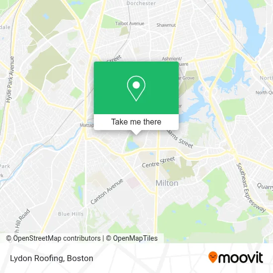
See Lydon Roofing, Milton, on the map
Public Transit to Lydon Roofing in Milton
Wondering how to get to Lydon Roofing in Milton? Moovit helps you find the best way to get to Lydon Roofing with step-by-step directions from the nearest public transit station.
Moovit provides free maps and live directions to help you navigate through your city. View schedules, routes, timetables, and find out how long does it take to get to Lydon Roofing in real time.
Looking for the nearest stop or station to Lydon Roofing? Check out this list of stops closest to your destination: Eliot St Opp Valley Rd Sta; Central Ave Opp Hinckley Rd; Mattapan.
Bus: 240, MATTAPAN LINE SHUTTLE, MATTAPAN LINE SHUTTLE, RED/MATTAPAN LINE SHUTTLE, 12.Train: FAIRMOUNT.Subway: MATTAPAN LINE.
Want to see if there’s another route that gets you there at an earlier time? Moovit helps you find alternative routes or times. Get directions from and directions to Lydon Roofing easily from the Moovit App or Website.
We make riding to Lydon Roofing easy, which is why over 1.7 million users, including users in Milton, trust Moovit as the best app for public transit. You don’t need to download an individual bus app or train app, Moovit is your all-in-one transit app that helps you find the best bus time or train time available.
For information on prices of bus, subway and train, costs and ride fares to Lydon Roofing, please check the Moovit app.
Use the app to navigate to popular places including to the airport, hospital, stadium, grocery store, mall, coffee shop, school, college, and university.
Lydon Roofing Address: 17 Herrick Dr street in Milton
- JM Lydon,
- Locksmith Milton MA,
- Central Avenue M Line MBTA Station,
- Grant Gray PC,
- Castles Unlimited,
- Milton Village, Massachusetts,
- Appliance Repair Kenmore Repair Service,
- Design Dimensions,
- Pepsi-Cola Bottling,
- Cambridge Port Construction,
- Ron Scott Realtor Milton Ma,
- Milton Academy,
- Milton, Massachusetts,
- New Locks Installation Services,
- Pierce Middle School,
- To Life Coach,
- Thomas Green,
- Irwin & Irwin,
- Auto Glass Back Window,
- Shields Park Pool Seymour in
Places Near Lydon Roofing (Milton)
- Isabella Stewart Gardner Museum, Boston,
- Cheers, Boston,
- Seaport District, Boston,
- House Of Blues, Boston,
- Boston Common, Boston,
- Wilbur Theatre, Boston,
- Leader Bank Pavilion (Leader Bank Pavillion), Boston,
- Faneuil Hall, Boston,
- Boston Medical Center, Boston,
- Quincy Market, Boston,
- Boston Children's Hospital, Boston,
- Massachusetts General Hospital, Boston,
- North End, Boston,
- Boston Convention & Exhibition Center, Boston,
- Museum Of Science, Boston,
- Mgm Music Hall, Boston,
- Wang Theater, Boston,
- Castle Island, Boston,
- Prudential Center, Boston,
- Td Garden, Boston
How to get to popular places in Boston with public transit
Get around Milton by public transit!
Traveling around Milton has never been so easy. See step by step directions as you travel to any attraction, street or major public transit station. View bus and train schedules, arrival times, service alerts and detailed routes on a map, so you know exactly how to get to anywhere in Milton.
When traveling to any destination around Milton use Moovit's Live Directions with Get Off Notifications to know exactly where and how far to walk, how long to wait for your line, and how many stops are left. Moovit will alert you when it's time to get off — no need to constantly re-check whether yours is the next stop.
Wondering how to use public transit in Milton or how to pay for public transit in Milton? Moovit public transit app can help you navigate your way with public transit easily, and at minimum cost. It includes public transit fees, ticket prices, and costs. Looking for a map of Milton public transit lines? Moovit public transit app shows all public transit maps in Milton with all Bus, Train, Subway and Ferry routes and stops on an interactive map.
Boston has 4 transit type(s), including: Bus, Train, Subway and Ferry, operated by several transit agencies, including MBTA, Southeastern Regional Transit Authority, MetroWest Regional Transit Authority, Rhode Island Public Transit Authority, WRTA, Lowell Regional Transit Authority, Merrimack Valley Transit, Montachusett Regional Transit Authority, Cape Cod Regional Transit Authority, Brockton Area Transit Authority, Martha's Vineyard Transit Authority, the WAVE - Nantucket Regional Transit Authority, GATRA, Cape Ann Transportation Authority and Massport