Directions to Lyla Rose Fishing Charters (Gloucester) with public transportation
The following transit lines have routes that pass near Lyla Rose Fishing Charters
How to get to Lyla Rose Fishing Charters by bus?
Click on the bus route to see step by step directions with maps, line arrival times and updated time schedules.
How to get to Lyla Rose Fishing Charters by train?
Click on the train route to see step by step directions with maps, line arrival times and updated time schedules.
Bus stops near Lyla Rose Fishing Charters in Gloucester
Train station near Lyla Rose Fishing Charters in Gloucester
- Gloucester, 11 min walk,VIEW
Bus lines to Lyla Rose Fishing Charters in Gloucester
What are the closest stations to Lyla Rose Fishing Charters?
The closest stations to Lyla Rose Fishing Charters are:
- Washington St & Poplar St is 437 yards away, 6 min walk.
- Poplar Park is 585 yards away, 7 min walk.
- Across From Mcpherson Park is 682 yards away, 9 min walk.
- Gloucester is 921 yards away, 11 min walk.
- Gloucester High School is 942 yards away, 12 min walk.
Which bus lines stop near Lyla Rose Fishing Charters?
These bus lines stop near Lyla Rose Fishing Charters: BEVERLY COMMUTER, CITY OF BEVERLY SHUTTLE.
Which train line stops near Lyla Rose Fishing Charters?
NEWBURYPORT/ROCKPORT (#21 | Rockport)
What’s the nearest train station to Lyla Rose Fishing Charters in Gloucester?
The nearest train station to Lyla Rose Fishing Charters in Gloucester is Gloucester. It’s a 11 min walk away.
What’s the nearest bus station to Lyla Rose Fishing Charters in Gloucester?
The nearest bus station to Lyla Rose Fishing Charters in Gloucester is Washington St & Poplar St. It’s a 6 min walk away.
What time is the first train to Lyla Rose Fishing Charters in Gloucester?
The NEWBURYPORT/ROCKPORT is the first train that goes to Lyla Rose Fishing Charters in Gloucester. It stops nearby at 5:14 AM.
What time is the last train to Lyla Rose Fishing Charters in Gloucester?
The NEWBURYPORT/ROCKPORT is the last train that goes to Lyla Rose Fishing Charters in Gloucester. It stops nearby at 12:47 AM.
What time is the first bus to Lyla Rose Fishing Charters in Gloucester?
The LANESVILLE is the first bus that goes to Lyla Rose Fishing Charters in Gloucester. It stops nearby at 6:15 AM.
What time is the last bus to Lyla Rose Fishing Charters in Gloucester?
The GLOUCESTER CROSSING/BUSINESS EXPRESS is the last bus that goes to Lyla Rose Fishing Charters in Gloucester. It stops nearby at 6:43 PM.
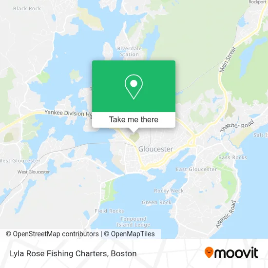
See Lyla Rose Fishing Charters, Gloucester, on the map
Public Transit to Lyla Rose Fishing Charters in Gloucester
Wondering how to get to Lyla Rose Fishing Charters in Gloucester? Moovit helps you find the best way to get to Lyla Rose Fishing Charters with step-by-step directions from the nearest public transit station.
Moovit provides free maps and live directions to help you navigate through your city. View schedules, routes, timetables, and find out how long does it take to get to Lyla Rose Fishing Charters in real time.
Looking for the nearest stop or station to Lyla Rose Fishing Charters? Check out this list of stops closest to your destination: Washington St & Poplar St; Poplar Park; Across From Mcpherson Park; Gloucester; Gloucester High School.
Bus: BEVERLY COMMUTER, CITY OF BEVERLY SHUTTLE, LANESVILLE, GLOUCESTER CROSSING/BUSINESS EXPRESS, GLOUCESTER CROSSING/BLACKBURN EXPRESS, GLOUCESTER - ROCKPORT VIA THATCHER ROAD, MAGNOLIA.Train: NEWBURYPORT/ROCKPORT.
Want to see if there’s another route that gets you there at an earlier time? Moovit helps you find alternative routes or times. Get directions from and directions to Lyla Rose Fishing Charters easily from the Moovit App or Website.
We make riding to Lyla Rose Fishing Charters easy, which is why over 1.7 million users, including users in Gloucester, trust Moovit as the best app for public transit. You don’t need to download an individual bus app or train app, Moovit is your all-in-one transit app that helps you find the best bus time or train time available.
For information on prices of train and bus, costs and ride fares to Lyla Rose Fishing Charters, please check the Moovit app.
Use the app to navigate to popular places including to the airport, hospital, stadium, grocery store, mall, coffee shop, school, college, and university.
Lyla Rose Fishing Charters Address: 4 Wheeler St street in Gloucester
- Saint Peters Fiesta,
- Vanilza's Cleaning,
- Courtney's Beauty Lab,
- Healthy Gloucester Collab,
- Backyard Growers Program,
- Cape Ann Lighthouse,
- Nami Cape Ann,
- Gloucester Ave Used Cars,
- Crystal Cottage Candies & More,
- Laurence G Knight DC,
- Cape Ann Copper Company,
- Afterglo Skincare Studio,
- Candid Auto Glass Glass Auto,
- Medicare Insurance Advisors Gloucester,
- Warde Plumbing & Heating,
- Geoffrey H. Richon Company, Inc.,
- North Shore 24 Gloucester,
- Azorean Restaurant,
- Interstate Batteries,
- Lograsso's Auto
Places Near Lyla Rose Fishing Charters (Gloucester)
- Boston Common, Boston,
- Seaport District, Boston,
- Isabella Stewart Gardner Museum, Boston,
- Leader Bank Pavilion (Leader Bank Pavillion), Boston,
- Mgm Music Hall, Boston,
- Cheers, Boston,
- Boston Children's Hospital, Boston,
- Castle Island, Boston,
- North End, Boston,
- Td Garden, Boston,
- Boston Convention & Exhibition Center, Boston,
- Wang Theater, Boston,
- Boston Medical Center, Boston,
- Museum Of Science, Boston,
- Massachusetts General Hospital, Boston,
- Faneuil Hall, Boston,
- Prudential Center, Boston,
- House Of Blues, Boston,
- Quincy Market, Boston,
- Wilbur Theatre, Boston
How to get to popular places in Boston with public transit
Get around Gloucester by public transit!
Traveling around Gloucester has never been so easy. See step by step directions as you travel to any attraction, street or major public transit station. View bus and train schedules, arrival times, service alerts and detailed routes on a map, so you know exactly how to get to anywhere in Gloucester.
When traveling to any destination around Gloucester use Moovit's Live Directions with Get Off Notifications to know exactly where and how far to walk, how long to wait for your line, and how many stops are left. Moovit will alert you when it's time to get off — no need to constantly re-check whether yours is the next stop.
Wondering how to use public transit in Gloucester or how to pay for public transit in Gloucester? Moovit public transit app can help you navigate your way with public transit easily, and at minimum cost. It includes public transit fees, ticket prices, and costs. Looking for a map of Gloucester public transit lines? Moovit public transit app shows all public transit maps in Gloucester with all Bus, Train, Subway and Ferry routes and stops on an interactive map.
Boston has 4 transit type(s), including: Bus, Train, Subway and Ferry, operated by several transit agencies, including MBTA, Southeastern Regional Transit Authority, MetroWest Regional Transit Authority, Rhode Island Public Transit Authority, WRTA, Lowell Regional Transit Authority, Merrimack Valley Transit, Montachusett Regional Transit Authority, Cape Cod Regional Transit Authority, Brockton Area Transit Authority, Martha's Vineyard Transit Authority, the WAVE - Nantucket Regional Transit Authority, GATRA, Cape Ann Transportation Authority and Massport