Directions to Lynch And Pine (Boston) with public transportation
The following transit lines have routes that pass near Lynch And Pine
 Bus: 1, 21, 35, 54, 51.
- Train: PROVIDENCE/STOUGHTON, ACELA, NORTHEAST REGIONAL, PROVIDENCE LINE SHUTTLE, PROVIDENCE LINE SHUTTLE.
How to get to Lynch And Pine by bus?
Click on the bus route to see step by step directions with maps, line arrival times and updated time schedules.
How to get to Lynch And Pine by train?
Click on the train route to see step by step directions with maps, line arrival times and updated time schedules.
Bus stops near Lynch And Pine in Boston
- Roger Williams National Memorial, 2 min walk,VIEW
- Memorial Before Exchange, 2 min walk,VIEW
- Memorial After Exchange, 2 min walk,VIEW
- Westminster After Memorial, 3 min walk,VIEW
- Kennedy Plaza (Stop J), 4 min walk,VIEW
- Kennedy Plaza (Stop Y), 5 min walk,VIEW
- S Main Ns Washington, 5 min walk,VIEW
- Tunnel Before S Main, 5 min walk,VIEW
- Canal After Smith, 6 min walk,VIEW
- Park Row West (Drop-Off Only), 8 min walk,VIEW
Train stations near Lynch And Pine in Boston
- Providence, 50 min walk,VIEW
Bus lines to Lynch And Pine in Boston
- 51, Hospital District Via Charles St,VIEW
- 54, Hospital District,VIEW
- 58, E-Cubed Academy,VIEW
- 72, Hospital District (Providence),VIEW
- R, Broad Street Terminal (Providence),VIEW
- 21, Reservoir Ave/Garden City/CCRI Warwick,VIEW
- 30, Oaklawn Ave,VIEW
- 56, Chalkstone Ave,VIEW
- QX, Quonset Express,VIEW
- 12X, Arctic/RI-117 Express,VIEW
- 59X, North Smithfield/Lincoln Express,VIEW
- 61X, Tiverton/East Bay Express,VIEW
- 65X, Narragansett/Wakefield Express,VIEW
- 95X, Westerly Express,VIEW
- 14, Newport Via Jamestown,VIEW
- 50, Bryant University,VIEW
- 55, Ri College Via Admiral St,VIEW
- 92, Riverview Place Via Governor Apts,VIEW
- 6, Kennedy Plaza,VIEW
- 60, Newport Via W Main Rd,VIEW
What are the closest stations to Lynch And Pine?
The closest stations to Lynch And Pine are:
- Roger Williams National Memorial is 98 yards away, 2 min walk.
- Memorial Before Exchange is 113 yards away, 2 min walk.
- Memorial After Exchange is 138 yards away, 2 min walk.
- Westminster After Memorial is 237 yards away, 3 min walk.
- Kennedy Plaza (Stop J) is 304 yards away, 4 min walk.
- Kennedy Plaza (Stop Y) is 367 yards away, 5 min walk.
- S Main Ns Washington is 381 yards away, 5 min walk.
- Tunnel Before S Main is 404 yards away, 5 min walk.
- Canal After Smith is 412 yards away, 6 min walk.
- Park Row West (Drop-Off Only) is 630 yards away, 8 min walk.
- Providence is 4147 yards away, 50 min walk.
Which bus lines stop near Lynch And Pine?
These bus lines stop near Lynch And Pine: 1, 21, 35, 54.
Which train line stops near Lynch And Pine?
PROVIDENCE/STOUGHTON (#819 | Providence)
What’s the nearest bus station to Lynch And Pine in Boston?
The nearest bus stations to Lynch And Pine in Boston are Roger Williams National Memorial, Memorial Before Exchange and Memorial After Exchange. The closest one is a 2 min walk away.
What time is the first train to Lynch And Pine in Boston?
The PROVIDENCE/STOUGHTON is the first train that goes to Lynch And Pine in Boston. It stops nearby at 4:10 AM.
What time is the last train to Lynch And Pine in Boston?
The NORTHEAST REGIONAL is the last train that goes to Lynch And Pine in Boston. It stops nearby at 9:17 AM.
What time is the first bus to Lynch And Pine in Boston?
The 54 is the first bus that goes to Lynch And Pine in Boston. It stops nearby at 5:17 AM.
What time is the last bus to Lynch And Pine in Boston?
The 60 is the last bus that goes to Lynch And Pine in Boston. It stops nearby at 1:00 AM.
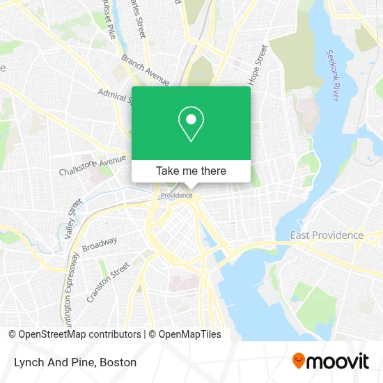
See Lynch And Pine, Boston, on the map
Public Transit to Lynch And Pine in Boston
Wondering how to get to Lynch And Pine in Boston? Moovit helps you find the best way to get to Lynch And Pine with step-by-step directions from the nearest public transit station.
Moovit provides free maps and live directions to help you navigate through your city. View schedules, routes, timetables, and find out how long does it take to get to Lynch And Pine in real time.
Looking for the nearest stop or station to Lynch And Pine? Check out this list of stops closest to your destination: Roger Williams National Memorial; Memorial Before Exchange; Memorial After Exchange; Westminster After Memorial; Kennedy Plaza (Stop J); Kennedy Plaza (Stop Y); S Main Ns Washington; Tunnel Before S Main; Canal After Smith; Park Row West (Drop-Off Only); Providence.
Bus: 1, 21, 35, 54, 51, 58, 72, R, 30, 56, QX, 12X, 14, 50, 55, 92.Train: PROVIDENCE/STOUGHTON, ACELA, NORTHEAST REGIONAL, PROVIDENCE LINE SHUTTLE, PROVIDENCE LINE SHUTTLE, PROVIDENCE LINE SHUTTLE, FOXBORO EVENT SERVICE.
Want to see if there’s another route that gets you there at an earlier time? Moovit helps you find alternative routes or times. Get directions from and directions to Lynch And Pine easily from the Moovit App or Website.
We make riding to Lynch And Pine easy, which is why over 1.7 million users, including users in Boston, trust Moovit as the best app for public transit. You don’t need to download an individual bus app or train app, Moovit is your all-in-one transit app that helps you find the best bus time or train time available.
For information on prices of bus and train, costs and ride fares to Lynch And Pine, please check the Moovit app.
Use the app to navigate to popular places including to the airport, hospital, stadium, grocery store, mall, coffee shop, school, college, and university.
Lynch And Pine Address: 1 Park Row street in Boston
- LPL Financial,
- Casey Candace Brown M Attorney,
- Hewtin's Dogs Mobile,
- Double Tap Academy,
- Rhode Island School of Design Msm (Museum of Art),
- Greater Kennedy Plaza,
- Ghosts of Providence by US Ghost Adventures,
- RISD Museum,
- 41agv Ga Chimney,
- Equal Housing Opportunity,
- Providence Train Station (PVD) - MBTA & Amtrak,
- Providence RI,
- Youth Action Council,
- Mobilequbes,
- Raffa Life,
- Providence Amtrak Station,
- GoBus - NYC,
- Cookson Investments,
- Johnson & Wales Book Store,
- Sasha Cesen - Tiaa Wealth Management Advisor
Places Near Lynch And Pine (Boston)
- Isabella Stewart Gardner Museum, Boston,
- Mgm Music Hall, Boston,
- Wilbur Theatre, Boston,
- Boston Medical Center, Boston,
- Quincy Market, Boston,
- Leader Bank Pavilion (Leader Bank Pavillion), Boston,
- Cheers, Boston,
- Castle Island, Boston,
- House Of Blues, Boston,
- Wang Theater, Boston,
- Boston Children's Hospital, Boston,
- Seaport District, Boston,
- Faneuil Hall, Boston,
- Boston Convention & Exhibition Center, Boston,
- Massachusetts General Hospital, Boston,
- Prudential Center, Boston,
- North End, Boston,
- Td Garden, Boston,
- Museum Of Science, Boston,
- Boston Common, Boston
How to get to popular places in Boston with public transit
Get around Boston by public transit!
Traveling around Boston has never been so easy. See step by step directions as you travel to any attraction, street or major public transit station. View bus and train schedules, arrival times, service alerts and detailed routes on a map, so you know exactly how to get to anywhere in Boston.
When traveling to any destination around Boston use Moovit's Live Directions with Get Off Notifications to know exactly where and how far to walk, how long to wait for your line, and how many stops are left. Moovit will alert you when it's time to get off — no need to constantly re-check whether yours is the next stop.
Wondering how to use public transit in Boston or how to pay for public transit in Boston? Moovit public transit app can help you navigate your way with public transit easily, and at minimum cost. It includes public transit fees, ticket prices, and costs. Looking for a map of Boston public transit lines? Moovit public transit app shows all public transit maps in Boston with all Bus, Train, Subway and Ferry routes and stops on an interactive map.
Boston has 4 transit type(s), including: Bus, Train, Subway and Ferry, operated by several transit agencies, including MBTA, Southeastern Regional Transit Authority, MetroWest Regional Transit Authority, Rhode Island Public Transit Authority, WRTA, Lowell Regional Transit Authority, Merrimack Valley Transit, Montachusett Regional Transit Authority, Cape Cod Regional Transit Authority, Brockton Area Transit Authority, Martha's Vineyard Transit Authority, the WAVE - Nantucket Regional Transit Authority, GATRA, Cape Ann Transportation Authority and Massport