How to get to Lynch Insurance Group by bus?
Click on the bus route to see step by step directions with maps, line arrival times and updated time schedules.
From Medford, MA, Medford
59 minFrom Chevalier Theatre (Chevalier Theater Show Line), Medford
53 minFrom Ac Hotel Cambridge, Cambridge
87 minFrom Assembly Square, Somerville
52 minFrom MBTA Alewife Station, Cambridge
78 minFrom MBTA / Alewife #6, Cambridge
82 minFrom Arlington, MA, Arlington
77 minFrom Holiday Inn Express-Saugus, Saugus
64 minFrom Target, Everett
59 minFrom Encore Boston Harbor, Everett
64 min
Bus stop near Lynch Insurance Group in Stoneham
- Main St Opp Maple St, 2 min walk,VIEW
Train station near Lynch Insurance Group in Stoneham
- Reading, 49 min walk,VIEW
Bus lines to Lynch Insurance Group in Stoneham
- 132, Malden,VIEW
What are the closest stations to Lynch Insurance Group?
The closest stations to Lynch Insurance Group are:
- Main St Opp Maple St is 93 yards away, 2 min walk.
- Reading is 4160 yards away, 49 min walk.
Which bus lines stop near Lynch Insurance Group?
These bus lines stop near Lynch Insurance Group: 132, 354.
What’s the nearest bus station to Lynch Insurance Group in Stoneham?
The nearest bus station to Lynch Insurance Group in Stoneham is Main St Opp Maple St. It’s a 2 min walk away.
What time is the first train to Lynch Insurance Group in Stoneham?
The HAVERHILL is the first train that goes to Lynch Insurance Group in Stoneham. It stops nearby at 5:18 AM.
What time is the last train to Lynch Insurance Group in Stoneham?
The HAVERHILL is the last train that goes to Lynch Insurance Group in Stoneham. It stops nearby at 12:13 AM.
What time is the first bus to Lynch Insurance Group in Stoneham?
The 132 is the first bus that goes to Lynch Insurance Group in Stoneham. It stops nearby at 5:41 AM.
What time is the last bus to Lynch Insurance Group in Stoneham?
The 132 is the last bus that goes to Lynch Insurance Group in Stoneham. It stops nearby at 11:30 PM.
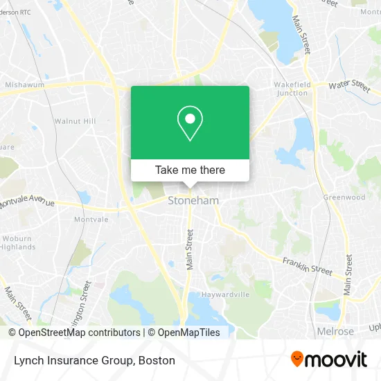
See Lynch Insurance Group, Stoneham, on the map
Public Transit to Lynch Insurance Group in Stoneham
Wondering how to get to Lynch Insurance Group in Stoneham? Moovit helps you find the best way to get to Lynch Insurance Group with step-by-step directions from the nearest public transit station.
Moovit provides free maps and live directions to help you navigate through your city. View schedules, routes, timetables, and find out how long does it take to get to Lynch Insurance Group in real time.
Looking for the nearest stop or station to Lynch Insurance Group? Check out this list of stops closest to your destination: Main St Opp Maple St; Reading.
Bus: 132, 354.Train: HAVERHILL.
Want to see if there’s another route that gets you there at an earlier time? Moovit helps you find alternative routes or times. Get directions from and directions to Lynch Insurance Group easily from the Moovit App or Website.
We make riding to Lynch Insurance Group easy, which is why over 1.7 million users, including users in Stoneham, trust Moovit as the best app for public transit. You don’t need to download an individual bus app or train app, Moovit is your all-in-one transit app that helps you find the best bus time or train time available.
For information on prices of bus and subway, costs and ride fares to Lynch Insurance Group, please check the Moovit app.
Use the app to navigate to popular places including to the airport, hospital, stadium, grocery store, mall, coffee shop, school, college, and university.
Lynch Insurance Group Address: 280 Main St street in Stoneham
- MBTA Bus Route 132,
- Bateman & Slade,
- Allure Lash and Beauty,
- Paint & Daisies,
- Princess Nails,
- Saint Patrick Church,
- Bitcoin Depot - Bitcoin ATM,
- Mobil Mart,
- Bacci's Restaurant,
- STARBUCKS,
- Coinstar - Bitcoin ATM,
- ATM,
- Stoneham Theatre,
- Coinstar,
- Shawmut Woodworking,
- Town Taxi of Stoneham,
- Mabbett & Associates,
- FedEx Office,
- 02180,
- Sound City Ent.
Places Near Lynch Insurance Group (Stoneham)
- Boston Children's Hospital, Boston,
- Castle Island, Boston,
- House Of Blues, Boston,
- North End, Boston,
- Seaport District, Boston,
- Faneuil Hall, Boston,
- Leader Bank Pavilion (Leader Bank Pavillion), Boston,
- Wang Theater, Boston,
- Boston Convention & Exhibition Center, Boston,
- Boston Common, Boston,
- Massachusetts General Hospital, Boston,
- Boston Medical Center, Boston,
- Prudential Center, Boston,
- Cheers, Boston,
- Td Garden, Boston,
- Mgm Music Hall, Boston,
- Quincy Market, Boston,
- Wilbur Theatre, Boston,
- Museum Of Science, Boston,
- Isabella Stewart Gardner Museum, Boston
How to get to popular places in Boston with public transit
Get around Stoneham by public transit!
Traveling around Stoneham has never been so easy. See step by step directions as you travel to any attraction, street or major public transit station. View bus and train schedules, arrival times, service alerts and detailed routes on a map, so you know exactly how to get to anywhere in Stoneham.
When traveling to any destination around Stoneham use Moovit's Live Directions with Get Off Notifications to know exactly where and how far to walk, how long to wait for your line, and how many stops are left. Moovit will alert you when it's time to get off — no need to constantly re-check whether yours is the next stop.
Wondering how to use public transit in Stoneham or how to pay for public transit in Stoneham? Moovit public transit app can help you navigate your way with public transit easily, and at minimum cost. It includes public transit fees, ticket prices, and costs. Looking for a map of Stoneham public transit lines? Moovit public transit app shows all public transit maps in Stoneham with all Bus, Train, Subway and Ferry routes and stops on an interactive map.
Boston has 4 transit type(s), including: Bus, Train, Subway and Ferry, operated by several transit agencies, including MBTA, Southeastern Regional Transit Authority, MetroWest Regional Transit Authority, Rhode Island Public Transit Authority, WRTA, Lowell Regional Transit Authority, Merrimack Valley Transit, Montachusett Regional Transit Authority, Cape Cod Regional Transit Authority, Brockton Area Transit Authority, Martha's Vineyard Transit Authority, the WAVE - Nantucket Regional Transit Authority, GATRA, Cape Ann Transportation Authority and Massport