Directions to Lyons School (Randolph) with public transportation
The following transit lines have routes that pass near Lyons School
 Bus: 238.
- Train: CAPEFLYER, FALL RIVER/NEW BEDFORD, KINGSTON.
- Subway: RED LINE.
How to get to Lyons School by bus?
Click on the bus route to see step by step directions with maps, line arrival times and updated time schedules.
From Walmart, Quincy
60 minFrom South Shore Hospital- Pratt 5, Weymouth Town
104 minFrom Wollaston Beach, Quincy
84 minFrom Washington St, Boston
48 minFrom Quincy Center Station, Quincy
36 minFrom Best Western Adams Inn Quincy - Boston, Quincy
82 minFrom Academy Of the Pacific Rim Charter Public School, Boston
105 minFrom Milton, MA, Milton
48 minFrom Good Samaritan Medical Center, Brockton
70 min
Bus stop near Lyons School in Randolph
- North St @ Scannel Rd, 5 min walk,VIEW
Train station near Lyons School in Randolph
- Braintree, 54 min walk,VIEW
Subway station near Lyons School in Randolph
- Braintree, 56 min walk,VIEW
Bus lines to Lyons School in Randolph
- 238, Quincy Center,VIEW
What are the closest stations to Lyons School?
The closest stations to Lyons School are:
- North St @ Scannel Rd is 375 yards away, 5 min walk.
- Braintree is 4564 yards away, 54 min walk.
Which bus line stops near Lyons School?
238 (Quincy Center)
What’s the nearest bus station to Lyons School in Randolph?
The nearest bus station to Lyons School in Randolph is North St @ Scannel Rd. It’s a 5 min walk away.
What time is the first subway to Lyons School in Randolph?
The RED LINE is the first subway that goes to Lyons School in Randolph. It stops nearby at 5:09 AM.
What time is the last subway to Lyons School in Randolph?
The RED LINE is the last subway that goes to Lyons School in Randolph. It stops nearby at 2:00 AM.
What time is the first train to Lyons School in Randolph?
The FALL RIVER/NEW BEDFORD is the first train that goes to Lyons School in Randolph. It stops nearby at 5:27 AM.
What time is the last train to Lyons School in Randolph?
The KINGSTON is the last train that goes to Lyons School in Randolph. It stops nearby at 12:25 AM.
What time is the first bus to Lyons School in Randolph?
The 238 is the first bus that goes to Lyons School in Randolph. It stops nearby at 5:11 AM.
What time is the last bus to Lyons School in Randolph?
The 238 is the last bus that goes to Lyons School in Randolph. It stops nearby at 11:15 PM.
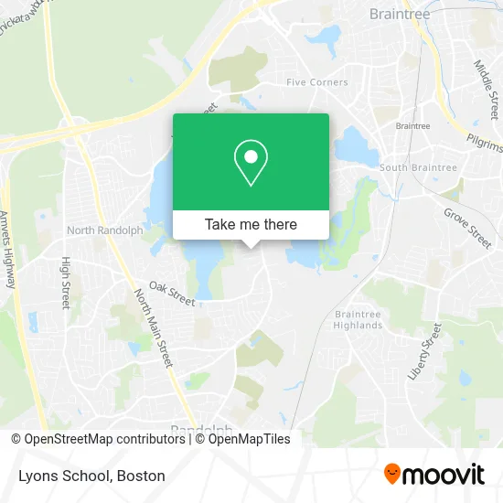
See Lyons School, Randolph, on the map
Public Transit to Lyons School in Randolph
Wondering how to get to Lyons School in Randolph? Moovit helps you find the best way to get to Lyons School with step-by-step directions from the nearest public transit station.
Moovit provides free maps and live directions to help you navigate through your city. View schedules, routes, timetables, and find out how long does it take to get to Lyons School in real time.
Looking for the nearest stop or station to Lyons School? Check out this list of stops closest to your destination: North St @ Scannel Rd; Braintree.
Bus: 238.Train: CAPEFLYER, FALL RIVER/NEW BEDFORD, KINGSTON.Subway: RED LINE.
Want to see if there’s another route that gets you there at an earlier time? Moovit helps you find alternative routes or times. Get directions from and directions to Lyons School easily from the Moovit App or Website.
We make riding to Lyons School easy, which is why over 1.7 million users, including users in Randolph, trust Moovit as the best app for public transit. You don’t need to download an individual bus app or train app, Moovit is your all-in-one transit app that helps you find the best bus time or train time available.
For information on prices of bus, subway and train, costs and ride fares to Lyons School, please check the Moovit app.
Use the app to navigate to popular places including to the airport, hospital, stadium, grocery store, mall, coffee shop, school, college, and university.
Location: Randolph, Boston
- Budget,
- Riteway Construction,
- Accurate Collision Center,
- JBL Bus Lines,
- Groupe Missionnarrie Pelerins,
- Braintree American Challenger League,
- Broad Meadow,
- Express Tools,
- Worldwide Part & Accessories,
- USPS Collection Box - Blue Box,
- Great Pond Manor Function Hall,
- Glam Factory,
- Sweeney Dawley Recovery Center,
- Hines Financial Group,
- Garage Door Repair Braintree Ma,
- Riverbend Condominium Trust,
- Trashremovalkings,
- Bug Swamp Galore,
- Allstar Logistics and Warehousing,
- Brigham and Women's Hospital
Places Near Lyons School (Randolph)
- Faneuil Hall, Boston,
- Mgm Music Hall, Boston,
- Leader Bank Pavilion (Leader Bank Pavillion), Boston,
- Castle Island, Boston,
- Museum Of Science, Boston,
- Prudential Center, Boston,
- Cheers, Boston,
- Td Garden, Boston,
- Isabella Stewart Gardner Museum, Boston,
- Boston Children's Hospital, Boston,
- Boston Medical Center, Boston,
- North End, Boston,
- House Of Blues, Boston,
- Wilbur Theatre, Boston,
- Seaport District, Boston,
- Wang Theater, Boston,
- Boston Convention & Exhibition Center, Boston,
- Massachusetts General Hospital, Boston,
- Quincy Market, Boston,
- Boston Common, Boston
How to get to popular places in Boston with public transit
Get around Randolph by public transit!
Traveling around Randolph has never been so easy. See step by step directions as you travel to any attraction, street or major public transit station. View bus and train schedules, arrival times, service alerts and detailed routes on a map, so you know exactly how to get to anywhere in Randolph.
When traveling to any destination around Randolph use Moovit's Live Directions with Get Off Notifications to know exactly where and how far to walk, how long to wait for your line, and how many stops are left. Moovit will alert you when it's time to get off — no need to constantly re-check whether yours is the next stop.
Wondering how to use public transit in Randolph or how to pay for public transit in Randolph? Moovit public transit app can help you navigate your way with public transit easily, and at minimum cost. It includes public transit fees, ticket prices, and costs. Looking for a map of Randolph public transit lines? Moovit public transit app shows all public transit maps in Randolph with all Bus, Train, Subway and Ferry routes and stops on an interactive map.
Boston has 4 transit type(s), including: Bus, Train, Subway and Ferry, operated by several transit agencies, including MBTA, Southeastern Regional Transit Authority, MetroWest Regional Transit Authority, Rhode Island Public Transit Authority, WRTA, Lowell Regional Transit Authority, Merrimack Valley Transit, Montachusett Regional Transit Authority, Cape Cod Regional Transit Authority, Brockton Area Transit Authority, Martha's Vineyard Transit Authority, the WAVE - Nantucket Regional Transit Authority, GATRA, Cape Ann Transportation Authority and Massport