Directions to Műegyetem station (Budapest) with public transit
The following transit lines have routes that pass near Műegyetem
How to get to Műegyetem station by bus?
Click on the bus route to see step by step directions with maps, line arrival times and updated time schedules.
How to get to Műegyetem station by train?
Click on the train route to see step by step directions with maps, line arrival times and updated time schedules.
How to get to Műegyetem station by metro?
Click on the metro route to see step by step directions with maps, line arrival times and updated time schedules.
Bus stops near Műegyetem in Budapest
- Szent Gellért Tér - Műegyetem M, 3 min walk,
- Petőfi Híd, Budai Hídfő, 9 min walk,
- Fővám Tér M, 11 min walk,
Metro station near Műegyetem in Budapest
- Szent Gellért Tér, 4 min walk,
Light Rail stations near Műegyetem in Budapest
- Szent Gellért Tér - Műegyetem M, 6 min walk,
Bus lines to Műegyetem station in Budapest
- 107, Infopark ► Budapart,
- 133E, Újpalota, Nyírpalota Út,
- 7, Albertfalva Vasútállomás,
- 907, Csertő Utca,
- 973, Újpalota, Szentmihályi Út,
- 973A, Városház Tér,
- 153, Infopark (Pázmány Péter sétány) / Gazdagréti tér,
- 212, Boráros tér H / Normafa látogatóközpont,
- 212A, Boráros tér H / Svábhegy,
- 212B, Boráros tér H / Csillebérc KFKI,
- 918, Kelenföld vasútállomás M / Óbudai autóbuszgarázs,
- 154, Infopark ► Budapart,
- 15, Gyöngyösi Utca M,
- 83, Fővám Tér M,
- 934, Békásmegyer H,
- 979, Újpalota, Nyírpalota Út,
- 979A, Deák Ferenc Tér M,
What are the closest stations to Műegyetem?
The closest stations to Műegyetem are:
- Szent Gellért Tér - Műegyetem M is 208 meters away, 3 min walk.
- Szent Gellért Tér is 246 meters away, 4 min walk.
- Petőfi Híd, Budai Hídfő is 653 meters away, 9 min walk.
- Fővám Tér M is 861 meters away, 11 min walk.
Which bus lines stop near Műegyetem?
These bus lines stop near Műegyetem: 107, 133E, 15, 212, 212A.
Which train lines stop near Műegyetem?
These train lines stop near Műegyetem: H5, H7.
Which metro line stops near Műegyetem?
M4 (Kelenföld Vasútállomás)
Which light rail lines stop near Műegyetem?
These light rail lines stop near Műegyetem: 19, 2, 41, 56.
What’s the nearest light rail station to Műegyetem in Budapest?
The nearest light rail station to Műegyetem in Budapest is Szent Gellért Tér - Műegyetem M. It’s a 6 min walk away.
What’s the nearest metro station to Műegyetem in Budapest?
The nearest metro station to Műegyetem in Budapest is Szent Gellért Tér. It’s a 4 min walk away.
What’s the nearest bus stop to Műegyetem in Budapest?
The nearest bus stop to Műegyetem in Budapest is Szent Gellért Tér - Műegyetem M. It’s a 3 min walk away.
What time is the first light rail to Műegyetem in Budapest?
The 47 is the first light rail that goes to Műegyetem in Budapest. It stops nearby at 4:15 AM.
What time is the last light rail to Műegyetem in Budapest?
The 47 is the last light rail that goes to Műegyetem in Budapest. It stops nearby at 12:30 AM.
What time is the first metro to Műegyetem in Budapest?
The M4 is the first metro that goes to Műegyetem in Budapest. It stops nearby at 4:33 AM.
What time is the last metro to Műegyetem in Budapest?
The M4 is the last metro that goes to Műegyetem in Budapest. It stops nearby at 11:46 PM.
What time is the first bus to Műegyetem in Budapest?
The 6 is the first bus that goes to Műegyetem in Budapest. It stops nearby at 3:02 AM.
What time is the last bus to Műegyetem in Budapest?
The 973 is the last bus that goes to Műegyetem in Budapest. It stops nearby at 3:36 AM.
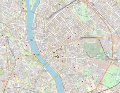
See Műegyetem, Budapest, on the map
Public Transit to Műegyetem in Budapest
Wondering how to get to Műegyetem in Budapest, Hungary? Moovit helps you find the best way to get to Műegyetem with step-by-step directions from the nearest public transit station.
Moovit provides free maps and live directions to help you navigate through your city. View schedules, routes, timetables, and find out how long does it take to get to Műegyetem in real time.
Looking for the nearest stop or station to Műegyetem? Check out this list of stops closest to your destination: Szent Gellért Tér - Műegyetem M; Szent Gellért Tér; Petőfi Híd; Fővám Tér M.
Bus: 107, 133E, 15, 212, 212A, 7, 907, 973, 973A, 153, 212B, 918.Train: H5, H7.Metro: M4.Light Rail: 19, 2, 41, 56.
Want to see if there’s another route that gets you there at an earlier time? Moovit helps you find alternative routes or times. Get directions from and directions to Műegyetem easily from the Moovit App or Website.
We make riding to Műegyetem easy, which is why over 1.5 million users, including users in Budapest, trust Moovit as the best app for public transit. You don’t need to download an individual bus app or train app, Moovit is your all-in-one transit app that helps you find the best bus time or train time available.
For information on prices of bus, metro, train and light rail, costs and ride fares to Műegyetem, please check the Moovit app.
Use the app to navigate to popular places including to the airport, hospital, stadium, grocery store, mall, coffee shop, school, college, and university.
Műegyetem Address: Valdemar és Nina Langlet rakpart street in Budapest
Places Near Műegyetem (Budapest)
How to get to popular places in Budapest with public transit
Get around Budapest by public transit!
Traveling around Budapest has never been so easy. See step by step directions as you travel to any attraction, street or major public transit station. View bus and train schedules, arrival times, service alerts and detailed routes on a map, so you know exactly how to get to anywhere in Budapest.
When traveling to any destination around Budapest use Moovit's Live Directions with Get Off Notifications to know exactly where and how far to walk, how long to wait for your line, and how many stops are left. Moovit will alert you when it's time to get off — no need to constantly re-check whether yours is the next stop.
Wondering how to use public transit in Budapest or how to pay for public transit in Budapest? Moovit public transit app can help you navigate your way with public transit easily, and at minimum cost. It includes public transit fees, ticket prices, and costs. Looking for a map of Budapest public transit lines? Moovit public transit app shows all public transit maps in Budapest with all Bus, Train, Metro, Light Rail and Ferry routes and stops on an interactive map.
Budapest has 5 transit type(s), including: Bus, Train, Metro, Light Rail and Ferry, operated by several transit agencies, including BKK and MÁV Személyszállítási Zrt. - HÉV