Directions to MB Custom Print - Uniforms & Co. (Boston) with public transportation
The following transit lines have routes that pass near MB Custom Print - Uniforms & Co.
 Bus: 10.
How to get to MB Custom Print - Uniforms & Co. by bus?
Click on the bus route to see step by step directions with maps, line arrival times and updated time schedules.
Bus stop near MB Custom Print - Uniforms & Co. in Boston
- Across From 2189 Lakeview, 7 min walk,VIEW
Bus lines to MB Custom Print - Uniforms & Co. in Boston
- 10, Kennedy Center,VIEW
What are the closest stations to MB Custom Print - Uniforms & Co.?
The closest stations to MB Custom Print - Uniforms & Co. are:
- Across From 2189 Lakeview is 562 yards away, 7 min walk.
Which bus line stops near MB Custom Print - Uniforms & Co.?
10 (Ayotte's Market)
What’s the nearest bus station to MB Custom Print - Uniforms & Co. in Boston?
The nearest bus station to MB Custom Print - Uniforms & Co. in Boston is Across From 2189 Lakeview. It’s a 7 min walk away.
What time is the first bus to MB Custom Print - Uniforms & Co. in Boston?
The 10 is the first bus that goes to MB Custom Print - Uniforms & Co. in Boston. It stops nearby at 6:54 AM.
What time is the last bus to MB Custom Print - Uniforms & Co. in Boston?
The 10 is the last bus that goes to MB Custom Print - Uniforms & Co. in Boston. It stops nearby at 6:40 PM.
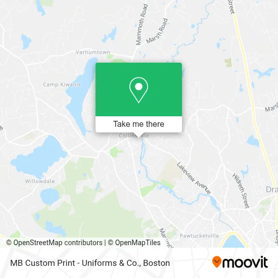
See MB Custom Print - Uniforms & Co., Boston, on the map
Public Transit to MB Custom Print - Uniforms & Co. in Boston
Wondering how to get to MB Custom Print - Uniforms & Co. in Boston? Moovit helps you find the best way to get to MB Custom Print - Uniforms & Co. with step-by-step directions from the nearest public transit station.
Moovit provides free maps and live directions to help you navigate through your city. View schedules, routes, timetables, and find out how long does it take to get to MB Custom Print - Uniforms & Co. in real time.
Looking for the nearest stop or station to MB Custom Print - Uniforms & Co.? Check out this list of stops closest to your destination: Across From 2189 Lakeview.
Bus: 10.
Want to see if there’s another route that gets you there at an earlier time? Moovit helps you find alternative routes or times. Get directions from and directions to MB Custom Print - Uniforms & Co. easily from the Moovit App or Website.
We make riding to MB Custom Print - Uniforms & Co. easy, which is why over 1.7 million users, including users in Boston, trust Moovit as the best app for public transit. You don’t need to download an individual bus app or train app, Moovit is your all-in-one transit app that helps you find the best bus time or train time available.
For information on prices of bus, costs and ride fares to MB Custom Print - Uniforms & Co., please check the Moovit app.
Use the app to navigate to popular places including to the airport, hospital, stadium, grocery store, mall, coffee shop, school, college, and university.
MB Custom Print - Uniforms & Co. Address: 101 Mill St street in Boston
- Beaver Brook Village,
- Nails by Christina,
- KCR Manufacturing,
- St. Paul's Calvary Evangelical Dracut,
- Back To Health Muscular Therapy,
- Little Trends Consignment & Childrens Store,
- Moonlight & Mindfulness,
- Carvalho & Sons Fence and Outdoor Materials,
- Brickhouse Pizza,
- Fadden Michael J,
- Hairstylist Amanda Jusczak,
- 1217 Mammoth Rd Parking,
- Town of Dracut,
- Bridgewell,
- Crazy Dave's Cantina,
- Gillis', Tom Remodeling,
- Timberline Roofing,
- The Fireplace Church,
- Plantz Cafe,
- Shred Nations
Places Near MB Custom Print - Uniforms & Co. (Boston)
- House Of Blues, Boston,
- Prudential Center, Boston,
- Wang Theater, Boston,
- Boston Convention & Exhibition Center, Boston,
- Wilbur Theatre, Boston,
- Boston Children's Hospital, Boston,
- North End, Boston,
- Boston Medical Center, Boston,
- Boston Common, Boston,
- Museum Of Science, Boston,
- Td Garden, Boston,
- Mgm Music Hall, Boston,
- Massachusetts General Hospital, Boston,
- Faneuil Hall, Boston,
- Seaport District, Boston,
- Quincy Market, Boston,
- Isabella Stewart Gardner Museum, Boston,
- Cheers, Boston,
- Leader Bank Pavilion (Leader Bank Pavillion), Boston,
- Castle Island, Boston
How to get to popular places in Boston with public transit
Get around Boston by public transit!
Traveling around Boston has never been so easy. See step by step directions as you travel to any attraction, street or major public transit station. View bus and train schedules, arrival times, service alerts and detailed routes on a map, so you know exactly how to get to anywhere in Boston.
When traveling to any destination around Boston use Moovit's Live Directions with Get Off Notifications to know exactly where and how far to walk, how long to wait for your line, and how many stops are left. Moovit will alert you when it's time to get off — no need to constantly re-check whether yours is the next stop.
Wondering how to use public transit in Boston or how to pay for public transit in Boston? Moovit public transit app can help you navigate your way with public transit easily, and at minimum cost. It includes public transit fees, ticket prices, and costs. Looking for a map of Boston public transit lines? Moovit public transit app shows all public transit maps in Boston with all Bus, Train, Subway and Ferry routes and stops on an interactive map.
Boston has 4 transit type(s), including: Bus, Train, Subway and Ferry, operated by several transit agencies, including MBTA, Southeastern Regional Transit Authority, MetroWest Regional Transit Authority, Rhode Island Public Transit Authority, WRTA, Lowell Regional Transit Authority, Merrimack Valley Transit, Montachusett Regional Transit Authority, Cape Cod Regional Transit Authority, Brockton Area Transit Authority, Martha's Vineyard Transit Authority, the WAVE - Nantucket Regional Transit Authority, GATRA, Cape Ann Transportation Authority and Massport