See M G Road Metro Station, Gurgaon, on the map
Directions to M G Road Metro Station (Gurgaon) with public transportation
The following transit lines have routes that pass near M G Road Metro Station
 Bus:
Bus: - Metro:
How to get to M G Road Metro Station by bus?
Click on the bus route to see step by step directions with maps, line arrival times and updated time schedules.
How to get to M G Road Metro Station by metro?
Click on the metro route to see step by step directions with maps, line arrival times and updated time schedules.
Bus stations near M G Road Metro Station in Gurgaon
- Iffco Chowk (B),6 min walk,
- Iffco Chowk Metro Station (B),9 min walk,
- Iffco Chowk,10 min walk,
Metro stations near M G Road Metro Station in Gurgaon
- M G Road,9 min walk,
- Phase 2,25 min walk,
Bus lines to M G Road Metro Station in Gurgaon
- NCR,Badarpur Border (T) ⬌ Gurugram Bus Stand,
- 119,Gurugram Bus Stand - N.I.T.Bus Stand (Faridabad),
- 122,Mahaveer Chowk (Gaushala Ground) - Kendriya Vihar,
- 133,M.G Road Metro Station ⬌ Police Line Manesar,
- 134B,Iffco Chowk Metro Station - Dhana Mode,
- 135B,Iffco Chowk Metro Station - N.T.H.-91 / Sector- 91,
- D202,Gurugram Bus Stand - Badarpur Border,
- 212CU,Basai Chowk To Basai Chowk Via Sector 12, Fortis Hospital, Iffco Chowk,
- AC-NCR,Anand Vihar I.S.B.T ⬌ Gurugram Bus Stand,
- AC-NCR,Karol Bagh (T) ⬌ Gurugram Bus Stand,
- NCR,Uttam Nagar (T) ⬌ Gurugram Bus Stand,
- NCR,Karol Bagh (T) ⬌ Gurugram Bus Stand,
- 212CD,Basai Chowk To Basai Chowk Via Iffco Chowk, Fortis Hospital, Sector 12,
- 132A,Hero Honda Chowk,
- 210,Gurugram Bus Stand,
What are the closest stations to M G Road Metro Station?
The closest stations to M G Road Metro Station are:
- Iffco Chowk (B) is 364 meters away, 6 min walk.
- Iffco Chowk Metro Station (B) is 614 meters away, 9 min walk.
- M G Road is 642 meters away, 9 min walk.
- Iffco Chowk is 714 meters away, 10 min walk.
- Phase 2 is 1916 meters away, 25 min walk.
Which bus lines stop near M G Road Metro Station?
These bus lines stop near M G Road Metro Station: 122, 133, D202, NCR.
Which metro line stops near M G Road Metro Station?
YELLOW
What’s the nearest metro station to M G Road Metro Station in Gurgaon?
The nearest metro station to M G Road Metro Station in Gurgaon is M G Road. It’s a 9 min walk away.
What’s the nearest bus stop to M G Road Metro Station in Gurgaon?
The nearest bus stop to M G Road Metro Station in Gurgaon is Iffco Chowk (B). It’s a 6 min walk away.
What time is the first metro to M G Road Metro Station in Gurgaon?
The YELLOW is the first metro that goes to M G Road Metro Station in Gurgaon. It stops nearby at 5:47 AM.
What time is the last metro to M G Road Metro Station in Gurgaon?
The YELLOW is the last metro that goes to M G Road Metro Station in Gurgaon. It stops nearby at 12:51 AM.
What time is the first bus to M G Road Metro Station in Gurgaon?
The NCR is the first bus that goes to M G Road Metro Station in Gurgaon. It stops nearby at 6:00 AM.
What time is the last bus to M G Road Metro Station in Gurgaon?
The 134B is the last bus that goes to M G Road Metro Station in Gurgaon. It stops nearby at 10:13 PM.
See M G Road Metro Station, Gurgaon, on the map
Public Transit to M G Road Metro Station in Gurgaon
Wondering how to get to M G Road Metro Station in Gurgaon, India? Moovit helps you find the best way to get to M G Road Metro Station with step-by-step directions from the nearest public transit station.
Moovit provides free maps and live directions to help you navigate through your city. View schedules, routes, timetables, and find out how long does it take to get to M G Road Metro Station in real time.
Looking for the nearest stop or station to M G Road Metro Station? Check out this list of stops closest to your destination: Iffco Chowk (B); Iffco Chowk Metro Station (B); M G Road; Iffco Chowk; Phase 2.
Bus:Metro:
Want to see if there’s another route that gets you there at an earlier time? Moovit helps you find alternative routes or times. Get directions from and directions to M G Road Metro Station easily from the Moovit App or Website.
We make riding to M G Road Metro Station easy, which is why over 1.5 million users, including users in Gurgaon, trust Moovit as the best app for public transit. You don’t need to download an individual bus app or train app, Moovit is your all-in-one transit app that helps you find the best bus time or train time available.
For information on prices of bus and metro, costs and ride fares to M G Road Metro Station, please check the Moovit app.
Use the app to navigate to popular places including to the airport, hospital, stadium, grocery store, mall, coffee shop, school, college, and university.
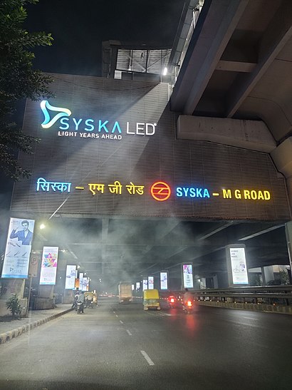
M G Road Metro Station Address: Service Road street in Gurgaon
Attractions near M G Road Metro Station
Lenskart,BHOG - Tiffin Services in Gurgaon,Sapphire,Lenskart. Com,Delhi Metro Pillar No- 106j,Oppo,Elegance,Hype,Diamond Court Essel Tower,Sbi Mutual Funds,The Empire in Near M G Road Metro Station,China Club,Central Mall & DT City Centre Mall, MG Road, Gurgaon,Central Mall & DT City Centre Mall,Paislei,BELMONTE,Udyog Vihar,Dynamic Industries,Aravali Hills In Gurgaon,Sulabh Toilet ComplexHow to get to popular attractions in Gurgaon with public transit
Shaheed Sukhdev College Of Business Studies, Delhi,Noida Sector 16 Metro Station, Dadri,The Park Hotel, Delhi,Barbeque Nation, Gurgaon,Main Market Rajouri Garden, Delhi,V3S Mall, East Center, Delhi,Al Bake | अल बेक | البيك, Delhi,Sultanpur Metro Station, Delhi,Zara, Delhi,Delhi Gymkhana Club, Delhi,KFC, Delhi,Janakpuri West Metro Station, Delhi,Costa Coffee, Delhi,Sector 50, Noida, Dadri,Vivanta by Taj, Gurgaon,Nizam's Kathi Kabab | निजा़म काठी कबाब, Delhi,Moments Mall, Delhi,ITC Maurya, Delhi,Dhaula Kuan Traffic Jam, Delhi,Preet Vihar, DelhiGet around Gurgaon by public transit!
Traveling around Gurgaon has never been so easy. See step by step directions as you travel to any attraction, street or major public transit station. View bus and train schedules, arrival times, service alerts and detailed routes on a map, so you know exactly how to get to anywhere in Gurgaon.
When traveling to any destination around Gurgaon use Moovit's Live Directions with Get Off Notifications to know exactly where and how far to walk, how long to wait for your line, and how many stops are left. Moovit will alert you when it's time to get off — no need to constantly re-check whether yours is the next stop.
Wondering how to use public transit in Gurgaon or how to pay for public transit in Gurgaon? Moovit public transit app can help you navigate your way with public transit easily, and at minimum cost. It includes public transit fees, ticket prices, and costs. Looking for a map of Gurgaon public transit lines? Moovit public transit app shows all public transit maps in Gurgaon with all bus or metro routes and stops on an interactive map.
Gurgaon has 2 transit type(s), including: bus or metro, operated by several transit agencies, including Delhi Metro Rail Corporation (DMRC), Delhi Metro Rail Corporation, Noida Metro Rail corporation, Delhi Transport Corporation (DTC), DMRC Feeder AC E-Buses, DTC AC Services, DTC Express Buses, DTC Night Bus, Delhi Integrated Multi-Modal Transit System Ltd., DIMTS (Delhi Integrated Multi-Modal Transit System Ltd.), AC bus lines, Airport AC bus lines, GMCBL (Gurugram Metropolitan City Bus Limited), Northern Railways and DTC Electric AC Buses