How to get to M Norcross Stratton by bus?
Click on the bus route to see step by step directions with maps, line arrival times and updated time schedules.
From the mall at rockingham park mall, Boston
77 minFrom Costco Wholesale, Everett
99 minFrom Boston University, Boston
83 minFrom The Garment District, Cambridge
66 minFrom Cambridgeside, Cambridge
78 minFrom Cambridge Crossing, Cambridge
78 minFrom CambridgeSide (Cambridgeside Galleria), Cambridge
79 minFrom Assembly Square Mall Shopping Center, Somerville
63 minFrom Cambridge Hospital, Cambridge
59 minFrom Paradise Rock Club, Boston
77 min
How to get to M Norcross Stratton by train?
Click on the train route to see step by step directions with maps, line arrival times and updated time schedules.
Bus stops near M Norcross Stratton in Arlington
Train stations near M Norcross Stratton in Arlington
Subway station near M Norcross Stratton in Arlington
- Alewife, 62 min walk,VIEW
Bus lines to M Norcross Stratton in Arlington
What are the closest stations to M Norcross Stratton?
The closest stations to M Norcross Stratton are:
- Forest St @ Thomas St is 381 yards away, 5 min walk.
- Massachusetts Ave @ Hobbs Ct is 1339 yards away, 16 min walk.
- West Medford is 3642 yards away, 43 min walk.
- Belmont is 3994 yards away, 47 min walk.
- Alewife is 5255 yards away, 62 min walk.
Which bus lines stop near M Norcross Stratton?
These bus lines stop near M Norcross Stratton: 67, 77.
Which train line stops near M Norcross Stratton?
LOWELL (#327 | Lowell)
What’s the nearest bus station to M Norcross Stratton in Arlington?
The nearest bus station to M Norcross Stratton in Arlington is Forest St @ Thomas St. It’s a 5 min walk away.
What time is the first subway to M Norcross Stratton in Arlington?
The RED LINE is the first subway that goes to M Norcross Stratton in Arlington. It stops nearby at 5:15 AM.
What time is the last subway to M Norcross Stratton in Arlington?
The RED LINE is the last subway that goes to M Norcross Stratton in Arlington. It stops nearby at 2:06 AM.
What time is the first train to M Norcross Stratton in Arlington?
The LOWELL is the first train that goes to M Norcross Stratton in Arlington. It stops nearby at 5:27 AM.
What time is the last train to M Norcross Stratton in Arlington?
The LOWELL is the last train that goes to M Norcross Stratton in Arlington. It stops nearby at 12:20 AM.
What time is the first bus to M Norcross Stratton in Arlington?
The 77 is the first bus that goes to M Norcross Stratton in Arlington. It stops nearby at 5:24 AM.
What time is the last bus to M Norcross Stratton in Arlington?
The 77 is the last bus that goes to M Norcross Stratton in Arlington. It stops nearby at 1:25 AM.
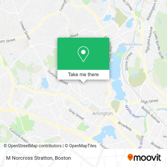
See M Norcross Stratton, Arlington, on the map
Public Transit to M Norcross Stratton in Arlington
Wondering how to get to M Norcross Stratton in Arlington? Moovit helps you find the best way to get to M Norcross Stratton with step-by-step directions from the nearest public transit station.
Moovit provides free maps and live directions to help you navigate through your city. View schedules, routes, timetables, and find out how long does it take to get to M Norcross Stratton in real time.
Looking for the nearest stop or station to M Norcross Stratton? Check out this list of stops closest to your destination: Forest St @ Thomas St; Massachusetts Ave @ Hobbs Ct; West Medford; Belmont; Alewife.
Bus: 67, 77.Train: LOWELL, FITCHBURG.Subway: RED LINE.
Want to see if there’s another route that gets you there at an earlier time? Moovit helps you find alternative routes or times. Get directions from and directions to M Norcross Stratton easily from the Moovit App or Website.
We make riding to M Norcross Stratton easy, which is why over 1.7 million users, including users in Arlington, trust Moovit as the best app for public transit. You don’t need to download an individual bus app or train app, Moovit is your all-in-one transit app that helps you find the best bus time or train time available.
For information on prices of bus, subway and train, costs and ride fares to M Norcross Stratton, please check the Moovit app.
Use the app to navigate to popular places including to the airport, hospital, stadium, grocery store, mall, coffee shop, school, college, and university.
M Norcross Stratton Address: 180 Mountain Ave street in Arlington
- Brackett Elementary School (Stratton Elementary School),
- Heliobook Photo & Cinema,
- Svetlo Consulting,
- Vocation Destination - Karen Samuelson, Career Coach,
- Bill Carr- Mobile Locksmith,
- Washington St @ Mohawk Rd,
- Light & Shade Garden Design,
- Dibiase,
- Rockaway Ln & RT-2A,
- Francis M. Donnelly Memorial Square,
- Summer Street Field,
- Hill's Hill Soccer Field,
- Locks & Locksmith,
- Fire and Water Restoration Companies,
- Townhomes at Arlington 360,
- Princeton Fuel Company,
- CW Fuels,
- Pillar To Post Home Inspectors - Arthur Staffiere ,
- ChargePoint,
- Seth Berman Gardeners
Places Near M Norcross Stratton (Arlington)
- Boston Common, Boston,
- Boston Medical Center, Boston,
- Td Garden, Boston,
- Seaport District, Boston,
- Massachusetts General Hospital, Boston,
- Castle Island, Boston,
- Museum Of Science, Boston,
- Boston Children's Hospital, Boston,
- Wilbur Theatre, Boston,
- Quincy Market, Boston,
- Cheers, Boston,
- House Of Blues, Boston,
- Wang Theater, Boston,
- Leader Bank Pavilion (Leader Bank Pavillion), Boston,
- Mgm Music Hall, Boston,
- Prudential Center, Boston,
- Isabella Stewart Gardner Museum, Boston,
- North End, Boston,
- Faneuil Hall, Boston,
- Boston Convention & Exhibition Center, Boston
How to get to popular places in Boston with public transit
Get around Arlington by public transit!
Traveling around Arlington has never been so easy. See step by step directions as you travel to any attraction, street or major public transit station. View bus and train schedules, arrival times, service alerts and detailed routes on a map, so you know exactly how to get to anywhere in Arlington.
When traveling to any destination around Arlington use Moovit's Live Directions with Get Off Notifications to know exactly where and how far to walk, how long to wait for your line, and how many stops are left. Moovit will alert you when it's time to get off — no need to constantly re-check whether yours is the next stop.
Wondering how to use public transit in Arlington or how to pay for public transit in Arlington? Moovit public transit app can help you navigate your way with public transit easily, and at minimum cost. It includes public transit fees, ticket prices, and costs. Looking for a map of Arlington public transit lines? Moovit public transit app shows all public transit maps in Arlington with all Bus, Train, Subway and Ferry routes and stops on an interactive map.
Boston has 4 transit type(s), including: Bus, Train, Subway and Ferry, operated by several transit agencies, including MBTA, Southeastern Regional Transit Authority, MetroWest Regional Transit Authority, Rhode Island Public Transit Authority, WRTA, Lowell Regional Transit Authority, Merrimack Valley Transit, Montachusett Regional Transit Authority, Cape Cod Regional Transit Authority, Brockton Area Transit Authority, Martha's Vineyard Transit Authority, the WAVE - Nantucket Regional Transit Authority, GATRA, Cape Ann Transportation Authority and Massport