See M. Rich Building, Atlanta, on the map
Directions to M. Rich Building (Atlanta) with public transportation
The following transit lines have routes that pass near M. Rich Building
 Bus:
Bus: - Subway:
How to get to M. Rich Building by bus?
Click on the bus route to see step by step directions with maps, line arrival times and updated time schedules.
How to get to M. Rich Building by subway?
Click on the subway route to see step by step directions with maps, line arrival times and updated time schedules.
Bus stations near M. Rich Building in Atlanta
- Peachtree St @ Martin L King Jr Dr, 2 min walk,
- Mlk Jr Dr & Pryor St, 2 min walk,
- Peachtree St SW @ Martin L King Jr Dr, 2 min walk,
- Pryor St at Mitchell St, 2 min walk,
- Central Ave at Mlk Jr Dr, 4 min walk,
- Alabama St @ Broad St (Five Points Station), 4 min walk,
Subway stations near M. Rich Building in Atlanta
- Five Points Station, 6 min walk,
Light Rail stations near M. Rich Building in Atlanta
- Woodruff Park, 7 min walk,
Bus lines to M. Rich Building in Atlanta
- 26, Bankhead Station Via Carver Hills,
- 40, West End Station,
- 42, Lakewood/ Ft. Mcpherson Station,
- 49, Metro Transitional Via Boulevard,
- 813, West Lake Station,
- 21, Kensington Station,
- 55, Five Points Station,
- 3, Helene Mills Senior Center,
- 430, 430 Mcdonough,
- 432, 432 Stockbridge / Brandsmart,
- 440, 440 Hampton / Jonesboro,
- 441, 441 Jonesboro,
- 442, 442 Riverdale,
- 453, 453 Newnan / Union City,
- SWPR, Sweeper,
- 101, I-985 P&R,
- 102, Indian Trail P&R,
- 103, Sugarloaf Mills,
- 400, 400 Cumming,
- 413, 413 Hamilton Mill / Mall Of Georgia,
What are the closest stations to M. Rich Building?
The closest stations to M. Rich Building are:
- Peachtree St @ Martin L King Jr Dr is 80 yards away, 2 min walk.
- Mlk Jr Dr & Pryor St is 90 yards away, 2 min walk.
- Peachtree St SW @ Martin L King Jr Dr is 100 yards away, 2 min walk.
- Pryor St at Mitchell St is 164 yards away, 2 min walk.
- Central Ave at Mlk Jr Dr is 267 yards away, 4 min walk.
- Alabama St @ Broad St (Five Points Station) is 288 yards away, 4 min walk.
- Five Points Station is 436 yards away, 6 min walk.
- Woodruff Park is 496 yards away, 7 min walk.
Which bus lines stop near M. Rich Building?
These bus lines stop near M. Rich Building: 107, 186, 3, 40, 42.
Which subway lines stop near M. Rich Building?
These subway lines stop near M. Rich Building: BLUE, GOLD, RED.
What’s the nearest light rail station to M. Rich Building in Atlanta?
The nearest light rail station to M. Rich Building in Atlanta is Woodruff Park. It’s a 7 min walk away.
What’s the nearest subway station to M. Rich Building in Atlanta?
The nearest subway station to M. Rich Building in Atlanta is Five Points Station. It’s a 6 min walk away.
What’s the nearest bus stop to M. Rich Building in Atlanta?
The nearest bus stops to M. Rich Building in Atlanta are Peachtree St @ Martin L King Jr Dr, Mlk Jr Dr & Pryor St, Peachtree St SW @ Martin L King Jr Dr and Pryor St at Mitchell St. The closest one is a 2 min walk away.
What time is the first light rail to M. Rich Building in Atlanta?
The ATLSC is the first light rail that goes to M. Rich Building in Atlanta. It stops nearby at 8:22 AM.
What time is the last light rail to M. Rich Building in Atlanta?
The ATLSC is the last light rail that goes to M. Rich Building in Atlanta. It stops nearby at 11:06 PM.
What time is the first subway to M. Rich Building in Atlanta?
The GREEN is the first subway that goes to M. Rich Building in Atlanta. It stops nearby at 5:52 AM.
What time is the last subway to M. Rich Building in Atlanta?
The BLUE is the last subway that goes to M. Rich Building in Atlanta. It stops nearby at 1:41 AM.
What time is the first bus to M. Rich Building in Atlanta?
The 26 is the first bus that goes to M. Rich Building in Atlanta. It stops nearby at 5:40 AM.
What time is the last bus to M. Rich Building in Atlanta?
The 42 is the last bus that goes to M. Rich Building in Atlanta. It stops nearby at 12:36 AM.
How much is the bus fare to M. Rich Building?
The bus fare to M. Rich Building costs about $2.50.
How much is the subway fare to M. Rich Building?
The subway fare to M. Rich Building costs about $2.50.
See M. Rich Building, Atlanta, on the map
Public Transit to M. Rich Building in Atlanta
Wondering how to get to M. Rich Building in Atlanta, United States? Moovit helps you find the best way to get to M. Rich Building with step-by-step directions from the nearest public transit station.
Moovit provides free maps and live directions to help you navigate through your city. View schedules, routes, timetables, and find out how long does it take to get to M. Rich Building in real time.
Looking for the nearest stop or station to M. Rich Building? Check out this list of stops closest to your destination: Peachtree St @ Martin L King Jr Dr; Mlk Jr Dr & Pryor St; Peachtree St SW @ Martin L King Jr Dr; Pryor St at Mitchell St; Central Ave at Mlk Jr Dr; Alabama St @ Broad St (Five Points Station); Five Points Station; Woodruff Park.
Bus:Subway:
Want to see if there’s another route that gets you there at an earlier time? Moovit helps you find alternative routes or times. Get directions from and directions to M. Rich Building easily from the Moovit App or Website.
We make riding to M. Rich Building easy, which is why over 1.5 million users, including users in Atlanta, trust Moovit as the best app for public transit. You don’t need to download an individual bus app or train app, Moovit is your all-in-one transit app that helps you find the best bus time or train time available.
For information on prices of bus and subway, costs and ride fares to M. Rich Building, please check the Moovit app.
Use the app to navigate to popular places including to the airport, hospital, stadium, grocery store, mall, coffee shop, school, college, and university.
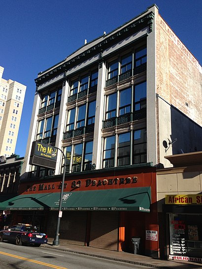
M. Rich Building Address: Martin Luther King Junior Drive Southwest street in Atlanta
Attractions near M. Rich Building
The Sessions Law Firm,Ups,Udcg,Fulton County Sherrif's Office,Fulton Co Probate Court,Vunity,Lewis b slaton courthouse,Fulton County Superior Court,Fulton County Government Center,Underground Atlanta,Clerk of Superior Court, Fulton County,C & S Beauty Supply,Economic Development,Tax Commissioners,Roadhammer Trucking,Fulton County District Attorney's Office,Fulton County Courthouse - State Court Civil Division,Metro by T-Mobile,Proactiv,Census Tract 35 - Atlanta Business RegionHow to get to popular attractions in Atlanta with public transit
I-285 & Donald Lee Hollowell Pkwy NW, Atlanta,Stockbridge Exit 228, Henry,Roswell Road & Northridge Road, Sandy Springs,CNN Center Lower Parking Deck, Atlanta,Chip Allen Fitness Center, Sandy Springs,Langford Pkwy @ 285, Atlanta,Cumberland Mall, Cobb,Turner Field Marta Bus, Atlanta,Bank Of America Plaza Cafeteria, Atlanta,Bishop Cornelius Henderson Student Center, Atlanta,Lenox Square, Atlanta,Central Gwinnett High School, Lawrenceville,Marta Bus Stop Route 85, Roswell,Gwinnett County Recorder's Court, Lawrenceville,Embassy Suites by Hilton Atlanta Kennesaw Town Center, Cobb,Atlanta Mission: My Sister's House, Atlanta,Ups Pleasantdale Road, Dekalb,Gool, Atlanta,Delta Air Lines OC1 / OC2 Connector, Atlanta,Piedmont Eye Surgery Center, AtlantaGet around Atlanta by public transit!
Traveling around Atlanta has never been so easy. See step by step directions as you travel to any attraction, street or major public transit station. View bus and train schedules, arrival times, service alerts and detailed routes on a map, so you know exactly how to get to anywhere in Atlanta.
When traveling to any destination around Atlanta use Moovit's Live Directions with Get Off Notifications to know exactly where and how far to walk, how long to wait for your line, and how many stops are left. Moovit will alert you when it's time to get off — no need to constantly re-check whether yours is the next stop.
Wondering how to use public transit in Atlanta or how to pay for public transit in Atlanta? Moovit public transit app can help you navigate your way with public transit easily, and at minimum cost. It includes public transit fees, ticket prices, and costs. Looking for a map of Atlanta public transit lines? Moovit public transit app shows all public transit maps in Atlanta with all bus or subway routes and stops on an interactive map.
Atlanta has 2 transit type(s), including: bus or subway, operated by several transit agencies, including MARTA, MARTA, Metropolitan Atlanta Rapid Transit Authority, Xpress, Atlantic Station Shuttle, CobbLinc, Ride Gwinnett, Connect Douglas, Amtrak, Stinger Bus and Tech Trolley, Emory University Transportation , Panther Express, Atlanta University Center Shuttle , Rome Transit Department and FlixBus-us