How to get to Ma Ma Cha by bus?
Click on the bus route to see step by step directions with maps, line arrival times and updated time schedules.
From Changsha Zhongdian Software Park, Yuelu District
47 minFrom Times Inclined City - Phase 2, Wangcheng District
55 minFrom Changsha Nanya Middle School, Yuhua District
58 minFrom Hunan Gaoxiao Large Market Co., Ltd., Yuhua District
26 minFrom Hunan Biological and Mechanical Vocational Technical College - Mechanical and Electrical Building, Furong District
49 minFrom Hunan Provincial Maternal and Child Health Hospital (East Hospital Area), Furong District
31 minFrom Changsha South High-Speed Railway Station, Yuhua District
51 minFrom Changsha International Convention and Exhibition Center, Kaifu District
27 minFrom Changsha South Station (West Entrance Store), Yuhua District
46 minFrom HappyB, Yuhua District
43 min
How to get to Ma Ma Cha by metro?
Click on the metro route to see step by step directions with maps, line arrival times and updated time schedules.
From Times Inclined City - Phase 2, Wangcheng District
59 minFrom Changsha Nanya Middle School, Yuhua District
52 minFrom Hunan Gaoxiao Large Market Co., Ltd., Yuhua District
47 minFrom Changsha South High-Speed Railway Station, Yuhua District
39 minFrom Changsha International Convention and Exhibition Center, Kaifu District
35 minFrom Changsha South Station (West Entrance Store), Yuhua District
35 min
Bus stops near Ma Ma Cha in Tianxin District
Metro station near Ma Ma Cha in Tianxin District
- May 1st Square, 4 min walk,VIEW
Bus lines to Ma Ma Cha in Tianxin District
- Temporary Route 314, Chigangchong,VIEW
- Temporary Route 317, Changhua Residential Area,VIEW
- Lishan Express, Changsha Railway,VIEW
- Route 109, Wangyue Residential Area,VIEW
- Route 303, Sifangping,VIEW
- 11, Chigangchong,VIEW
- Route 112, Xiangjiang Century City,VIEW
- Route 368, Sports New City Bus Terminal,VIEW
- Route 143 Inner Loop, Guitang River,VIEW
- Route 803 Inner Ring, Xinkai Road Junction,VIEW
- Route 308 Express, Dezheng Garden,VIEW
- Route 18, Dongfanghong Road Terminal,VIEW
- Route 202, Changsha Railway,VIEW
- 308, Changhua Residential Area,VIEW
- Route 138, Yatang Village,VIEW
- Route 145, Jia Yi Former Residence,VIEW
- 167, Huaxia,VIEW
- Route 358, Window of the World,VIEW
- Route 804, Xinkai Road Junction,VIEW
- Route 901, Xinkaipo,VIEW
What are the closest stations to Ma Ma Cha?
The closest stations to Ma Ma Cha are:
- Huatu Education (Taiping Street) is 105 meters away, 2 min walk.
- May 1st Square is 244 meters away, 4 min walk.
- Liberation West Road Intersection is 486 meters away, 7 min walk.
- Simen Entrance is 567 meters away, 8 min walk.
- Fanxi Lane is 626 meters away, 8 min walk.
Which bus lines stop near Ma Ma Cha?
These bus lines stop near Ma Ma Cha: Route 112, Route 145, 167, Route 18, 308, Route 368, Route 901, Temporary Route 401.
Which metro line stops near Ma Ma Cha?
Line 2 (Meixi Lake West)
What’s the nearest metro station to Ma Ma Cha in Tianxin District?
The nearest metro station to Ma Ma Cha in Tianxin District is May 1st Square. It’s a 4 min walk away.
What’s the nearest bus station to Ma Ma Cha in Tianxin District?
The nearest bus station to Ma Ma Cha in Tianxin District is Huatu Education (Taiping Street). It’s a 2 min walk away.
What time is the first metro to Ma Ma Cha in Tianxin District?
The Line 2 is the first metro that goes to Ma Ma Cha in Tianxin District. It stops nearby at 6:30 AM.
What time is the last metro to Ma Ma Cha in Tianxin District?
The Line 1 is the last metro that goes to Ma Ma Cha in Tianxin District. It stops nearby at 11:29 PM.
What time is the first bus to Ma Ma Cha in Tianxin District?
The Lishan Express is the first bus that goes to Ma Ma Cha in Tianxin District. It stops nearby at 5:37 AM.
What time is the last bus to Ma Ma Cha in Tianxin District?
The Temporary Route 314 is the last bus that goes to Ma Ma Cha in Tianxin District. It stops nearby at 1:14 AM.
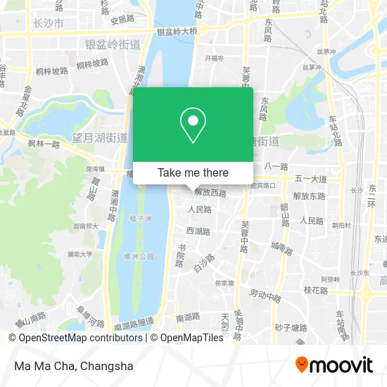
See Ma Ma Cha, Tianxin District, on the map
Public Transit to Ma Ma Cha in Tianxin District
Wondering how to get to Ma Ma Cha in Tianxin District? Moovit helps you find the best way to get to Ma Ma Cha with step-by-step directions from the nearest public transit station.
Moovit provides free maps and live directions to help you navigate through your city. View schedules, routes, timetables, and find out how long does it take to get to Ma Ma Cha in real time.
Looking for the nearest stop or station to Ma Ma Cha? Check out this list of stops closest to your destination: Huatu Education (Taiping Street); May 1st Square; Liberation West Road Intersection; Simen Entrance; Fanxi Lane.
Bus: Route 112, Route 145, 167, Route 18, 308, Route 368, Route 901, Temporary Route 401, Temporary Route 314, Temporary Route 317, Lishan Express, Route 109, Route 303, 11, Route 112, Route 368, Route 143 Inner Loop, Route 803 Inner Ring, Route 308 Express, Route 18, Route 202, 308, Temporary Route 117, Temporary Route 118, Temporary Route 401, Tourist Route 1, Route 401, Route 138, Route 145, 167, Route 358, Route 804.Metro: Line 2, Line 1, Line 2.
Want to see if there’s another route that gets you there at an earlier time? Moovit helps you find alternative routes or times. Get directions from and directions to Ma Ma Cha easily from the Moovit App or Website.
We make riding to Ma Ma Cha easy, which is why over 1.5 million users, including users in Tianxin District, trust Moovit as the best app for public transit. You don’t need to download an individual bus app or train app, Moovit is your all-in-one transit app that helps you find the best bus time or train time available.
For information on prices of bus and metro, costs and ride fares to Ma Ma Cha, please check the Moovit app.
Use the app to navigate to popular places including to the airport, hospital, stadium, grocery store, mall, coffee shop, school, college, and university.
Ma Ma Cha Address: Renmin Road street in Tianxin District
- Happy Mahjong Hall,
- Qiqian Garden Mini Club,
- Street Electric (Hunan Changsha Cai Lian Theme Hotel),
- MG Bilibili Internet Celebrity Bar,
- Changsha Juzhou Theme Hotel Wuyi Pedestrian Street Store,
- Changsha Yijia Family Hotel,
- Aishang Board Game Werewolf Script Fun Cinema (Jiefang West Branch),
- Changsha Tianxin District Holiday Inn,
- Dawei Digital,
- Soho Bar,
- Xipin Tang 001,
- Bao Master Pastry (Jiefang West Branch),
- Su River Soho Bar,
- Charm Diamond Store (Sanxing Street),
- Monkey Museum,
- Feng's Lin Hanging Beef Noodles,
- 33 Degrees Gray Beauty and Styling Center,
- Friendship Hotel,
- Jiefang West Road / Sanxing Street (Intersection),
- Li Fuchun Former Residence
Places Near Ma Ma Cha (Tianxin District)
- Hunan Provincial Museum - Multipurpose Hall, Kaifu District,
- Yuelu Mountain Juzizhou Tourist Area, Yuelu District,
- Changsha South Station, Yuhua District,
- First Club, Kaifu District,
- Apple Authorized Dealer (Sam Changsha Store), Yuhua District,
- Xingsha Police Station Songya Community Police Room, Changsha County,
- Changsha Bank ATM (Sifang Branch), Kaifu District,
- Zhongnan University Xiangya Hospital, Kaifu District,
- Changsha Yangming Mountain Funeral Home, Yuhua District,
- National University of Defense Technology (North Gate), Kaifu District,
- Changsha South Station Square, Yuelu District,
- First Affiliated Hospital of Hunan University of Traditional Chinese Medicine - Outpatient Department, Yuhua District,
- Changsha Bank (Sifang Branch), Kaifu District,
- Wanjiali International Mall, Furong District,
- Hunan Provincial Maternal and Child Health Hospital - Outpatient Department, Kaifu District,
- Hunan University of Traditional Chinese Medicine First Affiliated Hospital, Yuhua District,
- Desiqin City Square, Yuhua District,
- Hunan Province Tumor Hospital, Yuelu District,
- Du Fu River Pavilion, Tianxin District,
- Central South University Xiangya Second Hospital, Furong District
How to get to popular places in Changsha with public transit
Get around Tianxin District by public transit!
Traveling around Tianxin District has never been so easy. See step by step directions as you travel to any attraction, street or major public transit station. View bus and train schedules, arrival times, service alerts and detailed routes on a map, so you know exactly how to get to anywhere in Tianxin District.
When traveling to any destination around Tianxin District use Moovit's Live Directions with Get Off Notifications to know exactly where and how far to walk, how long to wait for your line, and how many stops are left. Moovit will alert you when it's time to get off — no need to constantly re-check whether yours is the next stop.
Wondering how to use public transit in Tianxin District or how to pay for public transit in Tianxin District? Moovit public transit app can help you navigate your way with public transit easily, and at minimum cost. It includes public transit fees, ticket prices, and costs. Looking for a map of Tianxin District public transit lines? Moovit public transit app shows all public transit maps in Tianxin District with all Bus and Metro routes and stops on an interactive map.
Changsha has 2 transit type(s), including: Bus and Metro, operated by several transit agencies, including Changsha Metro and Changsha Bus Group
Public transit lines with stations closest to Ma Ma Cha in Tianxin District
Metro lines with stations closest to Ma Ma Cha in Tianxin District
Bus lines with stations closest to Ma Ma Cha in Tianxin District
Liberation West Road Intersection
 11Chigangchong - Yanhe Road Bus Terminal
- Route 112Xiangjiang Century City (West Jintai Road) - Yingpan Road Liuyang River Bridge West
- Route 368Huaxia - Sports New City Bus Terminal
- Route 143 Inner LoopGuitang River - Guitang River
- Route 803 Inner RingXinkaipulu Intersection - Xinkaipulu Intersection
May 1st Square
- Temporary Route 117Changsha Railway Station - Guanshaling Community
- Temporary Route 118Information Industry Park - Changsha Railway Station
- Temporary Route 401Changsha Railway Station - Chazishan Community
- Tourist Route 1Changsha Railway Station - Science Education New Village
- Route 401Chazishan Community - Changsha Railway Station