Directions to Mac Cosmetics (Boston) with public transportation
The following transit lines have routes that pass near Mac Cosmetics
 Bus: 39, 42, 35, 41, ORANGE LINE SHUTTLE.
- Train: NEEDHAM, FRANKLIN/FOXBORO, PROVIDENCE/STOUGHTON.
- Subway: ORANGE LINE, GREEN LINE E.
How to get to Mac Cosmetics by bus?
Click on the bus route to see step by step directions with maps, line arrival times and updated time schedules.
From Hampton Inn Boston Logan Airport Chelsea, Chelsea
99 minFrom Apple Cinemas, Cambridge
90 minFrom Tufts University, Medford
92 minFrom Frog Pond, Boston
45 minFrom Assembly Row, Somerville
89 minFrom Kkkk, Boston
88 minFrom Terrace Room, Paige Hall, Medford
92 minFrom FOUR POINTS BY SHERATON Boston Newton, Newton
55 minFrom TownePlace Suites Boston Logan Airport/Chelsea, Chelsea
81 minFrom Wegmans, Medford
114 min
How to get to Mac Cosmetics by train?
Click on the train route to see step by step directions with maps, line arrival times and updated time schedules.
How to get to Mac Cosmetics by subway?
Click on the subway route to see step by step directions with maps, line arrival times and updated time schedules.
Bus stops near Mac Cosmetics in Boston
Subway stations near Mac Cosmetics in Boston
Train station near Mac Cosmetics in Boston
- Forest Hills, 28 min walk,VIEW
Bus lines to Mac Cosmetics in Boston
- 35, Avenue Louis Pasteur,VIEW
- 39, Haymarket Via Forest Hills,VIEW
- 41, Jfk/Umass,VIEW
- 42, Nubian,VIEW
- ORANGE LINE SHUTTLE, Forest Hills - Jackson Square,VIEW
- ORANGE LINE SHUTTLE, Forest Hills - Back Bay (Shuttle),VIEW
- ORANGE LINE SHUTTLE, Forest Hills - Jackson Square (Shuttle),VIEW
- ORANGE LINE SHUTTLE, Forest Hills - Ruggles,VIEW
- ORANGE LINE SHUTTLE, Forest Hills - Back Bay via Ruggles Busway (Shuttle),VIEW
- ORANGE LINE SHUTTLE, Forest Hills - Copley,VIEW
- ORANGE LINE SHUTTLE, Forest Hills - Back Bay via Copley (Shuttle),VIEW
What are the closest stations to Mac Cosmetics?
The closest stations to Mac Cosmetics are:
- Centre St @ Lochstead Ave is 290 yards away, 4 min walk.
- Washington St @ Ophir St is 710 yards away, 9 min walk.
- Stony Brook - Amory St @ Boylston St is 714 yards away, 9 min walk.
- Stony Brook is 805 yards away, 10 min walk.
- Heath Street is 1702 yards away, 20 min walk.
- Forest Hills is 2360 yards away, 28 min walk.
Which bus lines stop near Mac Cosmetics?
These bus lines stop near Mac Cosmetics: 39, 42.
Which train line stops near Mac Cosmetics?
NEEDHAM (#625 | Needham Heights)
Which subway line stops near Mac Cosmetics?
ORANGE LINE (Forest Hills)
What’s the nearest subway station to Mac Cosmetics in Boston?
The nearest subway station to Mac Cosmetics in Boston is Stony Brook. It’s a 10 min walk away.
What’s the nearest train station to Mac Cosmetics in Boston?
The nearest train station to Mac Cosmetics in Boston is Forest Hills. It’s a 28 min walk away.
What’s the nearest bus station to Mac Cosmetics in Boston?
The nearest bus station to Mac Cosmetics in Boston is Centre St @ Lochstead Ave. It’s a 4 min walk away.
What time is the first subway to Mac Cosmetics in Boston?
The ORANGE LINE is the first subway that goes to Mac Cosmetics in Boston. It stops nearby at 5:15 AM.
What time is the last subway to Mac Cosmetics in Boston?
The GREEN LINE E is the last subway that goes to Mac Cosmetics in Boston. It stops nearby at 2:00 AM.
What time is the first train to Mac Cosmetics in Boston?
The NEEDHAM is the first train that goes to Mac Cosmetics in Boston. It stops nearby at 7:34 AM.
What time is the last train to Mac Cosmetics in Boston?
The PROVIDENCE/STOUGHTON is the last train that goes to Mac Cosmetics in Boston. It stops nearby at 12:08 AM.
What time is the first bus to Mac Cosmetics in Boston?
The 39 is the first bus that goes to Mac Cosmetics in Boston. It stops nearby at 4:41 AM.
What time is the last bus to Mac Cosmetics in Boston?
The 39 is the last bus that goes to Mac Cosmetics in Boston. It stops nearby at 1:28 AM.
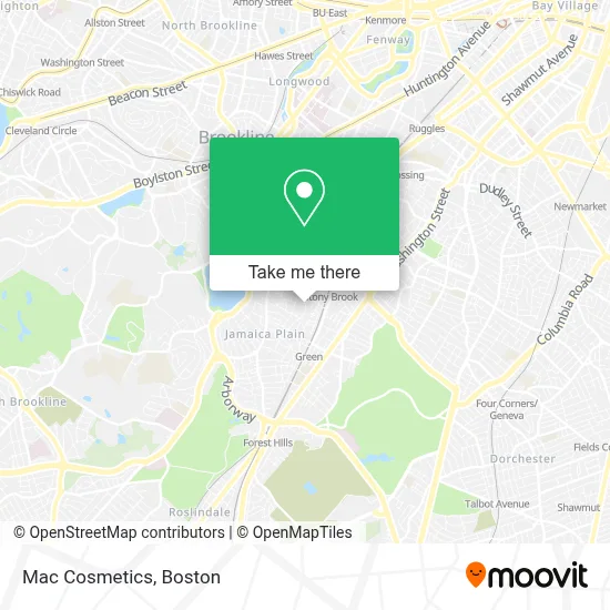
See Mac Cosmetics, Boston, on the map
Public Transit to Mac Cosmetics in Boston
Wondering how to get to Mac Cosmetics in Boston? Moovit helps you find the best way to get to Mac Cosmetics with step-by-step directions from the nearest public transit station.
Moovit provides free maps and live directions to help you navigate through your city. View schedules, routes, timetables, and find out how long does it take to get to Mac Cosmetics in real time.
Looking for the nearest stop or station to Mac Cosmetics? Check out this list of stops closest to your destination: Centre St @ Lochstead Ave; Washington St @ Ophir St; Stony Brook - Amory St @ Boylston St; Stony Brook; Heath Street; Forest Hills.
Bus: 39, 42, 35, 41, ORANGE LINE SHUTTLE, ORANGE LINE SHUTTLE, ORANGE LINE SHUTTLE, ORANGE LINE SHUTTLE, ORANGE LINE SHUTTLE.Train: NEEDHAM, FRANKLIN/FOXBORO, PROVIDENCE/STOUGHTON.Subway: ORANGE LINE, GREEN LINE E.
Want to see if there’s another route that gets you there at an earlier time? Moovit helps you find alternative routes or times. Get directions from and directions to Mac Cosmetics easily from the Moovit App or Website.
We make riding to Mac Cosmetics easy, which is why over 1.7 million users, including users in Boston, trust Moovit as the best app for public transit. You don’t need to download an individual bus app or train app, Moovit is your all-in-one transit app that helps you find the best bus time or train time available.
For information on prices of subway, bus and train, costs and ride fares to Mac Cosmetics, please check the Moovit app.
Use the app to navigate to popular places including to the airport, hospital, stadium, grocery store, mall, coffee shop, school, college, and university.
Mac Cosmetics Address: 225 Boylston Street street in Boston
- Jamaica Plain,
- Sully Paints,
- Happy Kid Travel,
- Stony Brook Playground and Splash Park,
- USPS Collection Box - Blue Box,
- Skatepark,
- Bloomingdales,
- New England Dental Center,
- Jaime's Guitar Studio,
- Haffenreffer Brewery,
- City Ballet Boston,
- A 24 Hour Jamaica Plain Emergency Loc,
- The Haven,
- Haven,
- Dance Freedom,
- Peer Education Recovery Center,
- Golden Living West Newton,
- Locksmith In 123,
- Al Freshco,
- Boylston St 8th Floor Boston Ma
Places Near Mac Cosmetics (Boston)
- Boston Children's Hospital, Boston,
- Castle Island, Boston,
- House Of Blues, Boston,
- North End, Boston,
- Seaport District, Boston,
- Faneuil Hall, Boston,
- Leader Bank Pavilion (Leader Bank Pavillion), Boston,
- Wang Theater, Boston,
- Boston Convention & Exhibition Center, Boston,
- Boston Common, Boston,
- Massachusetts General Hospital, Boston,
- Boston Medical Center, Boston,
- Prudential Center, Boston,
- Cheers, Boston,
- Td Garden, Boston,
- Mgm Music Hall, Boston,
- Quincy Market, Boston,
- Wilbur Theatre, Boston,
- Museum Of Science, Boston,
- Isabella Stewart Gardner Museum, Boston
How to get to popular places in Boston with public transit
Get around Boston by public transit!
Traveling around Boston has never been so easy. See step by step directions as you travel to any attraction, street or major public transit station. View bus and train schedules, arrival times, service alerts and detailed routes on a map, so you know exactly how to get to anywhere in Boston.
When traveling to any destination around Boston use Moovit's Live Directions with Get Off Notifications to know exactly where and how far to walk, how long to wait for your line, and how many stops are left. Moovit will alert you when it's time to get off — no need to constantly re-check whether yours is the next stop.
Wondering how to use public transit in Boston or how to pay for public transit in Boston? Moovit public transit app can help you navigate your way with public transit easily, and at minimum cost. It includes public transit fees, ticket prices, and costs. Looking for a map of Boston public transit lines? Moovit public transit app shows all public transit maps in Boston with all Bus, Train, Subway and Ferry routes and stops on an interactive map.
Boston has 4 transit type(s), including: Bus, Train, Subway and Ferry, operated by several transit agencies, including MBTA, Southeastern Regional Transit Authority, MetroWest Regional Transit Authority, Rhode Island Public Transit Authority, WRTA, Lowell Regional Transit Authority, Merrimack Valley Transit, Montachusett Regional Transit Authority, Cape Cod Regional Transit Authority, Brockton Area Transit Authority, Martha's Vineyard Transit Authority, the WAVE - Nantucket Regional Transit Authority, GATRA, Cape Ann Transportation Authority and Massport