How to get to Mac Cosmetics by bus?
Click on the bus route to see step by step directions with maps, line arrival times and updated time schedules.
From Terrace Room, Paige Hall, Medford
90 minFrom MBTA Alewife Station, Cambridge
79 minFrom Chelsea, MA, Chelsea
74 minFrom Hebrew Rehab Center, Boston
49 minFrom Revere, MA, Revere
85 minFrom MBTA / Alewife #6, Cambridge
79 minFrom Assembly Square Mall Shopping Center, Somerville
70 minFrom Porter Square, Cambridge
73 minFrom Beth Israel Deaconess Hospital-Milton, Milton
69 minFrom Tufts University, Medford
90 min
How to get to Mac Cosmetics by train?
Click on the train route to see step by step directions with maps, line arrival times and updated time schedules.
How to get to Mac Cosmetics by subway?
Click on the subway route to see step by step directions with maps, line arrival times and updated time schedules.
From Terrace Room, Paige Hall, Medford
55 minFrom MBTA Alewife Station, Cambridge
40 minFrom Hebrew Rehab Center, Boston
62 minFrom MBTA / Alewife #6, Cambridge
41 minFrom Assembly Square Mall Shopping Center, Somerville
43 minFrom Porter Square, Cambridge
34 minFrom Beth Israel Deaconess Hospital-Milton, Milton
69 minFrom Tufts University, Medford
55 min
Bus stops near Mac Cosmetics in Boston
Subway station near Mac Cosmetics in Boston
- Andrew, 13 min walk,VIEW
Bus lines to Mac Cosmetics in Boston
What are the closest stations to Mac Cosmetics?
The closest stations to Mac Cosmetics are:
- Massachusetts Ave @ Newmarket Station is 180 yards away, 3 min walk.
- South Bay Mall @ Allstate Rd is 221 yards away, 3 min walk.
- Boston St @ Rawson St is 347 yards away, 5 min walk.
- Newmarket Sq @ Massachusetts Ave1024 is 365 yards away, 5 min walk.
- Andrew is 998 yards away, 13 min walk.
- Jfk/Umass is 2157 yards away, 26 min walk.
- Newmarket is 2324 yards away, 28 min walk.
Which bus lines stop near Mac Cosmetics?
These bus lines stop near Mac Cosmetics: 10, 11, 16, 17, 8.
Which train lines stop near Mac Cosmetics?
These train lines stop near Mac Cosmetics: FAIRMOUNT, NEEDHAM.
Which subway line stops near Mac Cosmetics?
RED LINE (Ashmont/Braintree)
What’s the nearest subway station to Mac Cosmetics in Boston?
The nearest subway station to Mac Cosmetics in Boston is Andrew. It’s a 13 min walk away.
What’s the nearest train station to Mac Cosmetics in Boston?
The nearest train station to Mac Cosmetics in Boston is Jfk/Umass. It’s a 26 min walk away.
What’s the nearest bus station to Mac Cosmetics in Boston?
The nearest bus stations to Mac Cosmetics in Boston are Massachusetts Ave @ Newmarket Station and South Bay Mall @ Allstate Rd. The closest one is a 3 min walk away.
What time is the first subway to Mac Cosmetics in Boston?
The RED LINE is the first subway that goes to Mac Cosmetics in Boston. It stops nearby at 5:21 AM.
What time is the last subway to Mac Cosmetics in Boston?
The RED LINE is the last subway that goes to Mac Cosmetics in Boston. It stops nearby at 1:57 AM.
What time is the first train to Mac Cosmetics in Boston?
The FAIRMOUNT is the first train that goes to Mac Cosmetics in Boston. It stops nearby at 4:47 AM.
What time is the last train to Mac Cosmetics in Boston?
The FAIRMOUNT is the last train that goes to Mac Cosmetics in Boston. It stops nearby at 11:57 PM.
What time is the first bus to Mac Cosmetics in Boston?
The 16 is the first bus that goes to Mac Cosmetics in Boston. It stops nearby at 4:34 AM.
What time is the last bus to Mac Cosmetics in Boston?
The 16 is the last bus that goes to Mac Cosmetics in Boston. It stops nearby at 1:54 AM.
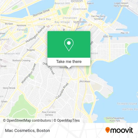
See Mac Cosmetics, Boston, on the map
Public Transit to Mac Cosmetics in Boston
Wondering how to get to Mac Cosmetics in Boston? Moovit helps you find the best way to get to Mac Cosmetics with step-by-step directions from the nearest public transit station.
Moovit provides free maps and live directions to help you navigate through your city. View schedules, routes, timetables, and find out how long does it take to get to Mac Cosmetics in real time.
Looking for the nearest stop or station to Mac Cosmetics? Check out this list of stops closest to your destination: Massachusetts Ave @ Newmarket Station; South Bay Mall @ Allstate Rd; Boston St @ Rawson St; Newmarket Sq @ Massachusetts Ave1024; Andrew; Jfk/Umass; Newmarket.
Bus: 10, 11, 16, 17, 8.Train: FAIRMOUNT, NEEDHAM, FALL RIVER/NEW BEDFORD, GREENBUSH, KINGSTON, FRANKLIN/FOXBORO, PROVIDENCE/STOUGHTON.Subway: RED LINE.
Want to see if there’s another route that gets you there at an earlier time? Moovit helps you find alternative routes or times. Get directions from and directions to Mac Cosmetics easily from the Moovit App or Website.
We make riding to Mac Cosmetics easy, which is why over 1.7 million users, including users in Boston, trust Moovit as the best app for public transit. You don’t need to download an individual bus app or train app, Moovit is your all-in-one transit app that helps you find the best bus time or train time available.
For information on prices of bus, subway and train, costs and ride fares to Mac Cosmetics, please check the Moovit app.
Use the app to navigate to popular places including to the airport, hospital, stadium, grocery store, mall, coffee shop, school, college, and university.
Mac Cosmetics Address: 32 District Avenue street in Boston
- Backyahd BOS,
- Ulta,
- Loft,
- MAC,
- Automotive Glass Service,
- Conference Hotels in Boston,
- 7 Allstate Rd Parking,
- Express Factory Outlet,
- Shop Express,
- Express Fashion,
- Olive Garden,
- Gyu-Kaku,
- Kura Revolving Sushi Bar,
- Super Eighty Eight Market,
- Crumbl - Dorchester,
- Amc South Bay 12 Macguffins,
- Gyu-Kaku Japanese BBQ,
- STARBUCKS,
- Amc South Bay Center 12,
- Express
Places Near Mac Cosmetics (Boston)
- Isabella Stewart Gardner Museum, Boston,
- Cheers, Boston,
- Seaport District, Boston,
- House Of Blues, Boston,
- Boston Common, Boston,
- Wilbur Theatre, Boston,
- Leader Bank Pavilion (Leader Bank Pavillion), Boston,
- Faneuil Hall, Boston,
- Boston Medical Center, Boston,
- Quincy Market, Boston,
- Boston Children's Hospital, Boston,
- Massachusetts General Hospital, Boston,
- North End, Boston,
- Boston Convention & Exhibition Center, Boston,
- Museum Of Science, Boston,
- Mgm Music Hall, Boston,
- Wang Theater, Boston,
- Castle Island, Boston,
- Prudential Center, Boston,
- Td Garden, Boston
How to get to popular places in Boston with public transit
Get around Boston by public transit!
Traveling around Boston has never been so easy. See step by step directions as you travel to any attraction, street or major public transit station. View bus and train schedules, arrival times, service alerts and detailed routes on a map, so you know exactly how to get to anywhere in Boston.
When traveling to any destination around Boston use Moovit's Live Directions with Get Off Notifications to know exactly where and how far to walk, how long to wait for your line, and how many stops are left. Moovit will alert you when it's time to get off — no need to constantly re-check whether yours is the next stop.
Wondering how to use public transit in Boston or how to pay for public transit in Boston? Moovit public transit app can help you navigate your way with public transit easily, and at minimum cost. It includes public transit fees, ticket prices, and costs. Looking for a map of Boston public transit lines? Moovit public transit app shows all public transit maps in Boston with all Bus, Train, Subway and Ferry routes and stops on an interactive map.
Boston has 4 transit type(s), including: Bus, Train, Subway and Ferry, operated by several transit agencies, including MBTA, Southeastern Regional Transit Authority, MetroWest Regional Transit Authority, Rhode Island Public Transit Authority, WRTA, Lowell Regional Transit Authority, Merrimack Valley Transit, Montachusett Regional Transit Authority, Cape Cod Regional Transit Authority, Brockton Area Transit Authority, Martha's Vineyard Transit Authority, the WAVE - Nantucket Regional Transit Authority, GATRA, Cape Ann Transportation Authority and Massport