Directions to Macy's Boston with public transportation
The following transit lines have routes that pass near Macy's Boston
 Bus: 111, 450, 504, EZRIDE, SL4.
- Train: FITCHBURG, FRAMINGHAM/WORCESTER, COMMUTER RAIL SHUTTLE, FAIRMOUNT LINE SHUTTLE, FRANKLIN LINE SHUTTLE.
- Subway: BLUE LINE, GREEN LINE B, GREEN LINE D, GREEN LINE E, ORANGE LINE.
How to get to Macy's Boston by bus?
Click on the bus route to see step by step directions with maps, line arrival times and updated time schedules.
From Boston Landing Station
59 minFrom Revere Beach
73 minFrom Homewood Suites by Hilton Boston Brookline-Longwood Medical
52 minFrom The Mall At Chestnut Hill
67 minFrom Highland Ave Somerville MA
47 minFrom Qea
96 minFrom Arlington, MA
91 minFrom Skating Club Of Boston
59 minFrom FOUR POINTS BY SHERATON Boston Newton
27 minFrom MBTA Suffolk Downs Station
55 min
How to get to Macy's Boston by train?
Click on the train route to see step by step directions with maps, line arrival times and updated time schedules.
How to get to Macy's Boston by subway?
Click on the subway route to see step by step directions with maps, line arrival times and updated time schedules.
Bus stops near Macy's Boston
- Downtown Crossing - Franklin St @ Washington St, 4 min walk,VIEW
- Lincoln St @ Essex St, 5 min walk,VIEW
- Federal St @ Matthews St, 5 min walk,VIEW
- Federal St @ Franklin St, 5 min walk,VIEW
- Park Street - Tremont St Opp Hamilton Pl, 5 min walk,VIEW
- South Station - Summer St @ Surface Rd, 6 min walk,VIEW
- Temple Pl @ Washington St, 6 min walk,VIEW
- Washington St @ Essex St, 8 min walk,VIEW
- Chauncy St @ Summer St, 9 min walk,VIEW
- Tremont St @ Boylston Station, 9 min walk,VIEW
- Park Street - Tremont St @ Winter St, 10 min walk,VIEW
- Tremont St Opp Temple Pl, 10 min walk,VIEW
Train station near Macy's Boston
- South Station, 6 min walk,VIEW
Bus lines to Macy's Boston
- RED LINE SHUTTLE, Ashmont - Park Street via Post Office,VIEW
- RED LINE SHUTTLE, JFK/UMass - Park Street via Post Office,VIEW
- RED LINE SHUTTLE, JFK/UMass - Park Street,VIEW
- 501, Downtown Via Cambridge St And Copley (Express),VIEW
- 504, Watertown Via Copley And Newton Corner (Express),VIEW
- 505, Waltham (Express),VIEW
- 7, City Point Via East First St,VIEW
- RED LINE SHUTTLE, Harvard - JFK/UMass via Congress Street,VIEW
- RED LINE SHUTTLE, Kendall/MIT - JFK/UMass,VIEW
- RED LINE SHUTTLE, Harvard - Broadway,VIEW
- RED LINE SHUTTLE, Kendall/MIT - Broadway via Downtown Crossing,VIEW
- RED LINE SHUTTLE, JFK/UMass - Kendall/MIT (Shuttle),VIEW
- RED LINE SHUTTLE, Alewife (Shuttle),VIEW
- RED LINE SHUTTLE, Park Street (Shuttle),VIEW
- RED LINE SHUTTLE, Jfk/Umass (Shuttle),VIEW
- SL5, Nubian,VIEW
- 11, City Point,VIEW
- 15, Mattapan Via Nubian & Fields Corner,VIEW
- SL4, South Station,VIEW
- 39, Haymarket Via Forest Hills,VIEW
What are the closest stations to Macy's Boston?
The closest stations to Macy's Boston are:
- Downtown Crossing - Franklin St @ Washington St is 305 yards away, 4 min walk.
- Lincoln St @ Essex St is 336 yards away, 5 min walk.
- Federal St @ Matthews St is 343 yards away, 5 min walk.
- Federal St @ Franklin St is 350 yards away, 5 min walk.
- Park Street - Tremont St Opp Hamilton Pl is 373 yards away, 5 min walk.
- South Station is 401 yards away, 6 min walk.
- South Station - Summer St @ Surface Rd is 434 yards away, 6 min walk.
- Temple Pl @ Washington St is 454 yards away, 6 min walk.
- Park Street is 623 yards away, 8 min walk.
- Chinatown is 650 yards away, 8 min walk.
- Washington St @ Essex St is 661 yards away, 8 min walk.
- Chauncy St @ Summer St is 676 yards away, 9 min walk.
- Tremont St @ Boylston Station is 736 yards away, 9 min walk.
- Park Street - Tremont St @ Winter St is 801 yards away, 10 min walk.
- Tremont St Opp Temple Pl is 837 yards away, 10 min walk.
Which bus lines stop near Macy's Boston?
These bus lines stop near Macy's Boston: 111, 450, 504, EZRIDE, SL4, SL5.
Which train lines stop near Macy's Boston?
These train lines stop near Macy's Boston: FITCHBURG, FRAMINGHAM/WORCESTER.
Which subway lines stop near Macy's Boston?
These subway lines stop near Macy's Boston: BLUE LINE, GREEN LINE B, GREEN LINE D, GREEN LINE E, ORANGE LINE, RED LINE.
What’s the nearest subway station to Macy's Boston?
The nearest subway stations to Macy's Boston are Park Street and Chinatown. The closest one is a 8 min walk away.
What’s the nearest train station to Macy's Boston?
The nearest train station to Macy's Boston is South Station. It’s a 6 min walk away.
What’s the nearest bus station to Macy's Boston?
The nearest bus station to Macy's Boston is Downtown Crossing - Franklin St @ Washington St. It’s a 4 min walk away.
What time is the first subway to Macy's Boston?
The GREEN LINE E is the first subway that goes to Macy's Boston. It stops nearby at 5:07 AM.
What time is the last subway to Macy's Boston?
The GREEN LINE E is the last subway that goes to Macy's Boston. It stops nearby at 2:18 AM.
What time is the first train to Macy's Boston?
The PROVIDENCE/STOUGHTON is the first train that goes to Macy's Boston. It stops nearby at 4:20 AM.
What time is the last train to Macy's Boston?
The LAKE SHORE LIMITED is the last train that goes to Macy's Boston. It stops nearby at 8:32 PM.
What time is the first bus to Macy's Boston?
The SLW is the first bus that goes to Macy's Boston. It stops nearby at 4:19 AM.
What time is the last bus to Macy's Boston?
The 11 is the last bus that goes to Macy's Boston. It stops nearby at 1:15 AM.
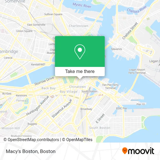
See Macy's Boston on the map
Public Transportation to Macy's Boston
Wondering how to get to Macy's Boston? Moovit helps you find the best way to get to Macy's Boston with step-by-step directions from the nearest public transit station.
Moovit provides free maps and live directions to help you navigate through your city. View schedules, routes, timetables, and find out how long does it take to get to Macy's Boston in real time.
Looking for the nearest stop or station to Macy's Boston? Check out this list of stops closest to your destination: Downtown Crossing - Franklin St @ Washington St; Lincoln St @ Essex St; Federal St @ Matthews St; Federal St @ Franklin St; Park Street - Tremont St Opp Hamilton Pl; South Station; South Station - Summer St @ Surface Rd; Temple Pl @ Washington St; Park Street; Chinatown; Washington St @ Essex St; Chauncy St @ Summer St; Tremont St @ Boylston Station; Park Street - Tremont St @ Winter St; Tremont St Opp Temple Pl.
Bus: 111, 450, 504, EZRIDE, SL4, SL5, RED LINE SHUTTLE, RED LINE SHUTTLE, RED LINE SHUTTLE, 501, 505, 7.Train: FITCHBURG, FRAMINGHAM/WORCESTER, COMMUTER RAIL SHUTTLE, FAIRMOUNT LINE SHUTTLE, FRANKLIN LINE SHUTTLE, KINGSTON LINE SHUTTLE, SL1.Subway: BLUE LINE, GREEN LINE B, GREEN LINE D, GREEN LINE E, ORANGE LINE, RED LINE, GREEN LINE C.
Want to see if there’s another route that gets you there at an earlier time? Moovit helps you find alternative routes or times. Get directions from and directions to Macy's Boston easily from the Moovit App or Website.
We make riding to Macy's Boston easy, which is why over 1.7 million users, including users in Boston, trust Moovit as the best app for public transit. You don’t need to download an individual bus app or train app, Moovit is your all-in-one transit app that helps you find the best bus time or train time available.
For information on prices of bus, subway and train, costs and ride fares to Macy's Boston, please check the Moovit app.
Use the app to navigate to popular places including to the airport, hospital, stadium, grocery store, mall, coffee shop, school, college, and university.
Macy's Boston Address: 450 Washington St street in Boston
- Carbonite,
- Stores At 500 Washington,
- Alternate Route,
- Godfrey Hotel Boston,
- Modern Theatre,
- My Tiddlywiki,
- Able Delivery,
- Hyatt Regency Boston,
- Brattle Book Shop,
- Mantra restaurant,
- Suffolk University Residence Hall,
- Estella,
- Lafayette Garage (Lafayette Place Garage),
- Swissotel,
- Downtown Crossing - to Forest Hills,
- Hugo Boss,
- Boston Opera House (Citizens Bank Opera House),
- Macy's,
- Many the Jeweler,
- Briggs
Places Near Macy's Boston
- Td Garden, Boston,
- Wilbur Theatre, Boston,
- Boston Common, Boston,
- Quincy Market, Boston,
- Mgm Music Hall, Boston,
- North End, Boston,
- Massachusetts General Hospital, Boston,
- Faneuil Hall, Boston,
- Museum Of Science, Boston,
- House Of Blues, Boston,
- Boston Children's Hospital, Boston,
- Prudential Center, Boston,
- Seaport District, Boston,
- Wang Theater, Boston,
- Isabella Stewart Gardner Museum, Boston,
- Leader Bank Pavilion (Leader Bank Pavillion), Boston,
- Cheers, Boston,
- Boston Medical Center, Boston,
- Boston Convention & Exhibition Center, Boston,
- Castle Island, Boston
How to get to popular places in Boston with public transit
Get around Boston by public transit!
Traveling around Boston has never been so easy. See step by step directions as you travel to any attraction, street or major public transit station. View bus and train schedules, arrival times, service alerts and detailed routes on a map, so you know exactly how to get to anywhere in Boston.
When traveling to any destination around Boston use Moovit's Live Directions with Get Off Notifications to know exactly where and how far to walk, how long to wait for your line, and how many stops are left. Moovit will alert you when it's time to get off — no need to constantly re-check whether yours is the next stop.
Wondering how to use public transit in Boston or how to pay for public transit in Boston? Moovit public transit app can help you navigate your way with public transit easily, and at minimum cost. It includes public transit fees, ticket prices, and costs. Looking for a map of Boston public transit lines? Moovit public transit app shows all public transit maps in Boston with all Bus, Train, Subway and Ferry routes and stops on an interactive map.
Boston has 4 transit type(s), including: Bus, Train, Subway and Ferry, operated by several transit agencies, including MBTA, Southeastern Regional Transit Authority, MetroWest Regional Transit Authority, Rhode Island Public Transit Authority, WRTA, Lowell Regional Transit Authority, Merrimack Valley Transit, Montachusett Regional Transit Authority, Cape Cod Regional Transit Authority, Brockton Area Transit Authority, Martha's Vineyard Transit Authority, the WAVE - Nantucket Regional Transit Authority, GATRA, Cape Ann Transportation Authority and Massport