Directions to Macy's Cambridge with public transportation
The following transit lines have routes that pass near Macy's Cambridge
 Bus: 69, 80, 85, 87, 88.
- Train: FAIRMOUNT.
- Subway: GREEN LINE D, ORANGE LINE, RED LINE, GREEN LINE B, GREEN LINE C.
How to get to Macy's Cambridge by bus?
Click on the bus route to see step by step directions with maps, line arrival times and updated time schedules.
How to get to Macy's Cambridge by train?
Click on the train route to see step by step directions with maps, line arrival times and updated time schedules.
How to get to Macy's Cambridge by subway?
Click on the subway route to see step by step directions with maps, line arrival times and updated time schedules.
Bus stops near Macy's Cambridge
Subway stations near Macy's Cambridge
Bus lines to Macy's Cambridge
- EZRIDE, Outbound Lechemere To Kendall,VIEW
- EZRIDE, Inbound To North Station From Erie St,VIEW
- EZRIDE, Outbound North Station To Erie St Via Lechmere And Kendall,VIEW
- EZRIDE, Inbound Kendall To Lechmere,VIEW
- EZRIDE, Outbound To Erie St From North Station,VIEW
- EZRIDE, Inbound To North Station Via Kendall And Lechmere,VIEW
- 69, Harvard,VIEW
- 80, Lechmere - Arlington Center,VIEW
- 87, Lechmere - Arlington Center,VIEW
- 88, Lechmere - Clarendon Hill,VIEW
- GREEN LINE E SHUTTLE, Government Center - Medford/Tufts (Shuttle),VIEW
- GREEN LINE E SHUTTLE, Medford/Tufts - North Station,VIEW
- GREEN LINE E SHUTTLE, North Station - Medford/Tufts (Shuttle),VIEW
- GREEN LINE SHUTTLE, Medford/Tufts - Government Center via Union Square,VIEW
- GREEN LINE SHUTTLE, Lechmere - North Station,VIEW
- GREEN LINE SHUTTLE, North Station - Sullivan Square via East Somerville,VIEW
- GREEN LINE SHUTTLE, Union Square (Shuttle),VIEW
- RED LINE SHUTTLE, Alewife - Park Street,VIEW
- RED LINE SHUTTLE, Kendall/MIT - Broadway via Pearl Street,VIEW
- RED LINE SHUTTLE, Harvard - JFK/UMass via Congress Street,VIEW
What are the closest stations to Macy's Cambridge?
The closest stations to Macy's Cambridge are:
- Morgan Ave. is 109 yards away, 2 min walk.
- Cambridge St @ Sciarappa St is 389 yards away, 5 min walk.
- Lechmere is 390 yards away, 5 min walk.
- Lechmere - Monsignor O'Brien Hwy Opp Gore St is 493 yards away, 6 min walk.
- Lechmere - Water St @ Lechmere Busway is 634 yards away, 8 min walk.
- Science Park / West End is 743 yards away, 9 min walk.
- Charles/Mgh - 325 Cambridge St is 758 yards away, 9 min walk.
- Charles/Mgh is 1023 yards away, 13 min walk.
- Community Collge is 1831 yards away, 22 min walk.
Which bus lines stop near Macy's Cambridge?
These bus lines stop near Macy's Cambridge: 69, 80, 85, 87, 88.
Which train line stops near Macy's Cambridge?
FAIRMOUNT (#1630 | South Station)
Which subway lines stop near Macy's Cambridge?
These subway lines stop near Macy's Cambridge: GREEN LINE D, ORANGE LINE, RED LINE.
What’s the nearest subway station to Macy's Cambridge?
The nearest subway station to Macy's Cambridge is Science Park / West End. It’s a 9 min walk away.
What’s the nearest bus station to Macy's Cambridge?
The nearest bus station to Macy's Cambridge is Morgan Ave.. It’s a 2 min walk away.
What time is the first subway to Macy's Cambridge?
The GREEN LINE E is the first subway that goes to Macy's Cambridge. It stops nearby at 4:55 AM.
What time is the last subway to Macy's Cambridge?
The GREEN LINE E is the last subway that goes to Macy's Cambridge. It stops nearby at 2:30 AM.
What time is the first bus to Macy's Cambridge?
The 80 is the first bus that goes to Macy's Cambridge. It stops nearby at 5:23 AM.
What time is the last bus to Macy's Cambridge?
The 69 is the last bus that goes to Macy's Cambridge. It stops nearby at 1:22 AM.
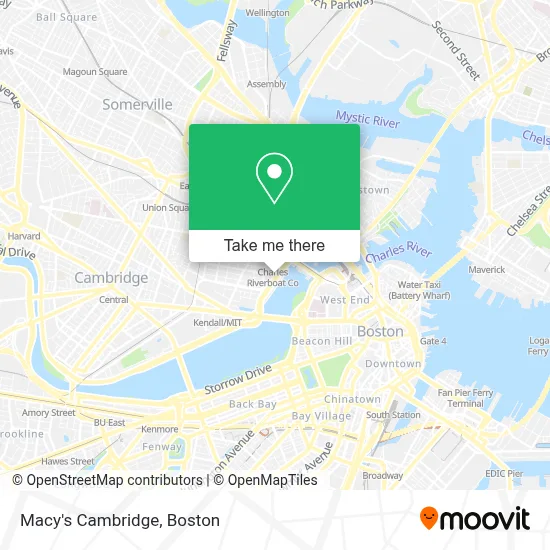
See Macy's Cambridge on the map
Public Transportation to Macy's Cambridge
Wondering how to get to Macy's Cambridge? Moovit helps you find the best way to get to Macy's Cambridge with step-by-step directions from the nearest public transit station.
Moovit provides free maps and live directions to help you navigate through your city. View schedules, routes, timetables, and find out how long does it take to get to Macy's Cambridge in real time.
Looking for the nearest stop or station to Macy's Cambridge? Check out this list of stops closest to your destination: Morgan Ave.; Cambridge St @ Sciarappa St; Lechmere; Lechmere - Monsignor O'Brien Hwy Opp Gore St; Lechmere - Water St @ Lechmere Busway; Science Park / West End; Charles/Mgh - 325 Cambridge St; Charles/Mgh; Community Collge.
Bus: 69, 80, 85, 87, 88, EZRIDE, EZRIDE, EZRIDE, EZRIDE, EZRIDE, GREEN LINE E SHUTTLE, GREEN LINE E SHUTTLE.Train: FAIRMOUNT.Subway: GREEN LINE D, ORANGE LINE, RED LINE, GREEN LINE B, GREEN LINE C, GREEN LINE E.
Want to see if there’s another route that gets you there at an earlier time? Moovit helps you find alternative routes or times. Get directions from and directions to Macy's Cambridge easily from the Moovit App or Website.
We make riding to Macy's Cambridge easy, which is why over 1.7 million users, including users in Cambridge, trust Moovit as the best app for public transit. You don’t need to download an individual bus app or train app, Moovit is your all-in-one transit app that helps you find the best bus time or train time available.
For information on prices of bus, subway and train, costs and ride fares to Macy's Cambridge, please check the Moovit app.
Use the app to navigate to popular places including to the airport, hospital, stadium, grocery store, mall, coffee shop, school, college, and university.
Macy's Cambridge Address: 100 Cambridgeside Pl Cambridgeside Galleria street in Cambridge
- Apple Store (Apple CambridgeSide),
- Cheesecake Factory,
- Galleria Mall,
- Hotel Marlowe (Kimpton Marlowe Hotel),
- Cambridgeside Galleria Shuttle Stop,
- SEPHORA,
- Royal Sonesta Hotel (Sonesta International Hotels Corporation Sonesta Hotel),
- Royal Sonesta Boston Cambridge,
- Spirit Halloween,
- Exotic Car Collection by Enterprise,
- Royal Sonesta Hotel,
- Kimpton Marlowe Hotel,
- Cambridgeside Galleria (Cambridge Galleria Mall),
- Superdry,
- CambridgeSide (Cambridgeside Galleria),
- American Eagle Outfitters,
- Cambridgeside,
- Royal Sonesta,
- ezride shuttle,
- Lechmere Canal Park
Places Near Macy's Cambridge
- Seaport District, Boston,
- Boston Medical Center, Boston,
- Boston Children's Hospital, Boston,
- Quincy Market, Boston,
- Mgm Music Hall, Boston,
- Cheers, Boston,
- House Of Blues, Boston,
- Leader Bank Pavilion (Leader Bank Pavillion), Boston,
- Massachusetts General Hospital, Boston,
- Castle Island, Boston,
- Museum Of Science, Boston,
- Boston Common, Boston,
- Faneuil Hall, Boston,
- North End, Boston,
- Isabella Stewart Gardner Museum, Boston,
- Boston Convention & Exhibition Center, Boston,
- Wang Theater, Boston,
- Prudential Center, Boston,
- Td Garden, Boston,
- Wilbur Theatre, Boston
How to get to popular places in Boston with public transit
Get around Cambridge by public transit!
Traveling around Cambridge has never been so easy. See step by step directions as you travel to any attraction, street or major public transit station. View bus and train schedules, arrival times, service alerts and detailed routes on a map, so you know exactly how to get to anywhere in Cambridge.
When traveling to any destination around Cambridge use Moovit's Live Directions with Get Off Notifications to know exactly where and how far to walk, how long to wait for your line, and how many stops are left. Moovit will alert you when it's time to get off — no need to constantly re-check whether yours is the next stop.
Wondering how to use public transit in Cambridge or how to pay for public transit in Cambridge? Moovit public transit app can help you navigate your way with public transit easily, and at minimum cost. It includes public transit fees, ticket prices, and costs. Looking for a map of Cambridge public transit lines? Moovit public transit app shows all public transit maps in Cambridge with all Bus, Train, Subway and Ferry routes and stops on an interactive map.
Boston has 4 transit type(s), including: Bus, Train, Subway and Ferry, operated by several transit agencies, including MBTA, Southeastern Regional Transit Authority, MetroWest Regional Transit Authority, Rhode Island Public Transit Authority, WRTA, Lowell Regional Transit Authority, Merrimack Valley Transit, Montachusett Regional Transit Authority, Cape Cod Regional Transit Authority, Brockton Area Transit Authority, Martha's Vineyard Transit Authority, the WAVE - Nantucket Regional Transit Authority, GATRA, Cape Ann Transportation Authority and Massport