Directions to Mahalakshmipuram with public transportation
The following transit lines have routes that pass near Mahalakshmipuram
How to get to Mahalakshmipuram by bus?
Click on the bus route to see step by step directions with maps, line arrival times and updated time schedules.
How to get to Mahalakshmipuram by metro?
Click on the metro route to see step by step directions with maps, line arrival times and updated time schedules.
Bus stops near Mahalakshmipuram
- Mahalakshmi Layout, 1 min walk,
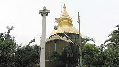
- Srinivasa Temple, 7 min walk,
- Mahalakshmi Layout Entrance, 11 min walk,
Metro stations near Mahalakshmipuram
- Yeshwanthpur, 11 min walk,
Bus lines to Mahalakshmipuram
- 174, Koramangala - Mahalakshmi Layout,
- 252F, Peenya 2nd stage - Kempegowda Bus Station,
- 252FC, Kempegowda Bus Station - Thigalarapalya,
- 252H, Laggere - Kempegowda Bus Station,
- 77, K.R.Market - Mahalakshmi Layout,
- 79G, Shivajinagar Bus Station - Vidhanasoudha Layout,
- 80E, Kempegowda Bus Station - Krishnananda Nagara,
- 80F, Kempegowda Bus Station - Jai Bhuvaneshwari Nagara,
- 80G, Kempegowda Bus Station - Summanahalli,
- 252FC, Thigalarapalya - Kempegowda Bus Station,
- 77B, NRColony - Mahalakshmi Layout,
- 79D, Shivajinagar Bus Station - Mahalakshmi Layout,
- 80, Kempegowda Bus Station - Mahalakshmi Layout,
- MLO-VSD-KKS, Mahalakshmi Layout To Kendriya Sadana Koramangala,
- 77C, NRColony - Nandhini Layout Bus Station,
- 77E, Krishnarajendra Market - Nandhini Layout Bus Station,
- 79E, Shivajinagar Bus Station - Nandhini Layout Bus Station,
- 80A, Kempegowda Bus Station - Nandhini Layout Bus Station,
- 80B, Kempegowda Bus Station - Jai Maruthi Nagara,
- 80D, Kempegowda Bus Station - Ravi Badavane,
What are the closest stations to Mahalakshmipuram?
The closest stations to Mahalakshmipuram are:
- Mahalakshmi Layout is 53 meters away, 1 min walk.
- Srinivasa Temple is 491 meters away, 7 min walk.
- Mahalakshmi Layout Entrance is 763 meters away, 11 min walk.
- Yeshwanthpur is 853 meters away, 11 min walk.
Which bus lines stop near Mahalakshmipuram?
These bus lines stop near Mahalakshmipuram: 252F, 252FC, 77, 79D, 80, 80F.
Which metro line stops near Mahalakshmipuram?
GREEN
What’s the nearest metro station to Mahalakshmipuram?
The nearest metro station to Mahalakshmipuram is Yeshwanthpur. It’s a 11 min walk away.
What’s the nearest bus stop to Mahalakshmipuram?
The nearest bus stop to Mahalakshmipuram is Mahalakshmi Layout. It’s a 1 min walk away.
What time is the first metro to Mahalakshmipuram?
The GREEN is the first metro that goes to Mahalakshmipuram. It stops nearby at 7:09 AM.
What time is the last metro to Mahalakshmipuram?
The GREEN is the last metro that goes to Mahalakshmipuram. It stops nearby at 11:50 PM.
What time is the first bus to Mahalakshmipuram?
The 252F is the first bus that goes to Mahalakshmipuram. It stops nearby at 3:11 AM.
What time is the last bus to Mahalakshmipuram?
The 401R is the last bus that goes to Mahalakshmipuram. It stops nearby at 2:48 AM.
How much is the bus fare to Mahalakshmipuram?
The bus fare to Mahalakshmipuram costs about ₹5.00 - ₹40.00.
See Mahalakshmipuram on the map
Public Transportation to Mahalakshmipuram
Wondering how to get to Mahalakshmipuram, India? Moovit helps you find the best way to get to Mahalakshmipuram with step-by-step directions from the nearest public transit station.
Moovit provides free maps and live directions to help you navigate through your city. View schedules, routes, timetables, and find out how long does it take to get to Mahalakshmipuram in real time.
Looking for the nearest stop or station to Mahalakshmipuram? Check out this list of stops closest to your destination: Mahalakshmi Layout; Srinivasa Temple; Mahalakshmi Layout Entrance; Yeshwanthpur.
Bus: 252F, 252FC, 77, 79D, 80, 80F, 174, 252H, 77B, MLO-VSD-KKS, 77C, 77E, 79E, 80A, 80B, CALL BUS-8, 180, 241S, 241T, 401-B, 401-E.Metro: GREEN.
Want to see if there’s another route that gets you there at an earlier time? Moovit helps you find alternative routes or times. Get directions from and directions to Mahalakshmipuram easily from the Moovit App or Website.
We make riding to Mahalakshmipuram easy, which is why over 1.5 million users, including users in Mahalakshmipura, trust Moovit as the best app for public transit. You don’t need to download an individual bus app or train app, Moovit is your all-in-one transit app that helps you find the best bus time or train time available.
For information on prices of bus and metro, costs and ride fares to Mahalakshmipuram, please check the Moovit app.
Use the app to navigate to popular places including to the airport, hospital, stadium, grocery store, mall, coffee shop, school, college, and university.
Mahalakshmipuram Address: Bangalore street in Mahalakshmipura
Attractions near Mahalakshmipuram
How to get to popular attractions in Mahalakshmipura with public transit
Get around Bengaluru by public transit!
Traveling around Bengaluru has never been so easy. See step by step directions as you travel to any attraction, street or major public transit station. View bus and train schedules, arrival times, service alerts and detailed routes on a map, so you know exactly how to get to anywhere in Bengaluru.
When traveling to any destination around Bengaluru use Moovit's Live Directions with Get Off Notifications to know exactly where and how far to walk, how long to wait for your line, and how many stops are left. Moovit will alert you when it's time to get off — no need to constantly re-check whether yours is the next stop.
Wondering how to use public transit in Bengaluru or how to pay for public transit in Bengaluru? Moovit public transit app can help you navigate your way with public transit easily, and at minimum cost. It includes public transit fees, ticket prices, and costs. Looking for a map of Bengaluru public transit lines? Moovit public transit app shows all public transit maps in Bengaluru with all Bus and Metro routes and stops on an interactive map.
Bengaluru has 2 transit type(s), including: Bus and Metro, operated by several transit agencies, including Namma Metro (BMRCL), NICE Road Services BMTC (NICE Buses), BMTC (Bengaluru Metropolitan Transport Corporation), Metro Feeder BMTC (MF Buses), Vajra BMTC (AC Services), Vayu-Vajra BMTC (Airport AC Services)