Mairie D'Issy station - Friday schedule
| Line | Direction | Time |
|---|---|---|
| H | Creil/ Pontoise/ Persan - Beaumont/ Luzarches | 05:30 |
| H | Creil/ Pontoise/ Persan - Beaumont/ Luzarches | 05:36 |
| H | Creil/ Pontoise/ Persan - Beaumont/ Luzarches | 05:42 |
| H | Creil/ Pontoise/ Persan - Beaumont/ Luzarches | 05:48 |
| H | Paris Nord | 05:49 |
| H | Creil/ Pontoise/ Persan - Beaumont/ Luzarches | 05:54 |
| H | Paris Nord | 05:54 |
| H | Paris Nord | 05:59 |
| H | Creil/ Pontoise/ Persan - Beaumont/ Luzarches | 06:00 |
| H | Paris Nord | 06:04 |
| H | Creil/ Pontoise/ Persan - Beaumont/ Luzarches | 06:05 |
| H | Paris Nord | 06:09 |
| H | Creil/ Pontoise/ Persan - Beaumont/ Luzarches | 06:10 |
| H | Paris Nord | 06:13 |
| H | Creil/ Pontoise/ Persan - Beaumont/ Luzarches | 06:14 |
| H | Paris Nord | 06:16 |
| H | Creil/ Pontoise/ Persan - Beaumont/ Luzarches | 06:18 |
| H | Paris Nord | 06:19 |
| H | Creil/ Pontoise/ Persan - Beaumont/ Luzarches | 06:22 |
| H | Paris Nord | 06:25 |
| H | Creil/ Pontoise/ Persan - Beaumont/ Luzarches | 06:26 |
| H | Creil/ Pontoise/ Persan - Beaumont/ Luzarches | 06:30 |
| H | Paris Nord | 06:31 |
| H | Creil/ Pontoise/ Persan - Beaumont/ Luzarches | 06:34 |
| H | Paris Nord | 06:37 |
See Mairie D'Issy, Paris, on the map
Directions to Mairie D'Issy (Paris) with public transportation
The following transit lines have routes that pass near Mairie D'Issy
 Train:
 - RER:
- Metro:
- Bus:
How to get to Mairie D'Issy by bus?
Click on the bus route to see step by step directions with maps, line arrival times and updated time schedules.
How to get to Mairie D'Issy by train?
Click on the train route to see step by step directions with maps, line arrival times and updated time schedules.
How to get to Mairie D'Issy by metro?
Click on the metro route to see step by step directions with maps, line arrival times and updated time schedules.
Bus stations near Mairie D'Issy in Paris
- Mairie D'Issy,1 min walk,
Light Rail stations near Mairie D'Issy in Paris
- Jacques-Henri Lartigue,15 min walk,
Rer stations near Mairie D'Issy in Paris
- Issy - Val de Seine,16 min walk,
Metro stations near Mairie D'Issy in Paris
- Corentin Celton,16 min walk,
Bus lines to Mairie D'Issy in Paris
- 169,Pont De Sèvres - Hôpital Européen Georges Pompidou,
- 290,La Boursidière - Issy - Val De Seine,
- 323,Châtillon - Montrouge - Métro - Gambetta,
- TUVIM,Mairie D'issy - Horace Vernet - Mairie D'issy,
- 123,Porte D'Auteuil - Métro,
- N13,Saint-Germain - Odéon,
- 190,Eglise,
What are the closest stations to Mairie D'Issy?
The closest stations to Mairie D'Issy are:
- Mairie D'Issy is 45 meters away, 1 min walk.
- Jacques-Henri Lartigue is 1101 meters away, 15 min walk.
- Issy - Val de Seine is 1199 meters away, 16 min walk.
- Corentin Celton is 1237 meters away, 16 min walk.
Which train line stops near Mairie D'Issy?
N
Which metro line stops near Mairie D'Issy?
12
Which bus lines stop near Mairie D'Issy?
These bus lines stop near Mairie D'Issy: 123, 126, 169, 290, 39.
What’s the nearest light rail station to Mairie D'Issy in Paris?
The nearest light rail station to Mairie D'Issy in Paris is Jacques-Henri Lartigue. It’s a 15 min walk away.
What’s the nearest metro station to Mairie D'Issy in Paris?
The nearest metro station to Mairie D'Issy in Paris is Corentin Celton. It’s a 16 min walk away.
What’s the nearest bus stop to Mairie D'Issy in Paris?
The nearest bus stop to Mairie D'Issy in Paris is Mairie D'Issy. It’s a 1 min walk away.
What’s the nearest RER station to Mairie D'Issy in Paris?
The nearest RER station to Mairie D'Issy in Paris is Issy - Val de Seine. It’s a 16 min walk away.
What time is the first light rail to Mairie D'Issy in Paris?
The T2 is the first light rail that goes to Mairie D'Issy in Paris. It stops nearby at 5:06 AM.
What time is the last light rail to Mairie D'Issy in Paris?
The T2 is the last light rail that goes to Mairie D'Issy in Paris. It stops nearby at 1:32 AM.
What time is the first metro to Mairie D'Issy in Paris?
The 12 is the first metro that goes to Mairie D'Issy in Paris. It stops nearby at 5:31 AM.
What time is the last metro to Mairie D'Issy in Paris?
The 12 is the last metro that goes to Mairie D'Issy in Paris. It stops nearby at 1:13 AM.
What time is the first bus to Mairie D'Issy in Paris?
The N13 is the first bus that goes to Mairie D'Issy in Paris. It stops nearby at 3:06 AM.
What time is the last bus to Mairie D'Issy in Paris?
The N13 is the last bus that goes to Mairie D'Issy in Paris. It stops nearby at 3:17 AM.
What time is the first RER to Mairie D'Issy in Paris?
The C is the first RER that goes to Mairie D'Issy in Paris. It stops nearby at 4:36 AM.
What time is the last RER to Mairie D'Issy in Paris?
The C is the last RER that goes to Mairie D'Issy in Paris. It stops nearby at 12:23 AM.
See Mairie D'Issy, Paris, on the map
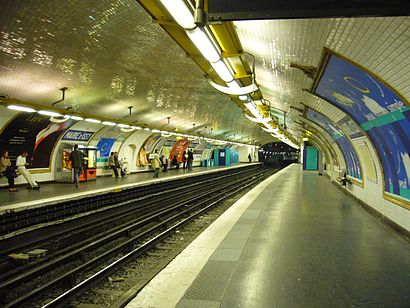
Public transit to Mairie D'Issy station in Paris
Looking for directions to Mairie D'Issy in Paris, France?
Download the Moovit App to find the current schedule and step-by-step directions for Metro, Bus, Train or RER routes that pass through Mairie D'Issy.
Looking for the nearest stops closest to Mairie D'Issy ? Check out this list of closest stops to your destination: Mairie D'Issy; Jacques-Henri Lartigue; Issy - Val de Seine; Corentin Celton.
Train:RER:Metro:Bus:
We make riding on public transit to Mairie D'Issy easy, which is why over 1.5 million users, including users in Paris trust Moovit as the best app for public transit.
Use the app to navigate to popular places including to the airport, hospital, stadium, grocery store, mall, coffee shop, school, college, and university.
The station has the following entrances: 0|Nr and 0|Nr
The first line to this station is H, at 05:30, and the last line is H at 02:15.
62 Rue du Général Leclerc, Issy-les-Moulineaux, France
This station serves Train’s lines
Bus stop near Mairie D'Issy
Mairie D'IssyLight Rail station near Mairie D'Issy
Jacques-Henri LartigueRer station near Mairie D'Issy
Issy - Val de SeineMetro station near Mairie D'Issy
Corentin CeltonPopular public transit stations in Paris
Bel-Air,Yerres,Bougainville,Rungis la Fraternelle,Villeneuve-Saint-Georges,Saint-Maur - Créteil,Quai de la Rapée,Église de Pantin,Bobigny - Pantin - Raymond Queneau,Balard,Hôpital Jacques Cartier,Youri Gagarine,Florian,Gare de Montfort L'Amaury - Méré,Gallieni,Pierre Et Marie Curie,Lièvre D'Or,Avenue du Château,Breuillet - Bruyères-Le-Châtel,Rond-Point WittlichGet around Paris by public transit!
Traveling around Paris has never been so easy. See step by step directions as you travel to any attraction, street or major public transit station. View bus and train schedules, arrival times, service alerts and detailed routes on a map, so you know exactly how to get to anywhere in Paris.
When traveling to any destination around Paris use Moovit's Live Directions with Get Off Notifications to know exactly where and how far to walk, how long to wait for your line, and how many stops are left. Moovit will alert you when it's time to get off — no need to constantly re-check whether yours is the next stop.
Wondering how to use public transit in Paris or how to pay for public transit in Paris? Moovit public transit app can help you navigate your way with public transit easily, and at minimum cost. It includes public transit fees, ticket prices, and costs. Looking for a map of Paris public transit lines? Moovit public transit app shows all public transit maps in Paris with all metro, bus, train or RER routes and stops on an interactive map.
Paris has 4 transit type(s), including: metro, bus, train or RER, operated by several transit agencies, including RATP, RER, RER Bus de remplacement, Train, Train Bus de remplacement, RATP, Tramway Bus de remplacement, TER, RATP, Tramway, ADP, ADP, RATP, Noctilien and Magical Shuttle