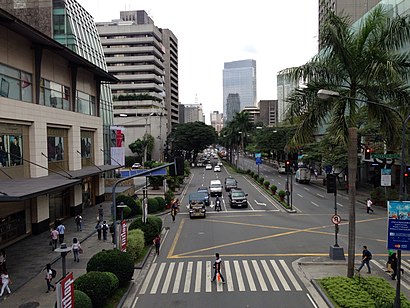
Directions to Makati Ave (Makati City) with public transportation
The following transit lines have routes that pass near Makati Ave
How to get to Makati Ave by bus?
Click on the bus route to see step by step directions with maps, line arrival times and updated time schedules.
How to get to Makati Ave by train?
Click on the train route to see step by step directions with maps, line arrival times and updated time schedules.
Bus stations near Makati Ave in Makati City
- Guerrero / Makati Ave Intersection, Makati City, Manila,2 min walk,
- Makati Ave / Paseo De Roxas Intersection, Makati City, Manila,3 min walk,
- J.P. Rizal Ave / A. Mabini Intersection, Makati City, Manila,5 min walk,
- Makati Cbd,7 min walk,
- Senator Gil Puyat Ave / Makati Avenue Intersection, Makati City, Manila,9 min walk,
- Paseo De Roxas / Senator Gil Puyat Ave Intersection, Makati City, Manila,9 min walk,
Train stations near Makati Ave in Makati City
- Ayala Mrt,9 min walk,
- Pasay Road Pnr,20 min walk,
Bus lines to Makati Ave in Makati City
- JEEP,GUADALUPE IBABAW - AYALA,
- JEEP,Guadalupe-Makati,
- JEEP,MAKATI P BURGOS - L GUINTO,
- JEEP,Ayala Guadalupe Ibabaw via JP Rizal,
- JEEP,Ayala - Pateros via J.P. Rizal,
- BUS,Makati Ave / Ayala Avenue Intersection, Makati City, Manila,
- JEEP,M. Almeda, Pateros, Manila,
- JEEP,South Dr / A. Arnaiz Ave Intersection, Makati City, Manila,
- JEEP,Makati Ave / A. Arnaiz Ave, Makati City, Manila,
- JEEP,Makati Ave / North Dr Intersection, Makati City, Manila,
- BUS,Alabang Lawton via Sucat,
- JEEP,Guadalupe Delpan MRT,
- JEEP,BERNARDINO - DELPAN,
- JEEP,Guadalupe Mkt. - L. Guinto via Pasig Line,
- JEEP,Guadalupe Mkt. - L. Guinto via P. Gil,
- JEEP,L GUINTO - MAKATI via SAN ANDRES,
- JEEP,Del Pan Guadalupe (Ibabaw),
- P2P,Alabang Town Center - Century City Mall,
- P2P,Eastwood - Makati CBD,
- JEEP,Guadalupe Cartimar via Roxas Blvd,
What are the closest stations to Makati Ave?
The closest stations to Makati Ave are:
- Guerrero / Makati Ave Intersection, Makati City, Manila is 102 meters away, 2 min walk.
- Makati Ave / Paseo De Roxas Intersection, Makati City, Manila is 127 meters away, 3 min walk.
- J.P. Rizal Ave / A. Mabini Intersection, Makati City, Manila is 312 meters away, 5 min walk.
- Makati Cbd is 471 meters away, 7 min walk.
- Senator Gil Puyat Ave / Makati Avenue Intersection, Makati City, Manila is 620 meters away, 9 min walk.
- Paseo De Roxas / Senator Gil Puyat Ave Intersection, Makati City, Manila is 639 meters away, 9 min walk.
- Ayala Mrt is 669 meters away, 9 min walk.
- Pasay Road Pnr is 1506 meters away, 20 min walk.
Which bus line stops near Makati Ave?
JEEP
Which train line stops near Makati Ave?
MRT3
What’s the nearest train station to Makati Ave in Makati City?
The nearest train station to Makati Ave in Makati City is Ayala Mrt. It’s a 9 min walk away.
What’s the nearest bus stop to Makati Ave in Makati City?
The nearest bus stop to Makati Ave in Makati City is Guerrero / Makati Ave Intersection, Makati City, Manila. It’s a 2 min walk away.
What time is the first train to Makati Ave in Makati City?
The MRT3 is the first train that goes to Makati Ave in Makati City. It stops nearby at 5:15 AM.
What time is the last train to Makati Ave in Makati City?
The PNR MC is the last train that goes to Makati Ave in Makati City. It stops nearby at 1:10 AM.
What time is the first bus to Makati Ave in Makati City?
The JEEP is the first bus that goes to Makati Ave in Makati City. It stops nearby at 7:00 AM.
What time is the last bus to Makati Ave in Makati City?
The BUS is the last bus that goes to Makati Ave in Makati City. It stops nearby at 12:41 AM.
See Makati Ave, Makati City, on the map
Public Transit to Makati Ave in Makati City
Wondering how to get to Makati Ave in Makati City, Philippines? Moovit helps you find the best way to get to Makati Ave with step-by-step directions from the nearest public transit station.
Moovit provides free maps and live directions to help you navigate through your city. View schedules, routes, timetables, and find out how long does it take to get to Makati Ave in real time.
Looking for the nearest stop or station to Makati Ave? Check out this list of stops closest to your destination: Guerrero / Makati Ave Intersection; Makati Ave / Paseo De Roxas Intersection; J.P. Rizal Ave / A. Mabini Intersection; Makati Cbd; Senator Gil Puyat Ave / Makati Avenue Intersection; Paseo De Roxas / Senator Gil Puyat Ave Intersection; Ayala Mrt; Pasay Road Pnr.
Bus:JEEPBUSBUSP2PP2PTrain:MRT3PNR MC
Want to see if there’s another route that gets you there at an earlier time? Moovit helps you find alternative routes or times. Get directions from and directions to Makati Ave easily from the Moovit App or Website.
We make riding to Makati Ave easy, which is why over 1.5 million users, including users in Makati City, trust Moovit as the best app for public transit. You don’t need to download an individual bus app or train app, Moovit is your all-in-one transit app that helps you find the best bus time or train time available.
For information on prices of bus and train, costs and ride fares to Makati Ave, please check the Moovit app.
Use the app to navigate to popular places including to the airport, hospital, stadium, grocery store, mall, coffee shop, school, college, and university.
Makati Ave Address: Tigris Street street in Makati City
Attractions near Makati Ave
City Garden Hotel Makati,Wild West @ Grand Prix,Moulin Rouge,Palawan Express Pera Padala,Citadel Inn (Citadel Makati),P. Burgos St / Caceres,Arabian Nights (Arabian Nights Bar),Arabian Nights,Red Light District P. Burgos Makati,Sunette Tower,Sunette Tower Condo Suites,Citadel Inn Makati Manila,Let's Talk Dirty Laundry & Dry Cleaning Services,China Bank,Citadel Inn,500 P. Burgos St,Virra 1 Condominium,Triple 7 Massage & Foot Spa Parlor,J'Mar,Makati Palace HotelHow to get to popular attractions in Makati City with public transit
F&E De Castro Village, Bacoor,Sauyo, Quezon City, Quezon City,Palacio del Gobernador, Manila,鹿港小鎮 Lugang Café,National Book Store,NLEx Meycauayan Exit, Bulacan,OLFU - College Of Medicine, Valenzuela,Smart LEC, PQ, Parañaque,Flora Vista Condominiums, Quezon City,Tramway Bayview Buffet,Newport City,Isabelle de Valenzuela, Valenzuela,Ace Water Spa and Ace Coffee Lounge, Quezon City,Nobu Hotel, Parañaque,Malate, Parañaque,Pilar Tricycle Station, Las Piñas,Sta Rosa Exit, Santa Rosa City,SM Cinema Southmall, Las Piñas,Philippine Airlines Inflight Center, Parañaque,C5 NB Toll Gate, TaguigGet around Makati City by public transit!
Traveling around Makati City has never been so easy. See step by step directions as you travel to any attraction, street or major public transit station. View bus and train schedules, arrival times, service alerts and detailed routes on a map, so you know exactly how to get to anywhere in Makati City.
When traveling to any destination around Makati City use Moovit's Live Directions with Get Off Notifications to know exactly where and how far to walk, how long to wait for your line, and how many stops are left. Moovit will alert you when it's time to get off — no need to constantly re-check whether yours is the next stop.
Wondering how to use public transit in Makati City or how to pay for public transit in Makati City? Moovit public transit app can help you navigate your way with public transit easily, and at minimum cost. It includes public transit fees, ticket prices, and costs. Looking for a map of Makati City public transit lines? Moovit public transit app shows all public transit maps in Makati City with all bus or train routes and stops on an interactive map.
Makati City has 2 transit type(s), including: bus or train, operated by several transit agencies, including MRTC, LRTA, PNR, LTFRB, BGC Bus, P2P and UV Express