Directions to Make A Booth (Malden) with public transportation
The following transit lines have routes that pass near Make A Booth
 Bus: 101, 108, 97.
- Train: HAVERHILL.
- Subway: ORANGE LINE, GREEN LINE B, GREEN LINE C, GREEN LINE E.
How to get to Make A Booth by bus?
Click on the bus route to see step by step directions with maps, line arrival times and updated time schedules.
From Liberty Mutual, Boston
70 minFrom Grill 23 & Bar, Boston
70 minFrom Harvard Club Of Boston, Boston
78 minFrom Roxbury, Boston
81 minFrom Haymarket, Boston, Boston
90 minFrom PwC, Boston
73 minFrom Boston City Hall, Boston
110 minFrom Harvard, Boston
66 minFrom Reggie Lewis Athletic Center, Boston
100 minFrom South Boston, Boston
90 min
How to get to Make A Booth by subway?
Click on the subway route to see step by step directions with maps, line arrival times and updated time schedules.
From Liberty Mutual, Boston
40 minFrom Grill 23 & Bar, Boston
39 minFrom Harvard Club Of Boston, Boston
50 minFrom Roxbury, Boston
49 minFrom Haymarket, Boston, Boston
47 minFrom PwC, Boston
45 minFrom Boston City Hall, Boston
44 minFrom Harvard, Boston
57 minFrom Reggie Lewis Athletic Center, Boston
44 minFrom South Boston, Boston
51 min
Bus stops near Make A Booth in Malden
Subway stations near Make A Booth in Malden
Train station near Make A Booth in Malden
- Oak Grove, 23 min walk,VIEW
What are the closest stations to Make A Booth?
The closest stations to Make A Booth are:
- Highland Ave @ Charles St is 78 yards away, 1 min walk.
- Commercial St @ Medford St is 93 yards away, 2 min walk.
- Assembly is 107 yards away, 2 min walk.
- Oak Grove is 1954 yards away, 23 min walk.
- Ball Square Station is 1960 yards away, 24 min walk.
Which bus lines stop near Make A Booth?
These bus lines stop near Make A Booth: 101, 108, 97.
Which subway line stops near Make A Booth?
ORANGE LINE (Oak Grove)
What’s the nearest subway station to Make A Booth in Malden?
The nearest subway station to Make A Booth in Malden is Assembly. It’s a 2 min walk away.
What’s the nearest train station to Make A Booth in Malden?
The nearest train station to Make A Booth in Malden is Oak Grove. It’s a 23 min walk away.
What’s the nearest bus station to Make A Booth in Malden?
The nearest bus station to Make A Booth in Malden is Highland Ave @ Charles St. It’s a 1 min walk away.
What time is the first subway to Make A Booth in Malden?
The GREEN LINE E is the first subway that goes to Make A Booth in Malden. It stops nearby at 4:55 AM.
What time is the last subway to Make A Booth in Malden?
The GREEN LINE E is the last subway that goes to Make A Booth in Malden. It stops nearby at 2:41 AM.
What time is the first train to Make A Booth in Malden?
The HAVERHILL is the first train that goes to Make A Booth in Malden. It stops nearby at 5:35 AM.
What time is the last train to Make A Booth in Malden?
The HAVERHILL is the last train that goes to Make A Booth in Malden. It stops nearby at 11:53 PM.
What time is the first bus to Make A Booth in Malden?
The 108 is the first bus that goes to Make A Booth in Malden. It stops nearby at 5:30 AM.
What time is the last bus to Make A Booth in Malden?
The 108 is the last bus that goes to Make A Booth in Malden. It stops nearby at 1:33 AM.
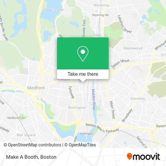
See Make A Booth, Malden, on the map
Public Transit to Make A Booth in Malden
Wondering how to get to Make A Booth in Malden? Moovit helps you find the best way to get to Make A Booth with step-by-step directions from the nearest public transit station.
Moovit provides free maps and live directions to help you navigate through your city. View schedules, routes, timetables, and find out how long does it take to get to Make A Booth in real time.
Looking for the nearest stop or station to Make A Booth? Check out this list of stops closest to your destination: Highland Ave @ Charles St; Commercial St @ Medford St; Assembly; Oak Grove; Ball Square Station.
Bus: 101, 108, 97.Train: HAVERHILL.Subway: ORANGE LINE, GREEN LINE B, GREEN LINE C, GREEN LINE E.
Want to see if there’s another route that gets you there at an earlier time? Moovit helps you find alternative routes or times. Get directions from and directions to Make A Booth easily from the Moovit App or Website.
We make riding to Make A Booth easy, which is why over 1.7 million users, including users in Malden, trust Moovit as the best app for public transit. You don’t need to download an individual bus app or train app, Moovit is your all-in-one transit app that helps you find the best bus time or train time available.
For information on prices of bus and subway, costs and ride fares to Make A Booth, please check the Moovit app.
Use the app to navigate to popular places including to the airport, hospital, stadium, grocery store, mall, coffee shop, school, college, and university.
Make A Booth Address: 80 Adams St street in Malden
- Staff Realty,
- Amman Atlas Market,
- Joanna's Alterations & Dry Cleaning,
- A Plus Locksmith 24 Hours,
- Great Eastern Vintage,
- 0 & O & 0 1 Emergency A 24 Hour Locksmith,
- Karla Montano,
- Di Pietro's (Dipietro's),
- Big A Malden,
- Bright Future Educare Center,
- El Potro,
- City of Malden Council on Aging,
- Masspro Appliance Service,
- Lexter International Technolog,
- Hibernian Club,
- Irish American Association (Malden's Veterans of Irish Ancestory Inc.),
- Monica Calvo Healing Center,
- Piantedosi Baking,
- Social Security Office,
- Super 88
Places Near Make A Booth (Malden)
- Boston Children's Hospital, Boston,
- Castle Island, Boston,
- House Of Blues, Boston,
- North End, Boston,
- Seaport District, Boston,
- Faneuil Hall, Boston,
- Leader Bank Pavilion (Leader Bank Pavillion), Boston,
- Wang Theater, Boston,
- Boston Convention & Exhibition Center, Boston,
- Boston Common, Boston,
- Massachusetts General Hospital, Boston,
- Boston Medical Center, Boston,
- Prudential Center, Boston,
- Cheers, Boston,
- Td Garden, Boston,
- Mgm Music Hall, Boston,
- Quincy Market, Boston,
- Wilbur Theatre, Boston,
- Museum Of Science, Boston,
- Isabella Stewart Gardner Museum, Boston
How to get to popular places in Boston with public transit
Get around Malden by public transit!
Traveling around Malden has never been so easy. See step by step directions as you travel to any attraction, street or major public transit station. View bus and train schedules, arrival times, service alerts and detailed routes on a map, so you know exactly how to get to anywhere in Malden.
When traveling to any destination around Malden use Moovit's Live Directions with Get Off Notifications to know exactly where and how far to walk, how long to wait for your line, and how many stops are left. Moovit will alert you when it's time to get off — no need to constantly re-check whether yours is the next stop.
Wondering how to use public transit in Malden or how to pay for public transit in Malden? Moovit public transit app can help you navigate your way with public transit easily, and at minimum cost. It includes public transit fees, ticket prices, and costs. Looking for a map of Malden public transit lines? Moovit public transit app shows all public transit maps in Malden with all Bus, Train, Subway and Ferry routes and stops on an interactive map.
Boston has 4 transit type(s), including: Bus, Train, Subway and Ferry, operated by several transit agencies, including MBTA, Southeastern Regional Transit Authority, MetroWest Regional Transit Authority, Rhode Island Public Transit Authority, WRTA, Lowell Regional Transit Authority, Merrimack Valley Transit, Montachusett Regional Transit Authority, Cape Cod Regional Transit Authority, Brockton Area Transit Authority, Martha's Vineyard Transit Authority, the WAVE - Nantucket Regional Transit Authority, GATRA, Cape Ann Transportation Authority and Massport