Directions to Malden Meat Stop with public transportation
The following transit lines have routes that pass near Malden Meat Stop
 Bus: 104, 105, 106, 411, 99.
- Train: NEWBURYPORT/ROCKPORT, HAVERHILL.
- Subway: ORANGE LINE.
How to get to Malden Meat Stop by bus?
Click on the bus route to see step by step directions with maps, line arrival times and updated time schedules.
From Legal Harborside
56 minFrom new hampshire!
87 minFrom Boston Children's Hospital
74 minFrom Wentworth Institute Of Technology
95 minFrom Mass Lottery
84 minFrom Puttshack
64 minFrom Grill 23 & Bar
83 minFrom Legal Sea Foods
83 minFrom Arsenal Mall
95 minFrom Beth Israel Deaconess Medical Center Is
100 min
How to get to Malden Meat Stop by subway?
Click on the subway route to see step by step directions with maps, line arrival times and updated time schedules.
Bus stops near Malden Meat Stop
Subway station near Malden Meat Stop
- Wellington, 38 min walk,VIEW
Bus lines to Malden Meat Stop
What are the closest stations to Malden Meat Stop?
The closest stations to Malden Meat Stop are:
- Eastern Ave @ Main St is 94 yards away, 2 min walk.
- Main St @ Madison St is 132 yards away, 2 min walk.
- Ferry St @ Eastern Ave is 170 yards away, 3 min walk.
- Main St @ Salem St is 232 yards away, 3 min walk.
- Centre St @ Jackson St is 317 yards away, 4 min walk.
- Chelsea is 1357 yards away, 19 min walk.
- Wellington is 3225 yards away, 38 min walk.
- Oak Grove is 4846 yards away, 57 min walk.
Which bus lines stop near Malden Meat Stop?
These bus lines stop near Malden Meat Stop: 104, 105, 106, 411.
Which subway line stops near Malden Meat Stop?
ORANGE LINE (Oak Grove)
What’s the nearest train station to Malden Meat Stop?
The nearest train station to Malden Meat Stop is Chelsea. It’s a 19 min walk away.
What’s the nearest bus station to Malden Meat Stop?
The nearest bus stations to Malden Meat Stop are Eastern Ave @ Main St and Main St @ Madison St. The closest one is a 2 min walk away.
What time is the first subway to Malden Meat Stop?
The ORANGE LINE is the first subway that goes to Malden Meat Stop. It stops nearby at 5:15 AM.
What time is the last subway to Malden Meat Stop?
The ORANGE LINE is the last subway that goes to Malden Meat Stop. It stops nearby at 1:59 AM.
What time is the first train to Malden Meat Stop?
The HAVERHILL is the first train that goes to Malden Meat Stop. It stops nearby at 5:35 AM.
What time is the last train to Malden Meat Stop?
The NEWBURYPORT/ROCKPORT is the last train that goes to Malden Meat Stop. It stops nearby at 12:06 AM.
What time is the first bus to Malden Meat Stop?
The 104 is the first bus that goes to Malden Meat Stop. It stops nearby at 4:27 AM.
What time is the last bus to Malden Meat Stop?
The 104 is the last bus that goes to Malden Meat Stop. It stops nearby at 1:38 AM.
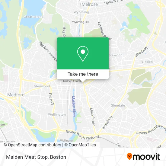
See Malden Meat Stop on the map
Public Transportation to Malden Meat Stop
Wondering how to get to Malden Meat Stop? Moovit helps you find the best way to get to Malden Meat Stop with step-by-step directions from the nearest public transit station.
Moovit provides free maps and live directions to help you navigate through your city. View schedules, routes, timetables, and find out how long does it take to get to Malden Meat Stop in real time.
Looking for the nearest stop or station to Malden Meat Stop? Check out this list of stops closest to your destination: Eastern Ave @ Main St; Main St @ Madison St; Ferry St @ Eastern Ave; Main St @ Salem St; Centre St @ Jackson St; Chelsea; Wellington; Oak Grove.
Bus: 104, 105, 106, 411, 99.Train: NEWBURYPORT/ROCKPORT, HAVERHILL.Subway: ORANGE LINE.
Want to see if there’s another route that gets you there at an earlier time? Moovit helps you find alternative routes or times. Get directions from and directions to Malden Meat Stop easily from the Moovit App or Website.
We make riding to Malden Meat Stop easy, which is why over 1.7 million users, including users in Malden, trust Moovit as the best app for public transit. You don’t need to download an individual bus app or train app, Moovit is your all-in-one transit app that helps you find the best bus time or train time available.
For information on prices of bus and subway, costs and ride fares to Malden Meat Stop, please check the Moovit app.
Use the app to navigate to popular places including to the airport, hospital, stadium, grocery store, mall, coffee shop, school, college, and university.
Malden Meat Stop Address: 302 Main St street in Malden
- Wantea,
- Atlantic Seafood Restaurant,
- Army Recuiter,
- F F Motorsports,
- New England Sports Car Center,
- Maxima Automobile Sales Co.,
- Spaulding Outpatient Center Malden,
- Trellis,
- Pine Banks Park Foundation,
- Dietrich Group,
- Smileland Pediatric de,
- Digi Burgers,
- Auto Braz,
- Radio Brazuca,
- Medicare Insurance Advisors Malden,
- Cha Center for Mindfulness and Compassion,
- Caliente Mexican Grill,
- Chiro Dynamics,
- Smile Land Dental- Malden,
- Cushion Clinic
Places Near Malden Meat Stop
- Leader Bank Pavilion (Leader Bank Pavillion), Boston,
- Isabella Stewart Gardner Museum, Boston,
- Prudential Center, Boston,
- Boston Common, Boston,
- Faneuil Hall, Boston,
- Boston Medical Center, Boston,
- Wang Theater, Boston,
- Mgm Music Hall, Boston,
- House Of Blues, Boston,
- Boston Children's Hospital, Boston,
- North End, Boston,
- Quincy Market, Boston,
- Td Garden, Boston,
- Wilbur Theatre, Boston,
- Cheers, Boston,
- Seaport District, Boston,
- Museum Of Science, Boston,
- Boston Convention & Exhibition Center, Boston,
- Massachusetts General Hospital, Boston,
- Castle Island, Boston
How to get to popular places in Boston with public transit
Get around Malden by public transit!
Traveling around Malden has never been so easy. See step by step directions as you travel to any attraction, street or major public transit station. View bus and train schedules, arrival times, service alerts and detailed routes on a map, so you know exactly how to get to anywhere in Malden.
When traveling to any destination around Malden use Moovit's Live Directions with Get Off Notifications to know exactly where and how far to walk, how long to wait for your line, and how many stops are left. Moovit will alert you when it's time to get off — no need to constantly re-check whether yours is the next stop.
Wondering how to use public transit in Malden or how to pay for public transit in Malden? Moovit public transit app can help you navigate your way with public transit easily, and at minimum cost. It includes public transit fees, ticket prices, and costs. Looking for a map of Malden public transit lines? Moovit public transit app shows all public transit maps in Malden with all Bus, Train, Subway and Ferry routes and stops on an interactive map.
Boston has 4 transit type(s), including: Bus, Train, Subway and Ferry, operated by several transit agencies, including MBTA, Southeastern Regional Transit Authority, MetroWest Regional Transit Authority, Rhode Island Public Transit Authority, WRTA, Lowell Regional Transit Authority, Merrimack Valley Transit, Montachusett Regional Transit Authority, Cape Cod Regional Transit Authority, Brockton Area Transit Authority, Martha's Vineyard Transit Authority, the WAVE - Nantucket Regional Transit Authority, GATRA, Cape Ann Transportation Authority and Massport