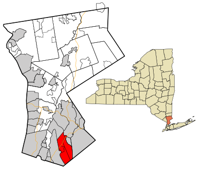
See Mamaroneck, Mamaroneck, Ny, on the map
Directions to Mamaroneck (Mamaroneck, Ny) with public transportation
The following transit lines have routes that pass near Mamaroneck
 Bus:
Bus: - Train:
How to get to Mamaroneck by bus?
Click on the bus route to see step by step directions with maps, line arrival times and updated time schedules.
How to get to Mamaroneck by train?
Click on the train route to see step by step directions with maps, line arrival times and updated time schedules.
Bus stations near Mamaroneck in Mamaroneck, Ny
- Mamaroneck Ave @ Halstead Ave,3 min walk,
- Mamaroneck Ave @ Hoyt Ave,4 min walk,
Train stations near Mamaroneck in Mamaroneck, Ny
- Mamaroneck ,6 min walk,
Bus lines to Mamaroneck in Mamaroneck, Ny
- 61,Fordham,
- 60,Mamaroneck,
What are the closest stations to Mamaroneck?
The closest stations to Mamaroneck are:
- Mamaroneck Ave @ Halstead Ave is 224 yards away, 3 min walk.
- Mamaroneck Ave @ Hoyt Ave is 252 yards away, 4 min walk.
- Mamaroneck is 479 yards away, 6 min walk.
Which bus lines stop near Mamaroneck?
These bus lines stop near Mamaroneck: 60, 61.
Which train line stops near Mamaroneck?
NEW HAVEN
What’s the nearest train station to Mamaroneck in Mamaroneck, Ny?
The nearest train station to Mamaroneck in Mamaroneck, Ny is Mamaroneck. It’s a 6 min walk away.
What’s the nearest bus stop to Mamaroneck in Mamaroneck, Ny?
The nearest bus stop to Mamaroneck in Mamaroneck, Ny is Mamaroneck Ave @ Halstead Ave. It’s a 3 min walk away.
See Mamaroneck, Mamaroneck, Ny, on the map
Public Transit to Mamaroneck in Mamaroneck, Ny
Wondering how to get to Mamaroneck in Mamaroneck, Ny, United States? Moovit helps you find the best way to get to Mamaroneck with step-by-step directions from the nearest public transit station.
Moovit provides free maps and live directions to help you navigate through your city. View schedules, routes, timetables, and find out how long does it take to get to Mamaroneck in real time.
Looking for the nearest stop or station to Mamaroneck? Check out this list of stops closest to your destination: Mamaroneck Ave @ Halstead Ave; Mamaroneck Ave @ Hoyt Ave; Mamaroneck .
Bus:Train:
Want to see if there’s another route that gets you there at an earlier time? Moovit helps you find alternative routes or times. Get directions from and directions to Mamaroneck easily from the Moovit App or Website.
We make riding to Mamaroneck easy, which is why over 1.5 million users, including users in Mamaroneck, Ny, trust Moovit as the best app for public transit. You don’t need to download an individual bus app or train app, Moovit is your all-in-one transit app that helps you find the best bus time or train time available.
For information on prices of bus, train and subway, costs and ride fares to Mamaroneck, please check the Moovit app.
Use the app to navigate to popular places including to the airport, hospital, stadium, grocery store, mall, coffee shop, school, college, and university.
Mamaroneck Address: NY 10543 street in Mamaroneck, Ny
Attractions near Mamaroneck
Supreme Carpet & Upholstery Cleaning Service,Gary Grossman,Northeast Oyster,Metro Music DJ & Live Entertainment SVCS,Fit Chic Personal Training,Ward Ave (ward avenue staub),Precision Door Service,Life of God Christian Ministry,Trinity Church,204 Valley Pl,LM Reality Management,Esto Photographics,Northeast Environmental,Pine Grove Tree & Shrub Care,Weiser Choices,Beresford Landscape Design,Stillman management,Dreamwork Kitchens,Barnaba Group,144 Spencer PlHow to get to popular attractions in Mamaroneck, Ny with public transit
The Biergarten at The Standard, Manhattan,The Dead Rabbit, Manhattan,Culture Espresso, Manhattan,The 13th Step, Manhattan,The Grey Dog, Manhattan,Central Park SummerStage, Manhattan,Nassau Community College, East Garden City, Ny,Hill Country Chicken, Manhattan,Jing Fong Restaurant 金豐大酒樓, Manhattan,Smith Haven Mall, Lake Grove, Ny,Food Gallery 32, Manhattan,Lombardi's Coal Oven Pizza, Manhattan,Stout, Manhattan,Caesars Atlantic City Hotel and Casino, Atlantic City, Nj,Fette Sau,Wingate by Wyndham Manhattan Midtown, Manhattan,Harrah's Resort Hotel & Casino, Atlantic City, Nj,Nathan's Famous,Bubba Gump Shrimp Co., Manhattan,Mad Dog & Beans Mexican Cantina, ManhattanGet around Mamaroneck, Ny by public transit!
Traveling around Mamaroneck, Ny has never been so easy. See step by step directions as you travel to any attraction, street or major public transit station. View bus and train schedules, arrival times, service alerts and detailed routes on a map, so you know exactly how to get to anywhere in Mamaroneck, Ny.
When traveling to any destination around Mamaroneck, Ny use Moovit's Live Directions with Get Off Notifications to know exactly where and how far to walk, how long to wait for your line, and how many stops are left. Moovit will alert you when it's time to get off — no need to constantly re-check whether yours is the next stop.
Wondering how to use public transit in Mamaroneck, Ny or how to pay for public transit in Mamaroneck, Ny? Moovit public transit app can help you navigate your way with public transit easily, and at minimum cost. It includes public transit fees, ticket prices, and costs. Looking for a map of Mamaroneck, Ny public transit lines? Moovit public transit app shows all public transit maps in Mamaroneck, Ny with all bus, train or subway routes and stops on an interactive map.
Mamaroneck, Ny has 3 transit type(s), including: bus, train or subway, operated by several transit agencies, including MTA Subway, Metro-North Railroad, LIRR, PATH, Shore Line East, MTA Bus Company, MTA New York City Transit - Express routes, MTA Bus, NJ Transit, NYC Ferry, NICE bus, Bee-Line Bus, NJ Transit Rail, NJ Transit Rail and Norwalk Transit District