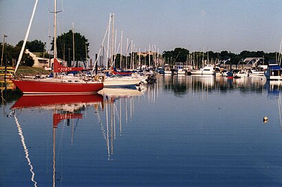
Directions to Mamaroneck Harbor (Mamaroneck, Ny) with public transportation
The following transit lines have routes that pass near Mamaroneck Harbor
How to get to Mamaroneck Harbor by bus?
Click on the bus route to see step by step directions with maps, line arrival times and updated time schedules.
How to get to Mamaroneck Harbor by train?
Click on the train route to see step by step directions with maps, line arrival times and updated time schedules.
Bus stations near Mamaroneck Harbor in Mamaroneck, Ny
- Palmer Ave @ Mamaroneck Ave, 3 min walk,
- Palmer Ave @ Delancey Ave, 13 min walk,
Train stations near Mamaroneck Harbor in Mamaroneck, Ny
- Mamaroneck, 16 min walk,
Bus lines to Mamaroneck Harbor in Mamaroneck, Ny
- 60, Mamaroneck,
- 61, Fordham,
- 70, Larchmont Railroad Station,
What are the closest stations to Mamaroneck Harbor?
The closest stations to Mamaroneck Harbor are:
- Palmer Ave @ Mamaroneck Ave is 194 yards away, 3 min walk.
- Palmer Ave @ Delancey Ave is 1066 yards away, 13 min walk.
- Mamaroneck is 1332 yards away, 16 min walk.
Which bus lines stop near Mamaroneck Harbor?
These bus lines stop near Mamaroneck Harbor: 60, 61.
Which train line stops near Mamaroneck Harbor?
NEW HAVEN
What’s the nearest train station to Mamaroneck Harbor in Mamaroneck, Ny?
The nearest train station to Mamaroneck Harbor in Mamaroneck, Ny is Mamaroneck. It’s a 16 min walk away.
What’s the nearest bus stop to Mamaroneck Harbor in Mamaroneck, Ny?
The nearest bus stop to Mamaroneck Harbor in Mamaroneck, Ny is Palmer Ave @ Mamaroneck Ave. It’s a 3 min walk away.
What time is the first train to Mamaroneck Harbor in Mamaroneck, Ny?
The NEW HAVEN is the first train that goes to Mamaroneck Harbor in Mamaroneck, Ny. It stops nearby at 5:00 AM.
What time is the last train to Mamaroneck Harbor in Mamaroneck, Ny?
The NEW HAVEN is the last train that goes to Mamaroneck Harbor in Mamaroneck, Ny. It stops nearby at 2:35 AM.
What time is the first bus to Mamaroneck Harbor in Mamaroneck, Ny?
The 60 is the first bus that goes to Mamaroneck Harbor in Mamaroneck, Ny. It stops nearby at 5:42 AM.
What time is the last bus to Mamaroneck Harbor in Mamaroneck, Ny?
The 60 is the last bus that goes to Mamaroneck Harbor in Mamaroneck, Ny. It stops nearby at 10:37 PM.
How much is the bus fare to Mamaroneck Harbor?
The bus fare to Mamaroneck Harbor costs about $2.75 - $2.90.
How much is the subway fare to Mamaroneck Harbor?
The subway fare to Mamaroneck Harbor costs about $2.90.
How much is the train fare to Mamaroneck Harbor?
The train fare to Mamaroneck Harbor costs about $2.75 - $15.25.
See Mamaroneck Harbor, Mamaroneck, Ny, on the map
Public Transit to Mamaroneck Harbor in Mamaroneck, Ny
Wondering how to get to Mamaroneck Harbor in Mamaroneck, Ny, United States? Moovit helps you find the best way to get to Mamaroneck Harbor with step-by-step directions from the nearest public transit station.
Moovit provides free maps and live directions to help you navigate through your city. View schedules, routes, timetables, and find out how long does it take to get to Mamaroneck Harbor in real time.
Looking for the nearest stop or station to Mamaroneck Harbor? Check out this list of stops closest to your destination: Palmer Ave @ Mamaroneck Ave; Palmer Ave @ Delancey Ave; Mamaroneck.
Bus: 60, 61, 70.Train: NEW HAVEN, NEW CANAAN.
Want to see if there’s another route that gets you there at an earlier time? Moovit helps you find alternative routes or times. Get directions from and directions to Mamaroneck Harbor easily from the Moovit App or Website.
We make riding to Mamaroneck Harbor easy, which is why over 1.5 million users, including users in Mamaroneck, Ny, trust Moovit as the best app for public transit. You don’t need to download an individual bus app or train app, Moovit is your all-in-one transit app that helps you find the best bus time or train time available.
For information on prices of train, bus and subway, costs and ride fares to Mamaroneck Harbor, please check the Moovit app.
Use the app to navigate to popular places including to the airport, hospital, stadium, grocery store, mall, coffee shop, school, college, and university.
Location: Mamaroneck, Ny, New York - New Jersey
Attractions near Mamaroneck Harbor
Harbor Island Park,Harbor Island Beach,Stephen E. Johnston Beach,Westchester Yacht Sales,ChargePoint,Bmw,Home Sweet Home Properties,Indian Cove,Ricci Fine Italian Restaurant,Village Mamaroneck,St. Thomas' Episcopal Church,County Government Treatment Plants Day or Night,Fiore Pilates,Zoffness College Prep,Molly Roze Bait & Tackle (Harbor Island Bait),W Boston Post Rd & Harbor Island Pk,Baby Duke's Kitchen,De Cara Makeup,One2one,SalonposhhairHow to get to popular attractions in Mamaroneck, Ny with public transit
Prince Street, Manhattan,Roosevelt Field Mall Bus Terminal, East Garden City, Ny,Teaneck, NJ, Teaneck, Nj,Rockefeller Center, Manhattan,Williamsburg,MTA Subway - 5th Ave / 53rd St (E / M), Manhattan,George Washington Bridge Bus Station, Manhattan,PNC Bank Arts Center, Holmdel, Nj,Jamaica Bus Terminal, Queens,Poconos, Pennsylvania, Bronx,1827 Westchester Avenue, Bronx,Whitehall, Manhattan,125, Manhattan,W 72nd St (central park west & W 72nd St), Manhattan,51 West 51st Street, Manhattan,MetLife Stadium, East Rutherford, Nj,Bellevue Hospital Center, Manhattan,125 Worth Street, Manhattan,The Met, Manhattan,404 Pine StGet around New York - New Jersey by public transit!
Traveling around New York - New Jersey has never been so easy. See step by step directions as you travel to any attraction, street or major public transit station. View bus and train schedules, arrival times, service alerts and detailed routes on a map, so you know exactly how to get to anywhere in New York - New Jersey.
When traveling to any destination around New York - New Jersey use Moovit's Live Directions with Get Off Notifications to know exactly where and how far to walk, how long to wait for your line, and how many stops are left. Moovit will alert you when it's time to get off — no need to constantly re-check whether yours is the next stop.
Wondering how to use public transit in New York - New Jersey or how to pay for public transit in New York - New Jersey? Moovit public transit app can help you navigate your way with public transit easily, and at minimum cost. It includes public transit fees, ticket prices, and costs. Looking for a map of New York - New Jersey public transit lines? Moovit public transit app shows all public transit maps in New York - New Jersey with all Bus, Train, Subway, Light Rail, Ferry and Cable Car routes and stops on an interactive map.
New York - New Jersey has 6 transit type(s), including: Bus, Train, Subway, Light Rail, Ferry and Cable Car, operated by several transit agencies, including MTA Subway, Metro-North Railroad, LIRR, PATH, Shore Line East, MTA Bus Company, MTA New York City Transit - Express routes, MTA Bus, NJ Transit, NYC Ferry, NICE bus, Bee-Line Bus, NJ Transit Rail, Norwalk Transit District, CTTransit - Waterbury-Meriden