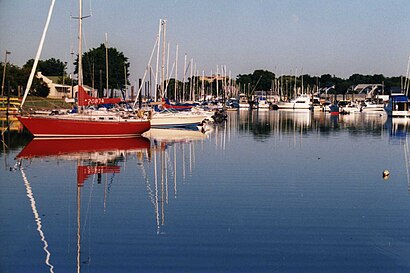
See Mamaroneck Harbor, Mamaroneck, Ny, on the map
Directions to Mamaroneck Harbor (Mamaroneck, Ny) with public transportation
The following transit lines have routes that pass near Mamaroneck Harbor
 Bus:
Bus: - Train:
How to get to Mamaroneck Harbor by bus?
Click on the bus route to see step by step directions with maps, line arrival times and updated time schedules.
How to get to Mamaroneck Harbor by train?
Click on the train route to see step by step directions with maps, line arrival times and updated time schedules.
Bus stations near Mamaroneck Harbor in Mamaroneck, Ny
- Palmer Ave @ Mamaroneck Ave,43 min walk,
- Larchmont Ave @ Addison St,79 min walk,
Train stations near Mamaroneck Harbor in Mamaroneck, Ny
- Mamaroneck,46 min walk,
Bus lines to Mamaroneck Harbor in Mamaroneck, Ny
- 60,Mamaroneck,
- 61,Fordham,
- 71,Larchmont Railroad Station,
What are the closest stations to Mamaroneck Harbor?
The closest stations to Mamaroneck Harbor are:
- Palmer Ave @ Mamaroneck Ave is 3017 yards away, 43 min walk.
- Mamaroneck is 3231 yards away, 46 min walk.
- Larchmont Ave @ Addison St is 6078 yards away, 79 min walk.
Which bus lines stop near Mamaroneck Harbor?
These bus lines stop near Mamaroneck Harbor: 60, 61.
Which train line stops near Mamaroneck Harbor?
NEW HAVEN
See Mamaroneck Harbor, Mamaroneck, Ny, on the map
Public Transit to Mamaroneck Harbor in Mamaroneck, Ny
Wondering how to get to Mamaroneck Harbor in Mamaroneck, Ny, United States? Moovit helps you find the best way to get to Mamaroneck Harbor with step-by-step directions from the nearest public transit station.
Moovit provides free maps and live directions to help you navigate through your city. View schedules, routes, timetables, and find out how long does it take to get to Mamaroneck Harbor in real time.
Looking for the nearest stop or station to Mamaroneck Harbor? Check out this list of stops closest to your destination: Palmer Ave @ Mamaroneck Ave; Mamaroneck; Larchmont Ave @ Addison St.
Bus:Train:
Want to see if there’s another route that gets you there at an earlier time? Moovit helps you find alternative routes or times. Get directions from and directions to Mamaroneck Harbor easily from the Moovit App or Website.
We make riding to Mamaroneck Harbor easy, which is why over 1.5 million users, including users in Mamaroneck, Ny, trust Moovit as the best app for public transit. You don’t need to download an individual bus app or train app, Moovit is your all-in-one transit app that helps you find the best bus time or train time available.
For information on prices of bus and train, costs and ride fares to Mamaroneck Harbor, please check the Moovit app.
Use the app to navigate to popular places including to the airport, hospital, stadium, grocery store, mall, coffee shop, school, college, and university.
Location: Mamaroneck, Ny, New York - New Jersey
Attractions near Mamaroneck Harbor
Turkey Rock,Pops Rocks,Crane Island,Outer Steamboat Rock,1,Bonnie Brook,Merrimack River,Brevoort Shore,Black Tom,East Neck,Mamaroneck Neck,Sutton's Point,Richbell's Neck,DeLancey's Neck,Mamaroneck Point,Caywaywest,Mamaroneck Beach Cabana and Yacht Club,1,Post Island,Spike IslandHow to get to popular attractions in Mamaroneck, Ny with public transit
Clinton St. Baking Co. & Restaurant, Manhattan,Ulysses Folk House, Manhattan,Café Habana, Manhattan,Hair of the Dog, Manhattan,The Biergarten at The Standard, Manhattan,Jing Fong Restaurant 金豐大酒樓, Manhattan,Long Island, NY, Huntington Station, Ny,Top of The Standard, Manhattan,Boat Basin Cafe, Manhattan,Secaucus, NJ, Secaucus, Nj,Stout, Manhattan,The Plaza Hotel, Manhattan,Beauty & Essex, Manhattan,Eataly, Manhattan,Caesars Atlantic City Hotel and Casino, Atlantic City, Nj,Ferrara Bakery, Manhattan,Ace Hotel Lobby Bar, Manhattan,Bubba Gump Shrimp Co., Manhattan,The Meatball Shop,New Jersey, Nutley, NjGet around Mamaroneck, Ny by public transit!
Traveling around Mamaroneck, Ny has never been so easy. See step by step directions as you travel to any attraction, street or major public transit station. View bus and train schedules, arrival times, service alerts and detailed routes on a map, so you know exactly how to get to anywhere in Mamaroneck, Ny.
When traveling to any destination around Mamaroneck, Ny use Moovit's Live Directions with Get Off Notifications to know exactly where and how far to walk, how long to wait for your line, and how many stops are left. Moovit will alert you when it's time to get off — no need to constantly re-check whether yours is the next stop.
Wondering how to use public transit in Mamaroneck, Ny or how to pay for public transit in Mamaroneck, Ny? Moovit public transit app can help you navigate your way with public transit easily, and at minimum cost. It includes public transit fees, ticket prices, and costs. Looking for a map of Mamaroneck, Ny public transit lines? Moovit public transit app shows all public transit maps in Mamaroneck, Ny with all bus or train routes and stops on an interactive map.
Mamaroneck, Ny has 2 transit type(s), including: bus or train, operated by several transit agencies, including MTA Subway, Metro-North Railroad, LIRR, PATH, Shore Line East, MTA Bus Company, MTA New York City Transit - Express routes, MTA Bus, NJ Transit, NYC Ferry, NICE bus, Bee-Line Bus, NJ Transit Rail, NJ Transit Rail and Norwalk Transit District