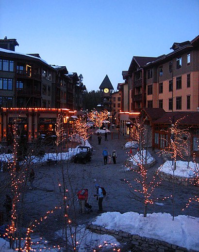
Directions to Mammoth Lakes CA with public transportation
The following transit lines have routes that pass near Mammoth Lakes CA
How to get to Mammoth Lakes CA by bus?
Click on the bus route to see step by step directions with maps, line arrival times and updated time schedules.
Bus stations near Mammoth Lakes CA
- Stop 75 - Lakeview Blvd / Mountainback (Upper),3 min walk,
- Stop 91 - Lake Mary Rd / Lee Rd,15 min walk,
Bus lines to Mammoth Lakes CA
- EVENING TROLLEY,Evening Trolley,
- TOWN TROLLEY,Town Trolley,
- LAKES BASIN TROLLEY,The Village,
What are the closest stations to Mammoth Lakes CA?
The closest stations to Mammoth Lakes CA are:
- Stop 75 - Lakeview Blvd / Mountainback (Upper) is 154 yards away, 3 min walk.
- Stop 91 - Lake Mary Rd / Lee Rd is 1220 yards away, 15 min walk.
Which bus lines stop near Mammoth Lakes CA?
These bus lines stop near Mammoth Lakes CA: GREEN, TEAL LINE.
What’s the nearest bus stop to Mammoth Lakes CA?
The nearest bus stop to Mammoth Lakes CA is Stop 75 - Lakeview Blvd / Mountainback (Upper). It’s a 3 min walk away.
What time is the first {{TRANSIT_TYPE}} to Mammoth Lakes CA?
The TOWN TROLLEY is the first {{TRANSIT_TYPE}} that goes to Mammoth Lakes CA. It stops nearby at 7:35 AM.
What time is the last {{TRANSIT_TYPE}} to Mammoth Lakes CA?
The EVENING TROLLEY is the last {{TRANSIT_TYPE}} that goes to Mammoth Lakes CA. It stops nearby at 10:06 PM.
See Mammoth Lakes CA on the map
Public Transportation to Mammoth Lakes CA
Wondering how to get to Mammoth Lakes CA, United States? Moovit helps you find the best way to get to Mammoth Lakes CA with step-by-step directions from the nearest public transit station.
Moovit provides free maps and live directions to help you navigate through your city. View schedules, routes, timetables, and find out how long does it take to get to Mammoth Lakes CA in real time.
Looking for the nearest stop or station to Mammoth Lakes CA? Check out this list of stops closest to your destination: Stop 75 - Lakeview Blvd / Mountainback (Upper); Stop 91 - Lake Mary Rd / Lee Rd.
Bus:GREENTEAL LINEEVENING TROLLEYTOWN TROLLEYLAKES BASIN TROLLEY
Want to see if there’s another route that gets you there at an earlier time? Moovit helps you find alternative routes or times. Get directions from and directions to Mammoth Lakes CA easily from the Moovit App or Website.
We make riding to Mammoth Lakes CA easy, which is why over 1.5 million users, including users in Mammoth Lakes, trust Moovit as the best app for public transit. You don’t need to download an individual bus app or train app, Moovit is your all-in-one transit app that helps you find the best bus time or train time available.
For information on prices of bus, costs and ride fares to Mammoth Lakes CA, please check the Moovit app.
Use the app to navigate to popular places including to the airport, hospital, stadium, grocery store, mall, coffee shop, school, college, and university.
Mammoth Lakes CA Address: 455 Lakeview Blvd Mammoth Lakes, CA 93546 street in Mammoth Lakes
Attractions near Mammoth Lakes CA
Mountainback by Mammoth Mountain Reservations,Mammoth Lakes Conestoga Condo,Rock Creek Lakes Resort,Discovery 4 Condominiums,Chamonix,Lake Mary Road & Lee Road,Duck Pass Trailhead,Canyon Blvd & Mammoth West Condo,The North Face,Lincoln Bar,Eric Leach Resort Property Realty Inc.,Meadow Ridge Condominiums,Austria Hof Restaurant,Tamarack Lodge & Resort,Mammoth Ski and Racquet Club,Flores Carpet Cleaning & Upholstery,Bill Wedde - Thrivent,Mammoth Ski and Racquet Club Condominiums,Mammoth Real Estate,Highland PlumbingHow to get to popular attractions in Mammoth Lakes with public transit
Woodward Park, Fresno,Lindsay CA USA, Lindsay,Fashion Fair Mall, Fresno,Fresno Yosemite International Airport (FAT), Fresno,Fresno, CA, Fresno,SANGER, CALIFORNIA, Sanger,Avenal, CA, Avenal,Ahwahnee Hotel, Yosemite Valley,Chukchansi Gold Resort & Casino,Table Mountain Casino, Fresno,Shaver Lake, Fresno,Eagle Mountain Casino,chukchansi,Fresno Fairgrounds, Fresno,Poverello House, Fresno,Madera, California, Madera,E Jensen Ave / S Golden State Blvd, Fresno,Highway 99 /Jensen Avenue Interchange, Fresno,VA Hospital, Fresno,Saint Agnes Hospital, FresnoGet around Mammoth Lakes by public transit!
Traveling around Mammoth Lakes has never been so easy. See step by step directions as you travel to any attraction, street or major public transit station. View bus and train schedules, arrival times, service alerts and detailed routes on a map, so you know exactly how to get to anywhere in Mammoth Lakes.
When traveling to any destination around Mammoth Lakes use Moovit's Live Directions with Get Off Notifications to know exactly where and how far to walk, how long to wait for your line, and how many stops are left. Moovit will alert you when it's time to get off — no need to constantly re-check whether yours is the next stop.
Wondering how to use public transit in Mammoth Lakes or how to pay for public transit in Mammoth Lakes? Moovit public transit app can help you navigate your way with public transit easily, and at minimum cost. It includes public transit fees, ticket prices, and costs. Looking for a map of Mammoth Lakes public transit lines? Moovit public transit app shows all public transit maps in Mammoth Lakes with all bus routes and stops on an interactive map.
Mammoth Lakes has 1 transit type(s), including: bus, operated by several transit agencies, including FAX, FCRTA, The Bus, Madera County Connection, Yosemite Area Regional Transportation System, Madera Metro, VISALIA TRANSIT, Kings Area Rural Transit, Tulare County Regional Transit Agency, Tulare County Area Transit (TCAT), Porterville Transit, Dinuba Area Regional Transit, Clovis Transit, Eastern Sierra Transit Authority and Amtrak