Directions to Manassas with public transportation
The following transit lines have routes that pass near Manassas
How to get to Manassas by bus?
Click on the bus route to see step by step directions with maps, line arrival times and updated time schedules.
How to get to Manassas by train?
Click on the train route to see step by step directions with maps, line arrival times and updated time schedules.
Bus stations near Manassas
- Center St @ Church St, 8 min walk,
- Church St @ Center St, 9 min walk,
Bus lines to Manassas
- 67, Route 67 - Hub - Pwc Courthouse,
- 96, 96 - Hub - Pwc Courthouse,
- 65, 65 - Nova Community College,
What are the closest stations to Manassas?
The closest stations to Manassas are:
- Center St @ Church St is 624 yards away, 8 min walk.
- Church St @ Center St is 694 yards away, 9 min walk.
Which bus lines stop near Manassas?
These bus lines stop near Manassas: 60, 68, 96.
Which train line stops near Manassas?
MANASSAS LINE
What’s the nearest bus stop to Manassas?
The nearest bus stop to Manassas is Center St @ Church St. It’s a 8 min walk away.
What time is the first train to Manassas?
The MANASSAS LINE is the first train that goes to Manassas. It stops nearby at 5:15 AM.
What time is the last train to Manassas?
The MANASSAS LINE is the last train that goes to Manassas. It stops nearby at 8:02 PM.
How much is the metro fare to Manassas?
The metro fare to Manassas costs about $2.00 - $6.00.
How much is the bus fare to Manassas?
The bus fare to Manassas costs about $2.00 - $9.20.
How much is the train fare to Manassas?
The train fare to Manassas costs about $3.50 - $10.00.
See Manassas on the map
Public Transportation to Manassas
Wondering how to get to Manassas, United States? Moovit helps you find the best way to get to Manassas with step-by-step directions from the nearest public transit station.
Moovit provides free maps and live directions to help you navigate through your city. View schedules, routes, timetables, and find out how long does it take to get to Manassas in real time.
Looking for the nearest stop or station to Manassas? Check out this list of stops closest to your destination: Center St @ Church St; Church St @ Center St.
Bus: 60, 68, 96, 67, 65.Train: MANASSAS LINE.
Want to see if there’s another route that gets you there at an earlier time? Moovit helps you find alternative routes or times. Get directions from and directions to Manassas easily from the Moovit App or Website.
We make riding to Manassas easy, which is why over 1.5 million users, including users in Manassas, trust Moovit as the best app for public transit. You don’t need to download an individual bus app or train app, Moovit is your all-in-one transit app that helps you find the best bus time or train time available.
For information on prices of bus, train and metro, costs and ride fares to Manassas, please check the Moovit app.
Use the app to navigate to popular places including to the airport, hospital, stadium, grocery store, mall, coffee shop, school, college, and university.
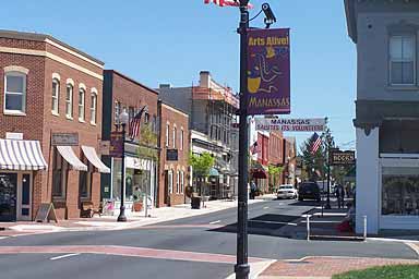
Manassas Address: Battle Street street in Manassas
Attractions near Manassas
Manassas Station,Mariachis Tequileria & Restaurant,Manassas Amtrak Station,Something Old Som,Rotary Club of Manassas,Amtrak Cardinal 51,The Bone,Battle St Locks,CVL,Prince William Garage,Travel Place Manassas,Foster's Grille,Cj Finz Raw Bar & Grille,Chandler & Mc Getrick,Whitlock Wealth Management - Ameriprise Financial Services,Life Energy Reiki & Readings,Actioncoach,ChargePoint,West Liberty,Farmer's MarketsHow to get to popular attractions in Manassas with public transit
War Memorial Plaza, Baltimore,Fairchild Building, Washington,Caboose Brewing Company, Fairfax County,Franklin High School, Baltimore County,1301 Pennsylvania Ave, Washington,Mason F. Lord Building - Johns Hopkins Bayview, Baltimore,Gadsby's Tavern, Alexandria,MICA Fox Building, Baltimore,Federal Reserve Board, Washington,Parkdale High School, Prince George's County,Sheridan Circle, Washington,Cherry Hill, Baltimore,Halethorpe MARC Station Parking Lot, Baltimore County,I-66 Exit 67: Dulles Toll Road (VA-267), Fairfax County,Wyndham Old Town Alexandria, Alexandria,Hillendale Shopping Center, Baltimore County,Rome Building - Johns Hopkins SAIS, Washington,Corduroy, Washington,Red Lounge Bar & Grill, Washington,Broken Land Parkway, Howard CountyGet around Washington, D.C. - Baltimore, MD by public transit!
Traveling around Washington, D.C. - Baltimore, MD has never been so easy. See step by step directions as you travel to any attraction, street or major public transit station. View bus and train schedules, arrival times, service alerts and detailed routes on a map, so you know exactly how to get to anywhere in Washington, D.C. - Baltimore, MD.
When traveling to any destination around Washington, D.C. - Baltimore, MD use Moovit's Live Directions with Get Off Notifications to know exactly where and how far to walk, how long to wait for your line, and how many stops are left. Moovit will alert you when it's time to get off — no need to constantly re-check whether yours is the next stop.
Wondering how to use public transit in Washington, D.C. - Baltimore, MD or how to pay for public transit in Washington, D.C. - Baltimore, MD? Moovit public transit app can help you navigate your way with public transit easily, and at minimum cost. It includes public transit fees, ticket prices, and costs. Looking for a map of Washington, D.C. - Baltimore, MD public transit lines? Moovit public transit app shows all public transit maps in Washington, D.C. - Baltimore, MD with all Bus, Train, Metro, Light Rail and Ferry routes and stops on an interactive map.
Washington, D.C. - Baltimore, MD has 5 transit type(s), including: Bus, Train, Metro, Light Rail and Ferry, operated by several transit agencies, including WMATA, Montgomery County Ride On, Montgomery County MD Ride On, Fairfax Connector, TheBus, PRTC, DC Circulator, DASH - Alexandria, Arlington Transit (ART), DC Streetcar, RTA of Central Maryland, FRED, MDOT MTA, Marc, Virginia Railway Express (VRE)