Directions to Mandamonium (Medford) with public transportation
The following transit lines have routes that pass near Mandamonium
 Bus: 80, 94, 95, 101, LOWELL LINE SHUTTLE.
- Train: LOWELL.
- Subway: GREEN LINE E, RED LINE, GREEN LINE B, GREEN LINE C.
How to get to Mandamonium by bus?
Click on the bus route to see step by step directions with maps, line arrival times and updated time schedules.
From Amtrak-Boston South Station, Boston
50 minFrom Lolita Cocina & Tequila Bar, Boston
65 minFrom Boston University Track and Tennis Center, Boston
62 minFrom moakley federal court house, Boston
86 minFrom Battery Wharf Hotel, Boston
50 minFrom TownePlace Suites Boston Logan Airport/Chelsea, Chelsea
74 minFrom Ruggles Station, Boston
68 minFrom Chart House Restaurant, Boston
49 minFrom Boston Harbor Hotel, Boston
49 minFrom Inman Sq, Cambridge
59 min
How to get to Mandamonium by train?
Click on the train route to see step by step directions with maps, line arrival times and updated time schedules.
How to get to Mandamonium by subway?
Click on the subway route to see step by step directions with maps, line arrival times and updated time schedules.
From Amtrak-Boston South Station, Boston
68 minFrom Lolita Cocina & Tequila Bar, Boston
68 minFrom Boston University Track and Tennis Center, Boston
95 minFrom moakley federal court house, Boston
77 minFrom Battery Wharf Hotel, Boston
66 minFrom TownePlace Suites Boston Logan Airport/Chelsea, Chelsea
86 minFrom Ruggles Station, Boston
69 minFrom Chart House Restaurant, Boston
65 minFrom Boston Harbor Hotel, Boston
70 minFrom Inman Sq, Cambridge
68 min
Bus stops near Mandamonium in Medford
Subway stations near Mandamonium in Medford
Train station near Mandamonium in Medford
- Wedgemere, 16 min walk,VIEW
Bus lines to Mandamonium in Medford
What are the closest stations to Mandamonium?
The closest stations to Mandamonium are:
- High St @ Mystic Valley Pkwy is 383 yards away, 5 min walk.
- Boston Ave @ High St is 506 yards away, 7 min walk.
- West Medford is 726 yards away, 9 min walk.
- Davis Sq. is 1243 yards away, 15 min walk.
- Wedgemere is 1297 yards away, 16 min walk.
- Medford/Tufts Station is 1800 yards away, 22 min walk.
Which bus lines stop near Mandamonium?
These bus lines stop near Mandamonium: 80, 94, 95.
Which train line stops near Mandamonium?
LOWELL (#323 | Lowell)
Which subway line stops near Mandamonium?
GREEN LINE E (Lechmere)
What’s the nearest subway station to Mandamonium in Medford?
The nearest subway station to Mandamonium in Medford is Davis Sq.. It’s a 15 min walk away.
What’s the nearest train station to Mandamonium in Medford?
The nearest train station to Mandamonium in Medford is Wedgemere. It’s a 16 min walk away.
What’s the nearest bus station to Mandamonium in Medford?
The nearest bus station to Mandamonium in Medford is High St @ Mystic Valley Pkwy. It’s a 5 min walk away.
What time is the first subway to Mandamonium in Medford?
The GREEN LINE E is the first subway that goes to Mandamonium in Medford. It stops nearby at 4:57 AM.
What time is the last subway to Mandamonium in Medford?
The GREEN LINE E is the last subway that goes to Mandamonium in Medford. It stops nearby at 2:41 AM.
What time is the first train to Mandamonium in Medford?
The LOWELL is the first train that goes to Mandamonium in Medford. It stops nearby at 5:29 AM.
What time is the last train to Mandamonium in Medford?
The LOWELL is the last train that goes to Mandamonium in Medford. It stops nearby at 12:20 AM.
What time is the first bus to Mandamonium in Medford?
The 95 is the first bus that goes to Mandamonium in Medford. It stops nearby at 4:57 AM.
What time is the last bus to Mandamonium in Medford?
The 95 is the last bus that goes to Mandamonium in Medford. It stops nearby at 1:36 AM.
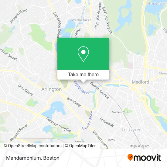
See Mandamonium, Medford, on the map
Public Transit to Mandamonium in Medford
Wondering how to get to Mandamonium in Medford? Moovit helps you find the best way to get to Mandamonium with step-by-step directions from the nearest public transit station.
Moovit provides free maps and live directions to help you navigate through your city. View schedules, routes, timetables, and find out how long does it take to get to Mandamonium in real time.
Looking for the nearest stop or station to Mandamonium? Check out this list of stops closest to your destination: High St @ Mystic Valley Pkwy; Boston Ave @ High St; West Medford; Davis Sq.; Wedgemere; Medford/Tufts Station.
Bus: 80, 94, 95, 101, LOWELL LINE SHUTTLE.Train: LOWELL.Subway: GREEN LINE E, RED LINE, GREEN LINE B, GREEN LINE C.
Want to see if there’s another route that gets you there at an earlier time? Moovit helps you find alternative routes or times. Get directions from and directions to Mandamonium easily from the Moovit App or Website.
We make riding to Mandamonium easy, which is why over 1.7 million users, including users in Medford, trust Moovit as the best app for public transit. You don’t need to download an individual bus app or train app, Moovit is your all-in-one transit app that helps you find the best bus time or train time available.
For information on prices of bus, subway and train, costs and ride fares to Mandamonium, please check the Moovit app.
Use the app to navigate to popular places including to the airport, hospital, stadium, grocery store, mall, coffee shop, school, college, and university.
Mandamonium Address: 32 Fairfield St street in Medford
- Phillips Electrical Maintenance and Construction,
- Little Red Fox Day Care,
- Amsell Colebrooke Playground,
- Bni Powder House,
- New England Meow Outfi,
- AAA Stables,
- SKBN Plumbing,
- Galvin Property Management,
- Thrive Pet Healthcare,
- Krasny Ugol ( Beautiful Corner ),
- John L Greco Attorney,
- Mls Property Information Network, Inc.,
- Medford Brewing Company,
- Post Run Bench,
- St Raphael's Church Medford, MA,
- Libertyx Bitcoin ATM,
- Serenity Spa of the Orient,
- Mls Property Information Network, Inc.,
- SMC Cycles,
- West Medford Station
Places Near Mandamonium (Medford)
- Prudential Center, Boston,
- Td Garden, Boston,
- Boston Medical Center, Boston,
- House Of Blues, Boston,
- North End, Boston,
- Mgm Music Hall, Boston,
- Wang Theater, Boston,
- Boston Common, Boston,
- Boston Convention & Exhibition Center, Boston,
- Quincy Market, Boston,
- Cheers, Boston,
- Castle Island, Boston,
- Wilbur Theatre, Boston,
- Isabella Stewart Gardner Museum, Boston,
- Leader Bank Pavilion (Leader Bank Pavillion), Boston,
- Museum Of Science, Boston,
- Faneuil Hall, Boston,
- Seaport District, Boston,
- Boston Children's Hospital, Boston,
- Massachusetts General Hospital, Boston
How to get to popular places in Boston with public transit
Get around Medford by public transit!
Traveling around Medford has never been so easy. See step by step directions as you travel to any attraction, street or major public transit station. View bus and train schedules, arrival times, service alerts and detailed routes on a map, so you know exactly how to get to anywhere in Medford.
When traveling to any destination around Medford use Moovit's Live Directions with Get Off Notifications to know exactly where and how far to walk, how long to wait for your line, and how many stops are left. Moovit will alert you when it's time to get off — no need to constantly re-check whether yours is the next stop.
Wondering how to use public transit in Medford or how to pay for public transit in Medford? Moovit public transit app can help you navigate your way with public transit easily, and at minimum cost. It includes public transit fees, ticket prices, and costs. Looking for a map of Medford public transit lines? Moovit public transit app shows all public transit maps in Medford with all Bus, Train, Subway and Ferry routes and stops on an interactive map.
Boston has 4 transit type(s), including: Bus, Train, Subway and Ferry, operated by several transit agencies, including MBTA, Southeastern Regional Transit Authority, MetroWest Regional Transit Authority, Rhode Island Public Transit Authority, WRTA, Lowell Regional Transit Authority, Merrimack Valley Transit, Montachusett Regional Transit Authority, Cape Cod Regional Transit Authority, Brockton Area Transit Authority, Martha's Vineyard Transit Authority, the WAVE - Nantucket Regional Transit Authority, GATRA, Cape Ann Transportation Authority and Massport