Directions to Mango Mania Us (Boston) with public transportation
The following transit lines have routes that pass near Mango Mania Us
 Bus: 14, 22, 39, 66, 41.
- Train: FRAMINGHAM/WORCESTER, PROVIDENCE/STOUGHTON.
- Subway: ORANGE LINE, GREEN LINE E.
How to get to Mango Mania Us by bus?
Click on the bus route to see step by step directions with maps, line arrival times and updated time schedules.
From FOUR POINTS BY SHERATON Boston Newton, Newton
51 minFrom Chevalier Theatre (Chevalier Theater Show Line), Medford
100 minFrom Sheraton-Needham Hotel (Sheraton Boston Needham Hotel), Needham
101 minFrom Hilton Garden Inn Boston Logan Airport, Boston
74 minFrom Medford Square, Medford
98 minFrom Market Basket, Somerville
80 minFrom Staybridge Suites Boston-Quincy, Quincy
83 minFrom Boston Harbor, Boston
59 minFrom Fairfield Inn Suites by Marriott Boston Cambridge, Cambridge
74 min
How to get to Mango Mania Us by train?
Click on the train route to see step by step directions with maps, line arrival times and updated time schedules.
How to get to Mango Mania Us by subway?
Click on the subway route to see step by step directions with maps, line arrival times and updated time schedules.
From Chevalier Theatre (Chevalier Theater Show Line), Medford
73 minFrom Hilton Garden Inn Boston Logan Airport, Boston
47 minFrom Medford Square, Medford
71 minFrom Market Basket, Somerville
55 minFrom Staybridge Suites Boston-Quincy, Quincy
45 minFrom Boston Harbor, Boston
30 minFrom Fairfield Inn Suites by Marriott Boston Cambridge, Cambridge
40 min
Bus stops near Mango Mania Us in Boston
Subway stations near Mango Mania Us in Boston
What are the closest stations to Mango Mania Us?
The closest stations to Mango Mania Us are:
- Heath St @ Parker St is 335 yards away, 4 min walk.
- Columbus Ave @ Cedar St is 412 yards away, 5 min walk.
- Jackson Square is 624 yards away, 8 min walk.
- Brigham Circle is 631 yards away, 8 min walk.
- Centre St @ Columbus Ave is 664 yards away, 8 min walk.
Which bus lines stop near Mango Mania Us?
These bus lines stop near Mango Mania Us: 14, 22, 39, 66.
Which train lines stop near Mango Mania Us?
These train lines stop near Mango Mania Us: FRAMINGHAM/WORCESTER, PROVIDENCE/STOUGHTON.
Which subway line stops near Mango Mania Us?
ORANGE LINE (Forest Hills)
What’s the nearest subway station to Mango Mania Us in Boston?
The nearest subway stations to Mango Mania Us in Boston are Jackson Square and Brigham Circle. The closest one is a 8 min walk away.
What’s the nearest bus station to Mango Mania Us in Boston?
The nearest bus station to Mango Mania Us in Boston is Heath St @ Parker St. It’s a 4 min walk away.
What time is the first subway to Mango Mania Us in Boston?
The ORANGE LINE is the first subway that goes to Mango Mania Us in Boston. It stops nearby at 5:20 AM.
What time is the last subway to Mango Mania Us in Boston?
The GREEN LINE E is the last subway that goes to Mango Mania Us in Boston. It stops nearby at 2:01 AM.
What time is the first bus to Mango Mania Us in Boston?
The 22 is the first bus that goes to Mango Mania Us in Boston. It stops nearby at 5:14 AM.
What time is the last bus to Mango Mania Us in Boston?
The 22 is the last bus that goes to Mango Mania Us in Boston. It stops nearby at 2:16 AM.
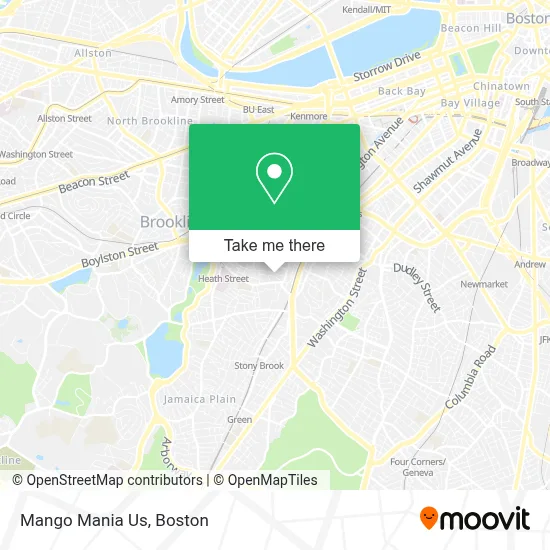
See Mango Mania Us, Boston, on the map
Public Transit to Mango Mania Us in Boston
Wondering how to get to Mango Mania Us in Boston? Moovit helps you find the best way to get to Mango Mania Us with step-by-step directions from the nearest public transit station.
Moovit provides free maps and live directions to help you navigate through your city. View schedules, routes, timetables, and find out how long does it take to get to Mango Mania Us in real time.
Looking for the nearest stop or station to Mango Mania Us? Check out this list of stops closest to your destination: Heath St @ Parker St; Columbus Ave @ Cedar St; Jackson Square; Brigham Circle; Centre St @ Columbus Ave.
Bus: 14, 22, 39, 66, 41.Train: FRAMINGHAM/WORCESTER, PROVIDENCE/STOUGHTON.Subway: ORANGE LINE, GREEN LINE E.
Want to see if there’s another route that gets you there at an earlier time? Moovit helps you find alternative routes or times. Get directions from and directions to Mango Mania Us easily from the Moovit App or Website.
We make riding to Mango Mania Us easy, which is why over 1.7 million users, including users in Boston, trust Moovit as the best app for public transit. You don’t need to download an individual bus app or train app, Moovit is your all-in-one transit app that helps you find the best bus time or train time available.
For information on prices of subway, bus and train, costs and ride fares to Mango Mania Us, please check the Moovit app.
Use the app to navigate to popular places including to the airport, hospital, stadium, grocery store, mall, coffee shop, school, college, and university.
Mango Mania Us Address: 34 Fisher Ave street in Boston
- U-Haul,
- geometry.xxx,
- Where Did the Gun Come From,
- The Boston Foundation,
- Eliza Jacob-Dolan, Licsw,
- Horan Way Building 57,
- Heath St Building 170,
- Greg's Auto & Collisio,
- R&R's Finest Auto Glass,
- Mildred C. Hailey Apartments,
- 37 Hillside St Parking,
- Orleans Plaza,
- Place Tailor,
- Fresh Truck,
- Roxbury Prep Charter School ,
- Edgar P. Benjamin Healthcare Center,
- Roxbury Preparatory Charter School,
- Alexandra A Epee-Bounya M.D.,
- Maria T. Pearl, MD,
- Philip Mahoney
Places Near Mango Mania Us (Boston)
- Wilbur Theatre, Boston,
- Td Garden, Boston,
- House Of Blues, Boston,
- North End, Boston,
- Castle Island, Boston,
- Massachusetts General Hospital, Boston,
- Faneuil Hall, Boston,
- Mgm Music Hall, Boston,
- Museum Of Science, Boston,
- Isabella Stewart Gardner Museum, Boston,
- Leader Bank Pavilion (Leader Bank Pavillion), Boston,
- Boston Convention & Exhibition Center, Boston,
- Wang Theater, Boston,
- Boston Medical Center, Boston,
- Quincy Market, Boston,
- Boston Children's Hospital, Boston,
- Prudential Center, Boston,
- Cheers, Boston,
- Boston Common, Boston,
- Seaport District, Boston
How to get to popular places in Boston with public transit
Get around Boston by public transit!
Traveling around Boston has never been so easy. See step by step directions as you travel to any attraction, street or major public transit station. View bus and train schedules, arrival times, service alerts and detailed routes on a map, so you know exactly how to get to anywhere in Boston.
When traveling to any destination around Boston use Moovit's Live Directions with Get Off Notifications to know exactly where and how far to walk, how long to wait for your line, and how many stops are left. Moovit will alert you when it's time to get off — no need to constantly re-check whether yours is the next stop.
Wondering how to use public transit in Boston or how to pay for public transit in Boston? Moovit public transit app can help you navigate your way with public transit easily, and at minimum cost. It includes public transit fees, ticket prices, and costs. Looking for a map of Boston public transit lines? Moovit public transit app shows all public transit maps in Boston with all Bus, Train, Subway and Ferry routes and stops on an interactive map.
Boston has 4 transit type(s), including: Bus, Train, Subway and Ferry, operated by several transit agencies, including MBTA, Southeastern Regional Transit Authority, MetroWest Regional Transit Authority, Rhode Island Public Transit Authority, WRTA, Lowell Regional Transit Authority, Merrimack Valley Transit, Montachusett Regional Transit Authority, Cape Cod Regional Transit Authority, Brockton Area Transit Authority, Martha's Vineyard Transit Authority, the WAVE - Nantucket Regional Transit Authority, GATRA, Cape Ann Transportation Authority and Massport