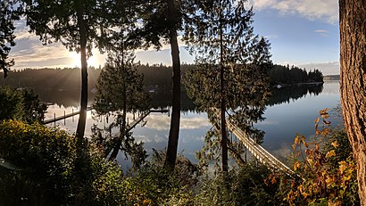
See Manzanita Bay, Bainbridge Island, on the map
Directions to Manzanita Bay (Bainbridge Island) with public transportation
The following transit lines have routes that pass near Manzanita Bay
 Bus:
Bus:
How to get to Manzanita Bay by bus?
Click on the bus route to see step by step directions with maps, line arrival times and updated time schedules.
Bus stations near Manzanita Bay in Bainbridge Island
- Manzanita at Day Rd,3 min walk,
Bus lines to Manzanita Bay in Bainbridge Island
- 93,Mazanita To Ferry,
What are the closest stations to Manzanita Bay?
The closest stations to Manzanita Bay are:
- Manzanita at Day Rd is 210 yards away, 3 min walk.
Which bus line stops near Manzanita Bay?
390
What’s the nearest bus stop to Manzanita Bay in Bainbridge Island?
The nearest bus stop to Manzanita Bay in Bainbridge Island is Manzanita at Day Rd. It’s a 3 min walk away.
What time is the first bus to Manzanita Bay in Bainbridge Island?
The 93 is the first bus that goes to Manzanita Bay in Bainbridge Island. It stops nearby at 4:50 AM.
What time is the last bus to Manzanita Bay in Bainbridge Island?
The 93 is the last bus that goes to Manzanita Bay in Bainbridge Island. It stops nearby at 6:44 PM.
How much is the bus fare to Manzanita Bay?
The bus fare to Manzanita Bay costs about $2.00 - $2.75.
How much is the ferry fare to Manzanita Bay?
The ferry fare to Manzanita Bay costs about $8.65.
See Manzanita Bay, Bainbridge Island, on the map
Public Transit to Manzanita Bay in Bainbridge Island
Wondering how to get to Manzanita Bay in Bainbridge Island, United States? Moovit helps you find the best way to get to Manzanita Bay with step-by-step directions from the nearest public transit station.
Moovit provides free maps and live directions to help you navigate through your city. View schedules, routes, timetables, and find out how long does it take to get to Manzanita Bay in real time.
Looking for the nearest stop or station to Manzanita Bay? Check out this list of stops closest to your destination: Manzanita at Day Rd.
Bus:
Want to see if there’s another route that gets you there at an earlier time? Moovit helps you find alternative routes or times. Get directions from and directions to Manzanita Bay easily from the Moovit App or Website.
We make riding to Manzanita Bay easy, which is why over 1.5 million users, including users in Bainbridge Island, trust Moovit as the best app for public transit. You don’t need to download an individual bus app or train app, Moovit is your all-in-one transit app that helps you find the best bus time or train time available.
For information on prices of bus and ferry, costs and ride fares to Manzanita Bay, please check the Moovit app.
Use the app to navigate to popular places including to the airport, hospital, stadium, grocery store, mall, coffee shop, school, college, and university.
Manzanita Bay Address: 12615 Manzanita Rd NE Bainbridge Island, WA 98110 street in Bainbridge Island
Attractions near Manzanita Bay
Fineline,Zwicker Construction,E Normus Tractor Service,Child & Family Guidance Center,Elevate Strength & Conditioning,Stourwater Pictures,Fiziologix Physical Therapy,Pegasus Coffee Roaster,Pegasus Coffee,Bainbridge Yoga House,Velox Robotics,Browning Research,Venice, Washington,Snap Sell Corporation,Isley Construction,Ty Johnson Dba,Willow Brook Farm,Leaps and Bounds Montessori Preschool,GMA International,Jerry's Air Duct CleaningHow to get to popular attractions in Bainbridge Island with public transit
TCC Transit Center, Tacoma,Stadium Thriftway, Tacoma,Amc Pacific Place 11, Seattle,Crossroads Bellevue, Bellevue,Woodland Park Zoo, Seattle,I-5,Alaska Airlines' McGee Building, Seatac,Georgetown Brewing Company, Seattle,South Seattle College, Seattle,QFC, Seattle,Alderwood Mall, Lynnwood,Renton Highlands, Renton,Dick's Drive-In, Seattle,Safeway, Seattle,Starbucks, Seattle,Everett, WA, Everett,Point Defiance Park, Tacoma,Marysville, WA,Costco Wholesale, Federal Way,City of Auburn, AuburnGet around Bainbridge Island by public transit!
Traveling around Bainbridge Island has never been so easy. See step by step directions as you travel to any attraction, street or major public transit station. View bus and train schedules, arrival times, service alerts and detailed routes on a map, so you know exactly how to get to anywhere in Bainbridge Island.
When traveling to any destination around Bainbridge Island use Moovit's Live Directions with Get Off Notifications to know exactly where and how far to walk, how long to wait for your line, and how many stops are left. Moovit will alert you when it's time to get off — no need to constantly re-check whether yours is the next stop.
Wondering how to use public transit in Bainbridge Island or how to pay for public transit in Bainbridge Island? Moovit public transit app can help you navigate your way with public transit easily, and at minimum cost. It includes public transit fees, ticket prices, and costs. Looking for a map of Bainbridge Island public transit lines? Moovit public transit app shows all public transit maps in Bainbridge Island with all bus or ferry routes and stops on an interactive map.
Bainbridge Island has 2 transit type(s), including: bus or ferry, operated by several transit agencies, including Sound Transit, Seattle Streetcar, Sound Transit, Metro Transit, Metro Transit, Sound Transit, Whatcom Transportation Authority, Mason Transit Authority, Snoqualmie Valley Transportation (SVT), Snoqualmie Valley Transportation, Amtrak, Island Transit, Kitsap Transit, Intercity Transit and Everett Transit