Directions to Map Family Learning Center Malden MA with public transportation
The following transit lines have routes that pass near Map Family Learning Center Malden MA
 Bus: 101, 104, 108, 99, 132.
- Train: HAVERHILL.
- Subway: ORANGE LINE, GREEN LINE B, GREEN LINE C, GREEN LINE E.
How to get to Map Family Learning Center Malden MA by bus?
Click on the bus route to see step by step directions with maps, line arrival times and updated time schedules.
From Boston University
78 minFrom Beth Israel Hospital
82 minFrom The Castle
80 minFrom 31 St. James Street
65 minFrom Edic Pier
76 minFrom Cruiseport Boston's Black Falcon Cruise Terminal
76 minFrom Northeastern University
95 minFrom Renaissance Boston Waterfront Hotel (Renaissance Waterfront Conference Center)
67 minFrom Beth Israel Deaconess Medical Center
82 minFrom Silver Line Stop Terminal B
58 min
How to get to Map Family Learning Center Malden MA by subway?
Click on the subway route to see step by step directions with maps, line arrival times and updated time schedules.
From Boston University
54 minFrom Beth Israel Hospital
59 minFrom The Castle
50 minFrom 31 St. James Street
36 minFrom Edic Pier
55 minFrom Northeastern University
35 minFrom Renaissance Boston Waterfront Hotel (Renaissance Waterfront Conference Center)
49 minFrom Beth Israel Deaconess Medical Center
58 minFrom Silver Line Stop Terminal B
59 min
Bus stops near Map Family Learning Center Malden MA
Subway stations near Map Family Learning Center Malden MA
Train station near Map Family Learning Center Malden MA
- Oak Grove, 33 min walk,VIEW
Bus lines to Map Family Learning Center Malden MA
What are the closest stations to Map Family Learning Center Malden MA?
The closest stations to Map Family Learning Center Malden MA are:
- Highland Ave @ Wentworth St is 93 yards away, 2 min walk.
- Pleasant St @ Talbot St is 279 yards away, 4 min walk.
- 14 Summer St is 327 yards away, 5 min walk.
- Wellington is 2160 yards away, 26 min walk.
- Oak Grove is 2779 yards away, 33 min walk.
- Medford/Tufts Station is 2842 yards away, 34 min walk.
Which bus lines stop near Map Family Learning Center Malden MA?
These bus lines stop near Map Family Learning Center Malden MA: 101, 104.
Which subway line stops near Map Family Learning Center Malden MA?
ORANGE LINE (Oak Grove)
What’s the nearest subway station to Map Family Learning Center Malden MA?
The nearest subway station to Map Family Learning Center Malden MA is Wellington. It’s a 26 min walk away.
What’s the nearest bus station to Map Family Learning Center Malden MA?
The nearest bus station to Map Family Learning Center Malden MA is Highland Ave @ Wentworth St. It’s a 2 min walk away.
What time is the first subway to Map Family Learning Center Malden MA?
The GREEN LINE E is the first subway that goes to Map Family Learning Center Malden MA. It stops nearby at 4:57 AM.
What time is the last subway to Map Family Learning Center Malden MA?
The GREEN LINE E is the last subway that goes to Map Family Learning Center Malden MA. It stops nearby at 2:41 AM.
What time is the first train to Map Family Learning Center Malden MA?
The HAVERHILL is the first train that goes to Map Family Learning Center Malden MA. It stops nearby at 5:35 AM.
What time is the last train to Map Family Learning Center Malden MA?
The HAVERHILL is the last train that goes to Map Family Learning Center Malden MA. It stops nearby at 11:53 PM.
What time is the first bus to Map Family Learning Center Malden MA?
The 101 is the first bus that goes to Map Family Learning Center Malden MA. It stops nearby at 4:49 AM.
What time is the last bus to Map Family Learning Center Malden MA?
The 99 is the last bus that goes to Map Family Learning Center Malden MA. It stops nearby at 1:43 AM.
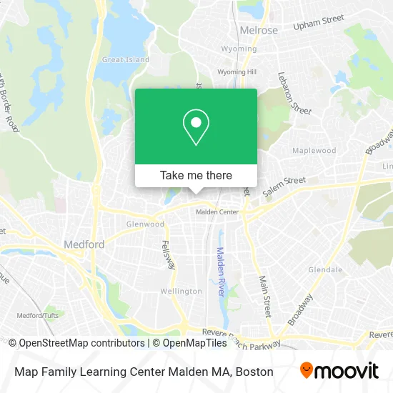
See Map Family Learning Center Malden MA on the map
Public Transportation to Map Family Learning Center Malden MA
Wondering how to get to Map Family Learning Center Malden MA? Moovit helps you find the best way to get to Map Family Learning Center Malden MA with step-by-step directions from the nearest public transit station.
Moovit provides free maps and live directions to help you navigate through your city. View schedules, routes, timetables, and find out how long does it take to get to Map Family Learning Center Malden MA in real time.
Looking for the nearest stop or station to Map Family Learning Center Malden MA? Check out this list of stops closest to your destination: Highland Ave @ Wentworth St; Pleasant St @ Talbot St; 14 Summer St; Wellington; Oak Grove; Medford/Tufts Station.
Bus: 101, 104, 108, 99, 132.Train: HAVERHILL.Subway: ORANGE LINE, GREEN LINE B, GREEN LINE C, GREEN LINE E.
Want to see if there’s another route that gets you there at an earlier time? Moovit helps you find alternative routes or times. Get directions from and directions to Map Family Learning Center Malden MA easily from the Moovit App or Website.
We make riding to Map Family Learning Center Malden MA easy, which is why over 1.7 million users, including users in Malden, trust Moovit as the best app for public transit. You don’t need to download an individual bus app or train app, Moovit is your all-in-one transit app that helps you find the best bus time or train time available.
For information on prices of subway and bus, costs and ride fares to Map Family Learning Center Malden MA, please check the Moovit app.
Use the app to navigate to popular places including to the airport, hospital, stadium, grocery store, mall, coffee shop, school, college, and university.
Map Family Learning Center Malden MA Address: 10 Dexter St street in Malden
- Dexter Estates Condo,
- Jby Homes,
- Leo White Construction,
- Tailored,
- Center for Muscular Therepy,
- All Purpose Construction,
- Carl Danielson MD,
- Action Glass Company,
- Mackey Painting Papering Drywall,
- Evav,
- Divine Grace Therapeutic Massage,
- Dr. Suzanne Avedikian, DMD,
- Steffi Koerner Acupuncture,
- David F Tee MD PC,
- Associated Home Care,
- Redbones Barbecue,
- Blacksmith Communication,
- Chester St & Stadium Rd,
- Mallon Tax Consultants, LLC (Mallon Real Estate and Ins Agency),
- Jackson Bell Locksmiths
Places Near Map Family Learning Center Malden MA
- Museum Of Science, Boston,
- Leader Bank Pavilion (Leader Bank Pavillion), Boston,
- Isabella Stewart Gardner Museum, Boston,
- Cheers, Boston,
- Wilbur Theatre, Boston,
- Seaport District, Boston,
- Boston Convention & Exhibition Center, Boston,
- Mgm Music Hall, Boston,
- Castle Island, Boston,
- Massachusetts General Hospital, Boston,
- Quincy Market, Boston,
- North End, Boston,
- Wang Theater, Boston,
- Boston Children's Hospital, Boston,
- Faneuil Hall, Boston,
- Boston Medical Center, Boston,
- Boston Common, Boston,
- Td Garden, Boston,
- House Of Blues, Boston,
- Prudential Center, Boston
How to get to popular places in Boston with public transit
Get around Malden by public transit!
Traveling around Malden has never been so easy. See step by step directions as you travel to any attraction, street or major public transit station. View bus and train schedules, arrival times, service alerts and detailed routes on a map, so you know exactly how to get to anywhere in Malden.
When traveling to any destination around Malden use Moovit's Live Directions with Get Off Notifications to know exactly where and how far to walk, how long to wait for your line, and how many stops are left. Moovit will alert you when it's time to get off — no need to constantly re-check whether yours is the next stop.
Wondering how to use public transit in Malden or how to pay for public transit in Malden? Moovit public transit app can help you navigate your way with public transit easily, and at minimum cost. It includes public transit fees, ticket prices, and costs. Looking for a map of Malden public transit lines? Moovit public transit app shows all public transit maps in Malden with all Bus, Train, Subway and Ferry routes and stops on an interactive map.
Boston has 4 transit type(s), including: Bus, Train, Subway and Ferry, operated by several transit agencies, including MBTA, Southeastern Regional Transit Authority, MetroWest Regional Transit Authority, Rhode Island Public Transit Authority, WRTA, Lowell Regional Transit Authority, Merrimack Valley Transit, Montachusett Regional Transit Authority, Cape Cod Regional Transit Authority, Brockton Area Transit Authority, Martha's Vineyard Transit Authority, the WAVE - Nantucket Regional Transit Authority, GATRA, Cape Ann Transportation Authority and Massport