How to get to Mapcargo Global Logistics by bus?
Click on the bus route to see step by step directions with maps, line arrival times and updated time schedules.
From Flynn Cruiseport Boston, Boston
39 minFrom Boston Children's Hospital, Boston
102 minFrom CambridgeSide (Cambridgeside Galleria), Cambridge
37 minFrom Haymarket, Boston, Boston
85 minFrom Shapiro Center, Boston
72 minFrom Dana-Farber Cancer Institute, Boston
101 minFrom Stone Zoo, Stoneham
93 minFrom Bidmc, Boston
101 minFrom Beth Israel Deaconess Medical Center West Campus, Boston
101 minFrom Paradise Rock Club & Lounge, Boston
97 min
How to get to Mapcargo Global Logistics by subway?
Click on the subway route to see step by step directions with maps, line arrival times and updated time schedules.
From Boston Children's Hospital, Boston
60 minFrom CambridgeSide (Cambridgeside Galleria), Cambridge
49 minFrom Haymarket, Boston, Boston
54 minFrom Shapiro Center, Boston
58 minFrom Dana-Farber Cancer Institute, Boston
66 minFrom Bidmc, Boston
62 minFrom Beth Israel Deaconess Medical Center West Campus, Boston
62 minFrom Paradise Rock Club & Lounge, Boston
60 min
Bus stops near Mapcargo Global Logistics in Boston
Subway station near Mapcargo Global Logistics in Boston
- Beachmont, 26 min walk,VIEW
Bus lines to Mapcargo Global Logistics in Boston
What are the closest stations to Mapcargo Global Logistics?
The closest stations to Mapcargo Global Logistics are:
- Boardman St @ Leyden St is 449 yards away, 6 min walk.
- Beachmont is 2217 yards away, 26 min walk.
- Mcclellan Highway @ Boardman St is 2265 yards away, 27 min walk.
Which bus lines stop near Mapcargo Global Logistics?
These bus lines stop near Mapcargo Global Logistics: 120, 450.
Which subway line stops near Mapcargo Global Logistics?
BLUE LINE (Wonderland)
What’s the nearest subway station to Mapcargo Global Logistics in Boston?
The nearest subway station to Mapcargo Global Logistics in Boston is Beachmont. It’s a 26 min walk away.
What’s the nearest bus station to Mapcargo Global Logistics in Boston?
The nearest bus station to Mapcargo Global Logistics in Boston is Boardman St @ Leyden St. It’s a 6 min walk away.
What time is the first subway to Mapcargo Global Logistics in Boston?
The BLUE LINE is the first subway that goes to Mapcargo Global Logistics in Boston. It stops nearby at 5:08 AM.
What time is the last subway to Mapcargo Global Logistics in Boston?
The BLUE LINE is the last subway that goes to Mapcargo Global Logistics in Boston. It stops nearby at 2:08 AM.
What time is the first bus to Mapcargo Global Logistics in Boston?
The 120 is the first bus that goes to Mapcargo Global Logistics in Boston. It stops nearby at 6:10 AM.
What time is the last bus to Mapcargo Global Logistics in Boston?
The 120 is the last bus that goes to Mapcargo Global Logistics in Boston. It stops nearby at 1:35 AM.
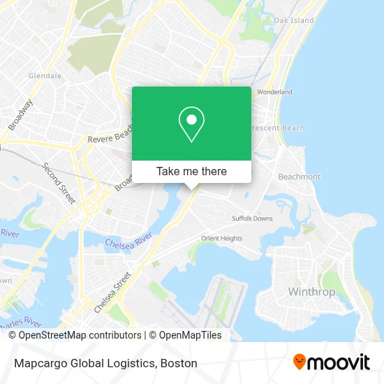
See Mapcargo Global Logistics, Boston, on the map
Public Transit to Mapcargo Global Logistics in Boston
Wondering how to get to Mapcargo Global Logistics in Boston? Moovit helps you find the best way to get to Mapcargo Global Logistics with step-by-step directions from the nearest public transit station.
Moovit provides free maps and live directions to help you navigate through your city. View schedules, routes, timetables, and find out how long does it take to get to Mapcargo Global Logistics in real time.
Looking for the nearest stop or station to Mapcargo Global Logistics? Check out this list of stops closest to your destination: Boardman St @ Leyden St; Beachmont; Mcclellan Highway @ Boardman St.
Bus: 120, 450.Subway: BLUE LINE.
Want to see if there’s another route that gets you there at an earlier time? Moovit helps you find alternative routes or times. Get directions from and directions to Mapcargo Global Logistics easily from the Moovit App or Website.
We make riding to Mapcargo Global Logistics easy, which is why over 1.7 million users, including users in Boston, trust Moovit as the best app for public transit. You don’t need to download an individual bus app or train app, Moovit is your all-in-one transit app that helps you find the best bus time or train time available.
For information on prices of bus and subway, costs and ride fares to Mapcargo Global Logistics, please check the Moovit app.
Use the app to navigate to popular places including to the airport, hospital, stadium, grocery store, mall, coffee shop, school, college, and university.
Mapcargo Global Logistics Address: 440 William F McClellan Hwy street in Boston
- Wonderland,
- Suffolk Downs,
- Cirque du Soleil,
- Legends Bar & Grill,
- Grossman Co.,
- Hilton Garden Inn Boston Logan Airport,
- Noyes Park,
- AVIS,
- Budget,
- Bellair Expediting Boston,
- Reference Real Estate,
- Constitution Beach,
- Don Orione Nursing Home,
- Madonna Queen Of the Universe Shrine,
- Madonna Queen Gift Shop,
- Madonna Shrine (Madonna Queen National Shrine),
- Dartmouth College,
- Wwzn,
- Enterprise,
- USPS Collection Box - Blue Box
Places Near Mapcargo Global Logistics (Boston)
- Boston Convention & Exhibition Center, Boston,
- Cheers, Boston,
- Prudential Center, Boston,
- Boston Children's Hospital, Boston,
- North End, Boston,
- Faneuil Hall, Boston,
- Boston Common, Boston,
- Seaport District, Boston,
- Museum Of Science, Boston,
- Massachusetts General Hospital, Boston,
- Boston Medical Center, Boston,
- Wang Theater, Boston,
- Td Garden, Boston,
- Quincy Market, Boston,
- Wilbur Theatre, Boston,
- House Of Blues, Boston,
- Isabella Stewart Gardner Museum, Boston,
- Leader Bank Pavilion (Leader Bank Pavillion), Boston,
- Mgm Music Hall, Boston,
- Castle Island, Boston
How to get to popular places in Boston with public transit
Get around Boston by public transit!
Traveling around Boston has never been so easy. See step by step directions as you travel to any attraction, street or major public transit station. View bus and train schedules, arrival times, service alerts and detailed routes on a map, so you know exactly how to get to anywhere in Boston.
When traveling to any destination around Boston use Moovit's Live Directions with Get Off Notifications to know exactly where and how far to walk, how long to wait for your line, and how many stops are left. Moovit will alert you when it's time to get off — no need to constantly re-check whether yours is the next stop.
Wondering how to use public transit in Boston or how to pay for public transit in Boston? Moovit public transit app can help you navigate your way with public transit easily, and at minimum cost. It includes public transit fees, ticket prices, and costs. Looking for a map of Boston public transit lines? Moovit public transit app shows all public transit maps in Boston with all Bus, Train, Subway and Ferry routes and stops on an interactive map.
Boston has 4 transit type(s), including: Bus, Train, Subway and Ferry, operated by several transit agencies, including MBTA, Southeastern Regional Transit Authority, MetroWest Regional Transit Authority, Rhode Island Public Transit Authority, WRTA, Lowell Regional Transit Authority, Merrimack Valley Transit, Montachusett Regional Transit Authority, Cape Cod Regional Transit Authority, Brockton Area Transit Authority, Martha's Vineyard Transit Authority, the WAVE - Nantucket Regional Transit Authority, GATRA, Cape Ann Transportation Authority and Massport