Directions to Mapfre Seguros (Jardim Botânico) with public transportation
The following transit lines have routes that pass near Mapfre Seguros
How to get to Mapfre Seguros by bus?
Click on the bus route to see step by step directions with maps, line arrival times and updated time schedules.
From Terminal Santa Cândida - 200 - Ligeirão Sta.Cândida/Pça. do Japão - 203 - Santa Cândida / Capão Ras, Tingüi
39 minFrom Rua Thereza Lopes Skroski, Santa Cândida
59 minFrom Avenida Vereador Toaldo Túlio, São Braz
47 minFrom Rua José Hauer, Boqueirão
45 minFrom Alphaville Graciosa, Pinhais
70 minFrom São Braz, São Braz
54 minFrom Utfpr - Sede Ecoville, Cic
48 minFrom Rua Paulo Gorski, Mossunguê
34 minFrom Rua Desembargador Hugo Simas, Vista Alegre
33 minFrom Alphaville, Pinhais
52 min
Bus stops near Mapfre Seguros in Jardim Botânico
Bus lines to Mapfre Seguros in Jardim Botânico
- E03 AFONSO PENA / GUADALUPE, Terminal Afonso Pena → Terminal Guadalupe,VIEW
- E71 JARDIM IPÊ / GUADALUPE, Jardim Ipê → Terminal Guadalupe,VIEW
- E72 JARDIM IZAURA / GUADALUPE, Sentido Anti-horário,VIEW
- E73 JARDIM CRUZEIRO / GUADALUPE, Terminal Guadalupe → Jardim Cruzeiro,VIEW
- E76 POSTO PARIS / GUADALUPE, Posto Paris → Terminal Guadalupe,VIEW
- E77 GUATUPÊ / GUADALUPE, Terminal Guadalupe → Guatupê,VIEW
- E78 ROSEIRA / GUADALUPE, Terminal Guadalupe → Roseira,VIEW
- E79 JARDIM IZAURA / GUADALUPE (VIA JARDIM IPÊ), Jardim Izaura → Terminal Guadalupe,VIEW
- 461 SANTA BÁRBARA, Praça Rui Barbosa → Santa Bárbara,VIEW
- 462 PETRÓPOLIS, Praça Rui Barbosa → Ouro Verde,VIEW
- 463 SOLITUDE / PLANTA EVARISTO, Planta Evaristo / Solitude → Praça Carlos Gomes,VIEW
- 464 ALCIDES MUNHOZ / JARDIM BOTÂNICO, Alcides Munhoz → Jardim Botânico,VIEW
- 489 MAD. PETRÓPOLIS / SOLITUDE, Praça Rui Barbosa ↺ Petrópolis / Solitude (Circular),VIEW
- E01 URANO / GUADALUPE, Terminal Guadalupe → Terminal Afonso Pena,VIEW
- E67 BRAGA / CURITIBA (VIA OURO FINO), Terminal Guadalupe ↺ Braga / Ouro Fino (via Conselheiro Laurindo) (Circular) ,VIEW
- E68 QUISSISSANA / GUADALUPE, Quississana → Terminal Guadalupe,VIEW
- E99 SÃO JOSÉ / GUADALUPE (VIA T. CENTRAL), Terminal Guadalupe → Praça Pedro Moro,VIEW
- 465 ERASTO GAERTNER, Hospital Erasto Gaertner → Praça Rui Barbosa,VIEW
- 466 ESTUDANTES, Centro Politécnico → Praça 19,VIEW
- 468 JARDIM CENTAURO, Jardim Centauro → Praça Rui Barbosa,VIEW
What are the closest stations to Mapfre Seguros?
The closest stations to Mapfre Seguros are:
- R. Brasílio Itiberê, 849 is 86 meters away, 2 min walk.
- Av. Comendador Franco, 275 is 100 meters away, 2 min walk.
- Viaduto Colorado / R. Brasílio Itiberê is 245 meters away, 4 min walk.
- R. Baltazar Carrasco dos Reis, 406 is 494 meters away, 7 min walk.
Which bus lines stop near Mapfre Seguros?
These bus lines stop near Mapfre Seguros: 461 SANTA BÁRBARA, 462 PETRÓPOLIS, 464 ALCIDES MUNHOZ / JARDIM BOTÂNICO, E01 URANO / GUADALUPE, E03 AFONSO PENA / GUADALUPE, E68 QUISSISSANA / GUADALUPE, E71 JARDIM IPÊ / GUADALUPE, E99 SÃO JOSÉ / GUADALUPE (VIA T. CENTRAL).
What’s the nearest bus station to Mapfre Seguros in Jardim Botânico?
The nearest bus stations to Mapfre Seguros in Jardim Botânico are R. Brasílio Itiberê, 849 and Av. Comendador Franco, 275. The closest one is a 2 min walk away.
What time is the first bus to Mapfre Seguros in Jardim Botânico?
The 489 MAD. PETRÓPOLIS / SOLITUDE is the first bus that goes to Mapfre Seguros in Jardim Botânico. It stops nearby at 3:04 AM.
What time is the last bus to Mapfre Seguros in Jardim Botânico?
The 489 MAD. PETRÓPOLIS / SOLITUDE is the last bus that goes to Mapfre Seguros in Jardim Botânico. It stops nearby at 2:45 AM.
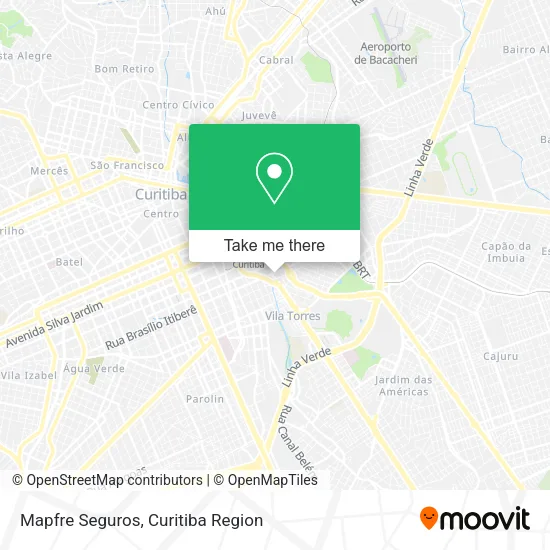
See Mapfre Seguros, Jardim Botânico, on the map
Public Transit to Mapfre Seguros in Jardim Botânico
Wondering how to get to Mapfre Seguros in Jardim Botânico? Moovit helps you find the best way to get to Mapfre Seguros with step-by-step directions from the nearest public transit station.
Moovit provides free maps and live directions to help you navigate through your city. View schedules, routes, timetables, and find out how long does it take to get to Mapfre Seguros in real time.
Looking for the nearest stop or station to Mapfre Seguros? Check out this list of stops closest to your destination: R. Brasílio Itiberê; Av. Comendador Franco; Viaduto Colorado / R. Brasílio Itiberê; R. Baltazar Carrasco dos Reis.
Bus: 461 SANTA BÁRBARA, 462 PETRÓPOLIS, 464 ALCIDES MUNHOZ / JARDIM BOTÂNICO, E01 URANO / GUADALUPE, E03 AFONSO PENA / GUADALUPE, E68 QUISSISSANA / GUADALUPE, E71 JARDIM IPÊ / GUADALUPE, E99 SÃO JOSÉ / GUADALUPE (VIA T. CENTRAL), E72 JARDIM IZAURA / GUADALUPE, E73 JARDIM CRUZEIRO / GUADALUPE, E76 POSTO PARIS / GUADALUPE, E67 BRAGA / CURITIBA (VIA OURO FINO), 465 ERASTO GAERTNER, 468 JARDIM CENTAURO, 474 JARDIM ITIBERÊ, 010 INTERBAIRROS I (HORÁRIO).
Want to see if there’s another route that gets you there at an earlier time? Moovit helps you find alternative routes or times. Get directions from and directions to Mapfre Seguros easily from the Moovit App or Website.
We make riding to Mapfre Seguros easy, which is why over 1.5 million users, including users in Jardim Botânico, trust Moovit as the best app for public transit. You don’t need to download an individual bus app or train app, Moovit is your all-in-one transit app that helps you find the best bus time or train time available.
For information on prices of bus, costs and ride fares to Mapfre Seguros, please check the Moovit app.
Use the app to navigate to popular places including to the airport, hospital, stadium, grocery store, mall, coffee shop, school, college, and university.
Location: Jardim Botânico, Curitiba Region
- Avenida Com. Franco 415,
- Reunidas Transportadora Rodoviária De Cargas,
- Volare rodo service,
- Rua Brasilio Itibere,
- Hay Locadora De Veiculos,
- Rua Engenheiros Rebouças,
- Viaduto Colorado,
- Rua Engenheiros Rebouças 707,
- Vertical Persianas | Cortinas | Persianas | Toldos,
- Auto Eletrica Botanico,
- Av. Comendador Franco, 648 - Jardim Botanico,
- Avenida Prefeito Omar Sabbag 721,
- Praça Plínio Tourinho,
- Colégio Estadual Hildebrando De Araújo,
- Avenida Prefeito Omar Sabbag 365,
- Kharina,
- Supermercado Super G,
- Biarticulado Pinhais / Rui Barbosa,
- Hospital da Policia Militar do Paraná,
- Rua Felipe Camarão 46
Places Near Mapfre Seguros (Jardim Botânico)
- Jockey Plaza Shopping Center, Tarumã,
- Rua General Mário Tourinho, Campina Do Siqueira,
- Pontifícia Universidade Católica do Paraná (PUCPR), Prado Velho,
- Rua Martim Afonso 558, Mercês,
- Parque Barigui, Mercês,
- Arena Da Baixada - Curitiba,
- Jardim Botânico de Curitiba PR, Centro,
- Campo Largo, Campo,
- Shopping Palladium, Portão,
- Hospital Universitário Evangélico de Curitiba, Bigorrilho,
- Shopping Estação, Rebouças,
- Hhhhh, Fazendinha,
- Hospital Nossa Senhora Das Graças, Mercês,
- Hospital Angelina Caron, Campina Grande Do Sul,
- Hospital de Clínicas (HC - UFPR), Centro,
- Hospital do Rocio, Campo,
- Hospital Madalena Sofia, Bairro Alto,
- Hospital Da Cruz Vermelha, Batel,
- Hospital Erasto Gaertner, Jardim Das Américas,
- Park Shopping Barigüi, Mossunguê
How to get to popular places in Curitiba Region with public transit
Get around Jardim Botânico by public transit!
Traveling around Jardim Botânico has never been so easy. See step by step directions as you travel to any attraction, street or major public transit station. View bus and train schedules, arrival times, service alerts and detailed routes on a map, so you know exactly how to get to anywhere in Jardim Botânico.
When traveling to any destination around Jardim Botânico use Moovit's Live Directions with Get Off Notifications to know exactly where and how far to walk, how long to wait for your line, and how many stops are left. Moovit will alert you when it's time to get off — no need to constantly re-check whether yours is the next stop.
Wondering how to use public transit in Jardim Botânico or how to pay for public transit in Jardim Botânico? Moovit public transit app can help you navigate your way with public transit easily, and at minimum cost. It includes public transit fees, ticket prices, and costs. Looking for a map of Jardim Botânico public transit lines? Moovit public transit app shows all public transit maps in Jardim Botânico with all Bus and Cable Car routes and stops on an interactive map.
Curitiba Region has 2 transit type(s), including: Bus and Cable Car, operated by several transit agencies, including Sistema Integrado de Mobilidade (URBS), Sistema Integrado de Mobilidade (AMEP), URBS (Cartões bancários e Dinheiro), URBS (Cartões bancários / Cartão URBS), AMEP (Cartões bancários / Cartão MetroCard), AMEP (Cartões bancários / Cartão MetroCard / Dinheiro), Viação Colombo (Dinheiro), TRIAR (Cartão TRIAR / Dinheiro), Empresa Curitiba Cerro Azul (Dinheiro), Expresso Nossa Senhora da Penha (Dinheiro), Empresa Campo Alto Tijucas (Dinheiro), Auto Viação São José (Cartão VEM / Dinheiro), BRT S/A (Cartão VEM / Dinheiro), TransPiedade (Cartão Cidadão / Dinheiro) and Oceânica Sul (Cartão Transporte / Dinheiro)