How to get to Maple Foundation by bus?
Click on the bus route to see step by step directions with maps, line arrival times and updated time schedules.
Bus stops near Maple Foundation in Boston
Bus lines to Maple Foundation in Boston
What are the closest stations to Maple Foundation?
The closest stations to Maple Foundation are:
- Opposite 2289 Pawtucket is 170 yards away, 3 min walk.
- S Broadway Before Belmont is 432 yards away, 6 min walk.
- Warren After Broadway is 531 yards away, 7 min walk.
Which bus lines stop near Maple Foundation?
These bus lines stop near Maple Foundation: 32, 34, 35, 60.
What’s the nearest bus station to Maple Foundation in Boston?
The nearest bus station to Maple Foundation in Boston is Opposite 2289 Pawtucket. It’s a 3 min walk away.
What time is the first bus to Maple Foundation in Boston?
The 33 is the first bus that goes to Maple Foundation in Boston. It stops nearby at 5:39 AM.
What time is the last bus to Maple Foundation in Boston?
The 33 is the last bus that goes to Maple Foundation in Boston. It stops nearby at 9:22 PM.
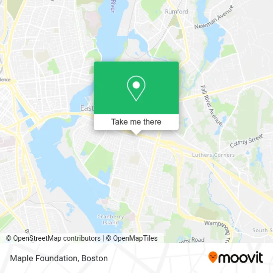
See Maple Foundation, Boston, on the map
Public Transit to Maple Foundation in Boston
Wondering how to get to Maple Foundation in Boston? Moovit helps you find the best way to get to Maple Foundation with step-by-step directions from the nearest public transit station.
Moovit provides free maps and live directions to help you navigate through your city. View schedules, routes, timetables, and find out how long does it take to get to Maple Foundation in real time.
Looking for the nearest stop or station to Maple Foundation? Check out this list of stops closest to your destination: Opposite 2289 Pawtucket; S Broadway Before Belmont; Warren After Broadway.
Bus: 32, 34, 35, 60, 33, 61X.
Want to see if there’s another route that gets you there at an earlier time? Moovit helps you find alternative routes or times. Get directions from and directions to Maple Foundation easily from the Moovit App or Website.
We make riding to Maple Foundation easy, which is why over 1.7 million users, including users in Boston, trust Moovit as the best app for public transit. You don’t need to download an individual bus app or train app, Moovit is your all-in-one transit app that helps you find the best bus time or train time available.
For information on prices of bus and train, costs and ride fares to Maple Foundation, please check the Moovit app.
Use the app to navigate to popular places including to the airport, hospital, stadium, grocery store, mall, coffee shop, school, college, and university.
Maple Foundation Address: 450 Warren Ave street in Boston
- Warren Ave,
- Bling Eyewear,
- A A A Locksmith A,
- Quality Painting,
- Aarons Plumbing,
- Sean Haughey,
- R & M Construction & Tile,
- Jim's Plumbing & Drain Cleaning,
- Duncs Pressure Washing,
- Cos Cleaning Service,
- FPW Wrestling,
- Riverside Pet Care,
- Lyons Repair & Contracting,
- Coastline Ems,
- Nails by Makayla,
- J G Remodeling,
- Pro Restoration One,
- Webwise Technology,
- Mommy Moon Doula,
- Autocare Brake Services
Places Near Maple Foundation (Boston)
- Leader Bank Pavilion (Leader Bank Pavillion), Boston,
- Boston Common, Boston,
- House Of Blues, Boston,
- Wilbur Theatre, Boston,
- Massachusetts General Hospital, Boston,
- Quincy Market, Boston,
- Boston Children's Hospital, Boston,
- Mgm Music Hall, Boston,
- Faneuil Hall, Boston,
- Prudential Center, Boston,
- Wang Theater, Boston,
- North End, Boston,
- Museum Of Science, Boston,
- Boston Medical Center, Boston,
- Boston Convention & Exhibition Center, Boston,
- Castle Island, Boston,
- Td Garden, Boston,
- Cheers, Boston,
- Seaport District, Boston,
- Isabella Stewart Gardner Museum, Boston
How to get to popular places in Boston with public transit
Get around Boston by public transit!
Traveling around Boston has never been so easy. See step by step directions as you travel to any attraction, street or major public transit station. View bus and train schedules, arrival times, service alerts and detailed routes on a map, so you know exactly how to get to anywhere in Boston.
When traveling to any destination around Boston use Moovit's Live Directions with Get Off Notifications to know exactly where and how far to walk, how long to wait for your line, and how many stops are left. Moovit will alert you when it's time to get off — no need to constantly re-check whether yours is the next stop.
Wondering how to use public transit in Boston or how to pay for public transit in Boston? Moovit public transit app can help you navigate your way with public transit easily, and at minimum cost. It includes public transit fees, ticket prices, and costs. Looking for a map of Boston public transit lines? Moovit public transit app shows all public transit maps in Boston with all Bus, Train, Subway and Ferry routes and stops on an interactive map.
Boston has 4 transit type(s), including: Bus, Train, Subway and Ferry, operated by several transit agencies, including MBTA, Southeastern Regional Transit Authority, MetroWest Regional Transit Authority, Rhode Island Public Transit Authority, WRTA, Lowell Regional Transit Authority, Merrimack Valley Transit, Montachusett Regional Transit Authority, Cape Cod Regional Transit Authority, Brockton Area Transit Authority, Martha's Vineyard Transit Authority, the WAVE - Nantucket Regional Transit Authority, GATRA, Cape Ann Transportation Authority and Massport