Directions to Marci E. Anderson (Cambridge) with public transportation
The following transit lines have routes that pass near Marci E. Anderson
 Bus: 109, 66, 96, 71, 73.
- Train: FITCHBURG, FRAMINGHAM/WORCESTER.
- Subway: RED LINE, GREEN LINE B, GREEN LINE D, GREEN LINE E.
How to get to Marci E. Anderson by bus?
Click on the bus route to see step by step directions with maps, line arrival times and updated time schedules.
From Angell Animal Medical Center (Mspca Angell), Boston
57 minFrom Fan Pier Park, Boston
57 minFrom Stone Zoo, Stoneham
93 minFrom 197 Friend St, Boston
62 minFrom Seaport Boston Hotel, Boston
59 minFrom Castle Island, Boston
87 minFrom Hampton Inn Boston Logan Airport, Revere
92 minFrom Kkkk, Boston
55 minFrom Melrose, MA, Melrose
91 minFrom Fort Independence, Boston
90 min
How to get to Marci E. Anderson by train?
Click on the train route to see step by step directions with maps, line arrival times and updated time schedules.
How to get to Marci E. Anderson by subway?
Click on the subway route to see step by step directions with maps, line arrival times and updated time schedules.
Bus stops near Marci E. Anderson in Cambridge
Subway stations near Marci E. Anderson in Cambridge
Train station near Marci E. Anderson in Cambridge
- Porter, 24 min walk,VIEW
Bus lines to Marci E. Anderson in Cambridge
- 71, Watertown Square,VIEW
- 73, Waverley,VIEW
- 66, Nubian via Allston - Harvard via Allston,VIEW
- 74, Harvard - Belmont Center,VIEW
- 75, Harvard - Belmont Center,VIEW
- 77, Harvard - Arlington Heights,VIEW
- 78, Harvard - Arlmont Village,VIEW
- 86, Reservoir - Harvard,VIEW
- 96, Harvard - Medford Square,VIEW
- 109, Harvard via Sullivan - Linden Square via Sullivan,VIEW
- RED LINE SHUTTLE, Jfk/Umass (Shuttle),VIEW
- RED LINE SHUTTLE, Park Street (Shuttle),VIEW
- RED LINE SHUTTLE, Harvard (Shuttle),VIEW
- RED LINE SHUTTLE, Kendall/MIT (Local Shuttle),VIEW
- 68, Kendall/MIT,VIEW
- 69, Lechmere,VIEW
What are the closest stations to Marci E. Anderson?
The closest stations to Marci E. Anderson are:
- Mt Auburn St @ Story St is 104 yards away, 2 min walk.
- Eliot St @ Bennett St is 108 yards away, 2 min walk.
- Harvard - Brattle St @ Palmer St is 221 yards away, 3 min walk.
- Packards Corner is 311 yards away, 5 min walk.
- Massachusetts Ave @ Johnston Gate is 516 yards away, 7 min walk.
- Harvard Square is 963 yards away, 12 min walk.
- Union Square is 1601 yards away, 19 min walk.
- Porter is 2018 yards away, 24 min walk.
Which bus lines stop near Marci E. Anderson?
These bus lines stop near Marci E. Anderson: 109, 66, 96.
Which train lines stop near Marci E. Anderson?
These train lines stop near Marci E. Anderson: FITCHBURG, FRAMINGHAM/WORCESTER.
Which subway line stops near Marci E. Anderson?
RED LINE (Alewife)
What’s the nearest subway station to Marci E. Anderson in Cambridge?
The nearest subway station to Marci E. Anderson in Cambridge is Packards Corner. It’s a 5 min walk away.
What’s the nearest train station to Marci E. Anderson in Cambridge?
The nearest train station to Marci E. Anderson in Cambridge is Porter. It’s a 24 min walk away.
What’s the nearest bus station to Marci E. Anderson in Cambridge?
The nearest bus stations to Marci E. Anderson in Cambridge are Mt Auburn St @ Story St and Eliot St @ Bennett St. The closest one is a 2 min walk away.
What time is the first subway to Marci E. Anderson in Cambridge?
The GREEN LINE E is the first subway that goes to Marci E. Anderson in Cambridge. It stops nearby at 4:50 AM.
What time is the last subway to Marci E. Anderson in Cambridge?
The GREEN LINE B is the last subway that goes to Marci E. Anderson in Cambridge. It stops nearby at 2:22 AM.
What time is the first train to Marci E. Anderson in Cambridge?
The FITCHBURG is the first train that goes to Marci E. Anderson in Cambridge. It stops nearby at 5:47 AM.
What time is the last train to Marci E. Anderson in Cambridge?
The FITCHBURG is the last train that goes to Marci E. Anderson in Cambridge. It stops nearby at 12:17 AM.
What time is the first bus to Marci E. Anderson in Cambridge?
The 73 is the first bus that goes to Marci E. Anderson in Cambridge. It stops nearby at 4:45 AM.
What time is the last bus to Marci E. Anderson in Cambridge?
The 66 is the last bus that goes to Marci E. Anderson in Cambridge. It stops nearby at 2:36 AM.
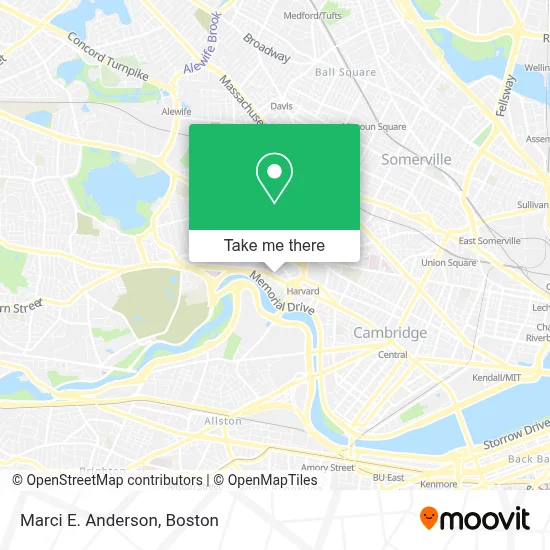
See Marci E. Anderson, Cambridge, on the map
Public Transit to Marci E. Anderson in Cambridge
Wondering how to get to Marci E. Anderson in Cambridge? Moovit helps you find the best way to get to Marci E. Anderson with step-by-step directions from the nearest public transit station.
Moovit provides free maps and live directions to help you navigate through your city. View schedules, routes, timetables, and find out how long does it take to get to Marci E. Anderson in real time.
Looking for the nearest stop or station to Marci E. Anderson? Check out this list of stops closest to your destination: Mt Auburn St @ Story St; Eliot St @ Bennett St; Harvard - Brattle St @ Palmer St; Packards Corner; Massachusetts Ave @ Johnston Gate; Harvard Square; Union Square; Porter.
Bus: 109, 66, 96, 71, 73, 74, 75, 77, 78.Train: FITCHBURG, FRAMINGHAM/WORCESTER.Subway: RED LINE, GREEN LINE B, GREEN LINE D, GREEN LINE E.
Want to see if there’s another route that gets you there at an earlier time? Moovit helps you find alternative routes or times. Get directions from and directions to Marci E. Anderson easily from the Moovit App or Website.
We make riding to Marci E. Anderson easy, which is why over 1.7 million users, including users in Cambridge, trust Moovit as the best app for public transit. You don’t need to download an individual bus app or train app, Moovit is your all-in-one transit app that helps you find the best bus time or train time available.
For information on prices of bus, subway and train, costs and ride fares to Marci E. Anderson, please check the Moovit app.
Use the app to navigate to popular places including to the airport, hospital, stadium, grocery store, mall, coffee shop, school, college, and university.
Marci E. Anderson Address: 22 Hilliard St street in Cambridge
- Nadja B. Gould, Licsw,
- Loeb Drama Center,
- American Repertory Theater,
- Gutman Conference Center,
- Society Of St. John the Evangelist,
- Charles Hotel,
- The Charles Hotel in Harvard Square Cambridge,
- harvard square lower busway,
- The Charles Hotel,
- Patagonia,
- Lesley University Library,
- Regattabar at The Charles Hotel,
- Eye Q Optical - Harvard Square,
- Visionworks,
- Harvard Square Hotel,
- King Bhumibol Adulyadej Square,
- Elizabeth Cary Agassiz House,
- Charlie's Kitchen,
- B.Good,
- Henry Vassall House
Places Near Marci E. Anderson (Cambridge)
- Boston Convention & Exhibition Center, Boston,
- Castle Island, Boston,
- Museum Of Science, Boston,
- Wilbur Theatre, Boston,
- Seaport District, Boston,
- Quincy Market, Boston,
- House Of Blues, Boston,
- Cheers, Boston,
- Prudential Center, Boston,
- Massachusetts General Hospital, Boston,
- Isabella Stewart Gardner Museum, Boston,
- Boston Common, Boston,
- Boston Children's Hospital, Boston,
- North End, Boston,
- Td Garden, Boston,
- Wang Theater, Boston,
- Faneuil Hall, Boston,
- Mgm Music Hall, Boston,
- Boston Medical Center, Boston,
- Leader Bank Pavilion (Leader Bank Pavillion), Boston
How to get to popular places in Boston with public transit
Get around Cambridge by public transit!
Traveling around Cambridge has never been so easy. See step by step directions as you travel to any attraction, street or major public transit station. View bus and train schedules, arrival times, service alerts and detailed routes on a map, so you know exactly how to get to anywhere in Cambridge.
When traveling to any destination around Cambridge use Moovit's Live Directions with Get Off Notifications to know exactly where and how far to walk, how long to wait for your line, and how many stops are left. Moovit will alert you when it's time to get off — no need to constantly re-check whether yours is the next stop.
Wondering how to use public transit in Cambridge or how to pay for public transit in Cambridge? Moovit public transit app can help you navigate your way with public transit easily, and at minimum cost. It includes public transit fees, ticket prices, and costs. Looking for a map of Cambridge public transit lines? Moovit public transit app shows all public transit maps in Cambridge with all Bus, Train, Subway and Ferry routes and stops on an interactive map.
Boston has 4 transit type(s), including: Bus, Train, Subway and Ferry, operated by several transit agencies, including MBTA, Southeastern Regional Transit Authority, MetroWest Regional Transit Authority, Rhode Island Public Transit Authority, WRTA, Lowell Regional Transit Authority, Merrimack Valley Transit, Montachusett Regional Transit Authority, Cape Cod Regional Transit Authority, Brockton Area Transit Authority, Martha's Vineyard Transit Authority, the WAVE - Nantucket Regional Transit Authority, GATRA, Cape Ann Transportation Authority and Massport