How to get to Marco Tacci by bus?
Click on the bus route to see step by step directions with maps, line arrival times and updated time schedules.
From Farewell Chapels of Misericordia of Antella, Bagno a Ripoli
38 minFrom Santa Maria Annunziata Hospital, Bagno a Ripoli
35 minFrom Valdisieve Hospital, Pelago
163 minFrom Vallombrosa, Reggello
130 minFrom Korian-Frate Sole Care Home, Figline Valdarno
35 minFrom Hu Norcenni Girasole Village, Figline Valdarno
34 minFrom Frate Sole Care Home, Figline Valdarno
35 minFrom E. Bettini Street / San Francesco Street, Pelago
148 minFrom Norcenni Girasole Club, Figline Valdarno
35 minFrom Serristori Hospital, Figline and Incisa Valdarno
26 min
How to get to Marco Tacci by train?
Click on the train route to see step by step directions with maps, line arrival times and updated time schedules.
Bus stops near Marco Tacci in Florence
Train station near Marco Tacci in Florence
- Incisa, 60 min walk,VIEW
Bus lines to Marco Tacci in Florence
- 351 A, Incisa Terminal Barberino,VIEW
- 353 A, Annunziata Hospital,VIEW
- 353 A, Old Montevarchi Bus Station,VIEW
- SI330, Ciliegi,VIEW
- 351 A, Europa,VIEW
- 360 A, San Giovanni Valdarno Coop,VIEW
- 360 A, Pontassieve State Road 67,VIEW
- SI330, Florence Montelungo Hub,VIEW
- 353 B, Ciliegi,VIEW
- 355, Fausto Melotti,VIEW
- 360 A, Old Montevarchi Bus Station,VIEW
- 911, Arezzo Terminal (Interior),VIEW
- 911, Figline Valdarno,VIEW
- 361 A, Ciliegi,VIEW
- 357 A, Giovanni Meyer Square,VIEW
What are the closest stations to Marco Tacci?
The closest stations to Marco Tacci are:
- Gramsci Square to Burchio is 68 meters away, 1 min walk.
- Gramsci Square to Incisa is 80 meters away, 2 min walk.
- Furnace is 356 meters away, 5 min walk.
- Incisa Marconi Avenue is 798 meters away, 11 min walk.
- Ciliegi is 1160 meters away, 15 min walk.
- Incisa is 4669 meters away, 60 min walk.
Which bus line stops near Marco Tacci?
353 A (Florence Montelungo Hub)
Which train line stops near Marco Tacci?
R (Foligno)
What’s the nearest bus station to Marco Tacci in Florence?
The nearest bus station to Marco Tacci in Florence is Gramsci Square to Burchio. It’s a 1 min walk away.
What time is the first train to Marco Tacci in Florence?
The R is the first train that goes to Marco Tacci in Florence. It stops nearby at 6:21 AM.
What time is the last train to Marco Tacci in Florence?
The R is the last train that goes to Marco Tacci in Florence. It stops nearby at 11:59 PM.
What time is the first bus to Marco Tacci in Florence?
The 351 A is the first bus that goes to Marco Tacci in Florence. It stops nearby at 5:58 AM.
What time is the last bus to Marco Tacci in Florence?
The 911 is the last bus that goes to Marco Tacci in Florence. It stops nearby at 1:52 AM.
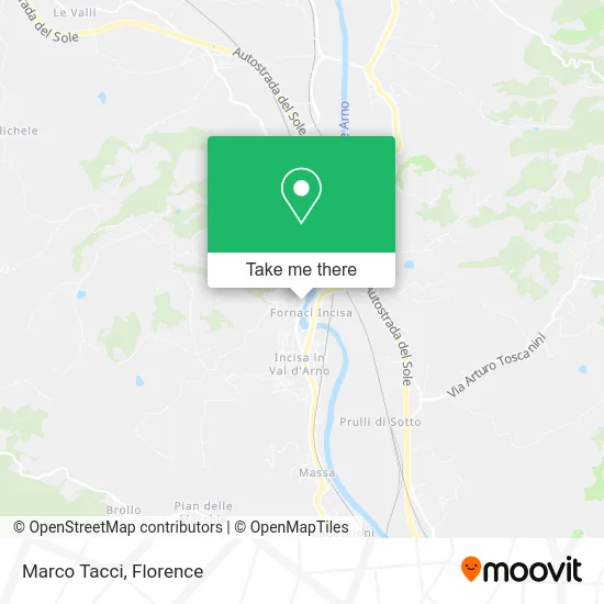
See Marco Tacci, Florence, on the map
Public Transit to Marco Tacci in Florence
Wondering how to get to Marco Tacci in Florence? Moovit helps you find the best way to get to Marco Tacci with step-by-step directions from the nearest public transit station.
Moovit provides free maps and live directions to help you navigate through your city. View schedules, routes, timetables, and find out how long does it take to get to Marco Tacci in real time.
Looking for the nearest stop or station to Marco Tacci? Check out this list of stops closest to your destination: Gramsci Square to Burchio; Gramsci Square to Incisa; Furnace; Incisa Marconi Avenue; Ciliegi; Incisa.
Bus: 353 A, 351 A, SI330, 351 A, 351 A, 360 A, 360 A, 360 A, SI330, 353 B, 355, 911, 911.Train: R.
Want to see if there’s another route that gets you there at an earlier time? Moovit helps you find alternative routes or times. Get directions from and directions to Marco Tacci easily from the Moovit App or Website.
We make riding to Marco Tacci easy, which is why over 1.5 million users, including users in Florence, trust Moovit as the best app for public transit. You don’t need to download an individual bus app or train app, Moovit is your all-in-one transit app that helps you find the best bus time or train time available.
For information on prices of bus and train, costs and ride fares to Marco Tacci, please check the Moovit app.
Use the app to navigate to popular places including to the airport, hospital, stadium, grocery store, mall, coffee shop, school, college, and university.
Marco Tacci Address: Via Francesco Petrarca, 108 50064 Figline e Incisa Valdarno street in Florence
- Monte dei Paschi di Siena Bank - Rome Agency 96-Fax,
- Masaccio Driving School,
- The Elves' Den,
- Bring,
- Incisa 1,
- GTR&C SAS by Riccardo Gonfiotti & C.,
- Unipolsai Insurance Mando' Angela,
- Capanni Carlo Alberto,
- Mauro Purchases,
- Incisa Furnace Nc.30,
- Tortoli Mario,
- Georin,
- The Ink Social Cooperative,
- Municipality of Incisa Valdarno,
- Italian Red Cross,
- Municipal Library,
- Klo Style,
- Unipol Insurance,
- Carrefur Stadium,
- Carrefour Market
Places Near Marco Tacci (Florence)
- Santa Maria Nuova Hospital, Florence,
- IKEA Florence, Sesto Fiorentino,
- Santa Maria Novella Station, Florence,
- Visarno Arena, Florence,
- Mandela Forum (Nelson Mandela Forum), Florence,
- Verdi Theater, Florence,
- Nelson Mandela Forum, Florence,
- Michelangelo Square, Florence,
- Cascine Park, Florence,
- Michelangelo Square, Florence,
- I Gigli, Campi Bisenzio,
- Tobacco Manufacture, Florence,
- Asmana, Campi Bisenzio,
- Campi Bisenzio, Campi Bisenzio,
- Field of Mars, Florence,
- Visarno Hippodrome, Florence,
- OOO, Florence,
- Piero Palagi Hospital Facility-Florence, Florence,
- Artemio Franchi Municipal Stadium, Florence,
- Torregalli Hospital Scandicci *, Scandicci
How to get to popular places in Florence with public transit
Get around Florence by public transit!
Traveling around Florence has never been so easy. See step by step directions as you travel to any attraction, street or major public transit station. View bus and train schedules, arrival times, service alerts and detailed routes on a map, so you know exactly how to get to anywhere in Florence.
When traveling to any destination around Florence use Moovit's Live Directions with Get Off Notifications to know exactly where and how far to walk, how long to wait for your line, and how many stops are left. Moovit will alert you when it's time to get off — no need to constantly re-check whether yours is the next stop.
Wondering how to use public transit in Florence or how to pay for public transit in Florence? Moovit public transit app can help you navigate your way with public transit easily, and at minimum cost. It includes public transit fees, ticket prices, and costs. Looking for a map of Florence public transit lines? Moovit public transit app shows all public transit maps in Florence with all Bus, Train, Light Rail, Ferry and Funicular routes and stops on an interactive map.
Florence has 5 transit type(s), including: Bus, Train, Light Rail, Ferry and Funicular, operated by several transit agencies, including Florence Urban - Tuscan Bus Lines, GEST, Livorno and Province - Tuscan Bus Lines, Arezzo, Florence and Provinces - Tuscan Bus Lines, Prato and Province - Tuscan Bus Lines, Lucca and Province - Tuscan Bus Lines, Massa, Carrara and Province - Tuscan Bus Lines, Pisa and Province - Tuscan Bus Lines, Grosseto, Siena and Provinces - Tuscan Bus Lines, Arezzo, Siena and Provinces - Tuscan Bus Lines, Florence and Province - Tuscan Bus Lines, Pistoia and Province - Tuscan Bus Lines, Siena and Province - Tuscan Bus Lines, Arezzo and Province - Tuscan Bus Lines and Trenitalia