Directions to Margalef de Montsant with public transportation
The following transit lines have routes that pass near Margalef de Montsant
How to get to Margalef de Montsant by bus?
Click on the bus route to see step by step directions with maps, line arrival times and updated time schedules.
Bus stops near Margalef de Montsant
- Pont Vell - Margalef, 2 min walk,
Bus lines to Margalef de Montsant
- F-1, La Palma d'Ebre - Margalef - La Bisbal de Falset - La Vilella Alta - La Vilella Baixa - Falset,
- 91, La Palma d’Ebre - Reus,
What are the closest stations to Margalef de Montsant?
The closest stations to Margalef de Montsant are:
- Pont Vell - Margalef is 105 meters away, 2 min walk.
Which bus line stops near Margalef de Montsant?
91
What’s the nearest bus stop to Margalef de Montsant?
The nearest bus stop to Margalef de Montsant is Pont Vell - Margalef. It’s a 2 min walk away.
See Margalef de Montsant on the map
Public Transportation to Margalef de Montsant
Wondering how to get to Margalef de Montsant, Spain? Moovit helps you find the best way to get to Margalef de Montsant with step-by-step directions from the nearest public transit station.
Moovit provides free maps and live directions to help you navigate through your city. View schedules, routes, timetables, and find out how long does it take to get to Margalef de Montsant in real time.
Looking for the nearest stop or station to Margalef de Montsant? Check out this list of stops closest to your destination: Pont Vell - Margalef.
Bus: 91, F-1.
Want to see if there’s another route that gets you there at an earlier time? Moovit helps you find alternative routes or times. Get directions from and directions to Margalef de Montsant easily from the Moovit App or Website.
We make riding to Margalef de Montsant easy, which is why over 1.5 million users, including users in Margalef, trust Moovit as the best app for public transit. You don’t need to download an individual bus app or train app, Moovit is your all-in-one transit app that helps you find the best bus time or train time available.
For information on prices of bus and train, costs and ride fares to Margalef de Montsant, please check the Moovit app.
Use the app to navigate to popular places including to the airport, hospital, stadium, grocery store, mall, coffee shop, school, college, and university.
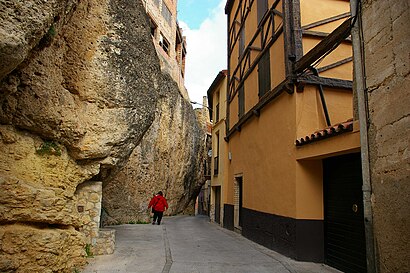
Margalef de Montsant Address: Margalef de Montsant, 43371, Tarragona, España street in Margalef
Attractions near Margalef de Montsant
Caja Rural de Aragón,Escola Sant Salvador,Arcos de la Plaza de Sant Miquel,Refugi de Margalef,Casa Catalunya,Cal Bruno,Bar y Café,Bisbat de Tortosa,The Ruin Margalef,Cal Bellardino,Cova De Santa Llúcia,Carrer Balmes 16,La Canal,Les Fonts,Granja Hermanos Masip,Bancs del Patiet de Cabacés,Pobla de la Granadella,D+Gustsarro,Bar Piscina Bellaguarda,Restaurant-Braseria Cal FerranHow to get to popular attractions in Margalef with public transit
Shôko, Barcelona,La Farga, L'Hospitalet De Llobregat,RENFE Sitges, Sitges,Recinto Modernista de Sant Pau, Barcelona,Parque Güell, Barcelona,Francesc Macià, Barcelona,Barri de Sant Andreu, Barcelona,Arco del Triunfo, Barcelona,Maria Cristina, Barcelona,Centre Comercial Espai Gironès, Salt,Park Güell, Barcelona,Platja de Santa Susanna, Santa Susanna,Sede Mango, Palau-Solità I Plegamans,Disco Tropics, Lloret De Mar,Cinesa Diagonal, Barcelona,Avenida Republica Argentina 187, Barcelona,Sant Just Desvern, Sant Just Desvern,Platja d'Aro, Castell-Platja D'Aro,METRO Collblanc, L'Hospitalet De Llobregat,La Porxada, GranollersGet around Barcelona by public transit!
Traveling around Barcelona has never been so easy. See step by step directions as you travel to any attraction, street or major public transit station. View bus and train schedules, arrival times, service alerts and detailed routes on a map, so you know exactly how to get to anywhere in Barcelona.
When traveling to any destination around Barcelona use Moovit's Live Directions with Get Off Notifications to know exactly where and how far to walk, how long to wait for your line, and how many stops are left. Moovit will alert you when it's time to get off — no need to constantly re-check whether yours is the next stop.
Wondering how to use public transit in Barcelona or how to pay for public transit in Barcelona? Moovit public transit app can help you navigate your way with public transit easily, and at minimum cost. It includes public transit fees, ticket prices, and costs. Looking for a map of Barcelona public transit lines? Moovit public transit app shows all public transit maps in Barcelona with all Bus, Train, Metro, Tramvia, Ferry, Funicular and Gondola routes and stops on an interactive map.
Barcelona has 7 transit type(s), including: Bus, Train, Metro, Tramvia, Ferry, Funicular and Gondola, operated by several transit agencies, including TMB, FGC, Rodalies de Catalunya, Renfe Operadora, SNCF, Trambaix, Trambesòs, Aeri de Montserrat, Teleféricos de Barcelona, Tibidabo, Monbus, Monbus i Julià, Urbà de Vic, Avanza, Moventis